2016 Aceh earthquake
| General Information | |
|
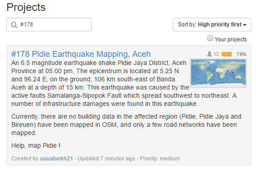
At 5.00 am Wednesday (7/12/16), a magnitude 6.5 earthquake shook Pidie Jaya District, Aceh Province. The epicentre is located at 5.25 N and 96.24 E on the ground, 106 km Southeast of Banda Aceh at a depth of 15 km. This earthquake was caused by the active faults Samalanga-Sipopok spreading from Southwest to Northeast. According to BNPB, the Indonesian national disaster management agency, a staggering number of 11,668 units of infrastructure were damaged, including 161 houses, 94 traditional houses, 61 mosques, 16 schools and 10 government offices. Financial lost inventory is still under further investigation and accounting. The latest update on Monday (12/12/16) reported that 101 people were killed, of which 94 people had been identified. 134 people were heavily injured adding to a total of 666 people injured. A total of 83.838 people are in shelter, spreading across 124 places. Most affected population are from Pidie Jaya (82.122 people in 120 spots), followed by Bireuen District (1,716 people in 4 spots). Indonesian earthquake caused widespread damage (on photo: destroyed mosque), leaves more than 45,000 homeless Source | |
The Response
BNPB, together with on-field volunteers, is distributing aid supplies, including food (rice, cooking oil, eggs and sugar) and medicine. Prior to the earthquake took a hit, no building data in the affected region (Pidie, Pidie Jaya and Bireuen) were found in OpenStreetMap and only a few road networks have been mapped. This data is crucial and urgently needed to speed up humanitarian aid delivery process.
The Humanitarian OpenStreetMap Team Indonesia responded to this by launching a tasking manager for Pidie Jaya Area and mobilize volunteers, both from home and internationally: http://tasks.openstreetmap.id/project/178#instructions. In 6 days, over 70% with 409 tasks were mapped by more than 90 volunteers. Up untill now (December 21st 2016), 82% of the tasks have been completed and 8% validated.
Map and Data Services
About OpenStreetMap
OpenStreetMap offers an online map and spatial database that is updated by the minute. Various online maps are based on OpenStreetMap, including Navigation tools such as OSRM. Tools and services allow data extracts for GIS specialists, routable data for Garmin GPS, GPS navigation with smartphones and other device-compatible downloads. With an Internet connection, regular syncing is possible, because there is open access to the community-contributed data as it comes in. Also bulk with downloads of OpenStreetMap data are ideal for use offline. In addition, maps can be printed to paper, if needed.
Browse the Activation Area to get a feel for the data that is currently available. Different map styles, including a special Humanitarian style, can be selected on the right side of the screen. Though some data may not render (appear) on the online map, it can be exported from the underlying database for other uses requiring more detail (See export section below).
Exporting OpenStreetMap data
Frequent updates
There is more than one source for the same file format. This should assure a constant access to data if any problems arise from one host.
| OpenStreetMap Exports | OSM Format | ShapeFiles (SHP) for GIS softwares | Offline Navigation on Small Devices |
|---|---|---|---|
| Daily updates | OSM data format (PBF) | Building Layers | GPS Garmin |
Information about the various OSM export formats
- OSM.pbf: These compressed OSM files are recognized by various GIS softwares.
- Shapefile: This data can be imported to GIS software, such as Quantum GIS or ESRI ArcGIS for Desktop.
- OSMAnd.OBF: OSMAnd / Android and iPhone Offline map and navigation
Note: launched 2015-04-19, the first iPhone version does not yet integrate all the functionalities of the Android version.- » Android File manager: Move the obf file from the download to the OSMAnd directory
- LearnOSM Tutorial Configure OSMAnd, and Offline map navigation
- How to use Voice Navigation
- GPS.IMG: Garmin GPS format
- » Rename the IMG file to gmapsupp.img and move it to the Garmin directory of the GPS card
- Other Mobile devices: See other Mobile device products.
How You Can Contribute
Edit the Map
- You can contribute from the Internet by tracing buildings, roads, waterways, etc. To react rapidly to support humanitarians deploying, we need a lot of contributors for remote editing. Visit LearnOSM.org to get started. See the specific LearnOSM Task Manager tutorial. The best way to learn is to participate to Mapathons where experience contributors of your community will show you the basics of editing.
- Humanitarian field teams and knowledgeable local people also are essential. You can complete the map by adding the names of roads or various infrastructure items. You even can edit the map using small mobile devices. In addition, applications are available for online or offline mapping.
- Add a Note or report an Error using the Notes feature on the Online Map. OSM contributors will edit the map from your comments.
Task Manager projects
The following projects have been set-up on the OSM Tasking Manager.
| Project | Priority | Location | What to map | Imagery Source | Task Mapping Status | Task Validation Status |
|---|---|---|---|---|---|---|
| #178 | Medium | Pidie, Pidie Jaya and Bireuen Districts | Roads and Buildings | Bing/Mapbox | In Progress (84%) | In Progress (9%) |
General map improvements
As well as small square shaped contributions, we can look to make more wide ranging improvements. Reviewing/improving the overall map data consistency is very useful, but that is also most prone to edit conflicts so please save often and understand in the busy time like this you might encounter edit conflicts.
Any local knowledge like infrastructure, buildings or road names that you know and can positively identify, are extremely helpful to responding organizations.
Mapping roads is a high priority.
OpenStreetMap is a editable map, so we can improve it if there's anything missing/wrong (Beginners' guide). This is particularly useful if you have any local knowledge or you can survey things on-the-ground (names of streets etc.).
People who have local knowledge but do not know how to edit OpenStreetMap are still vital to our aid efforts. You can share your local knowledge with the OpenStreetMap "Notes" feature. This lets you drop a marker and attach a note with information about the location/building/road that an experienced OSM mapper will then put in the OSM database. For simple instructions on how to share your knowledge with our mappers please see this quick guide to using notes:
How to easily share local knowledge with OSM Notes
Imagery and Reference Maps
Bing
Mapbox
Event (Pidie Mapathon)
To accelerate the process for an effective humanitarian relief and in line with HOT’s continuing support to provide tools that can be used to ease disaster management by completing spatial and mapping data, HOT in collaboration with BNPB, DMInnovation, supported by Australian Government, will host a #PidieMapathon event in BNPB headquarters on Wednesday-Thursday, 14-15 December 2016. Event.
The joint effort in mapping out exposure data and public facilities in Pidie will not only help the ongoing humanitarian response but can potentially be used to build-back-better and recover from this disaster event.


