Address Improvement/United States Address Data Import Sources
Some local, state and federal government organizations collect address data that may be suitable for importing into OSM. This page is used to collect information about those recourses.
Federal: See TIGER (2010: http://www.census.gov/geo/www/tiger, http://www.census.gov/geo/www/tiger/faq.html#16)
territory American Samoa
Territory
Local
territory Northern Marianas Islands
Territory
Local
territory Virgin Islands
Territory
Local
territory Puerto Rico
Territory
Local
District of Columbia
District
142k Address Points are available here. These are already imported into OSM.
Local
Past DC
Alabama
State
Local
Alaska
State
Local
Arizona
State
Local
Arkansas
State
Arkansas GeoStor contains cadastral parcels and parcel centroids that contain physical address data. The parcel dataset can be downloaded as a whole at the FTP site.
The data is free to use for any purpose as per the access and usage constraint sections in the metadata .
The parcel dataset does not have full statewide coverage, see coverage map below.
Local
California
State
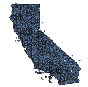
No address point data, however there is a 114k point POI database that could be useful. It can be found here. There is a mix of natural and man-made POIs in there.
Local
- SF Address Import project
- Marin County has Address points for download here.
- Contra Costa County http://www.ccmap.us/Details.asp?Product=134492
- Alameda County http://www.acgov.org/gis.htm
Past CA
Colorado
State
Local
Connecticut
State
Local
Delaware
State
Local
Florida
State
The county parcel data contains an address field, see the metadata. Downloads county by county here.
Local
Georgia
State
Local
Guam
State
Local
Hawaii
State
Local
Idaho
State
Local
Illinois
State
Local
Indiana
State
Local
Iowa
State
The Iowa road database has address ranges. It can be downloaded here.
This is basically ’just’ TIGER/Line data derived from the county TIGER files from Census.
Local
Kansas
State
Local
Kentucky
State
Local
Louisiana
State
Local
Maine
State
The Statewide parcel database contains address fields.
This is the metadata (with references to the files): for organized towns: here / for unorganized towns: here.
The E911 address pointsshould have the entire state, you may have to download the addresses in CSV format. If so, they use EPSG:2960 at the time of writing (2019-08-23).
Local
Maryland
State
Local
Massachusetts
State
Local
Michigan
State
The State roads database has address ranges. This PDF describes the dataset. The data is available here. The address ranges have originally been derived from TIGER but improvements have been made since.
Local
Minnesota
State
Local
Mississippi
State
Local
Missouri
State
Local
Address points are in compilation and may be available from the St Louis County GIS Service Center
Montana
State
Statewide parcel database has addresses. Metadata is here. Address data is in the PROPERTY_ADDRESS field.
Local
Nebraska
State
Local
Nevada
State
Local
New Hampshire
State
Local
New Jersey
State
Local
New Mexico
State
Local
New York State
State
Local
Several datasets, notably address points and building footprints. Terms of use and licensing is unclear. Metadata
North Carolina
State
Local
NCSU Library North Carolina County GIS Data
North Dakota
State
Local
Ohio
State
Local
Cuyahoga County (includes Cleveland) - http://gis.cuyahogacounty.us/en-US/GIS-Data.aspx - see Address Points
Oklahoma
State
Local
Oregon
State
Local
Pennsylvania
State
Local
Rhode Island
State
Local
South Carolina
State
Local
South Dakota
State
Local
Tennessee
State
Local
Texas
State
Local
Utah
State
A statewide address point database was released in the summer of 2013. More information and download link here. There is a project underway to import these addresses, see here.
Local
Vermont
State
Local
Virginia
State
Local
Washington State
State
Local
West Virginia
State
A geocoding service is available here but the data behind it is not public.

