ArcGIS
ArcGIS (arcgis.com) is a proprietary GIS software platform from ESRI. It is the canonical software for manipulation of ESRI Shapefiles. Note: Through the ArcGIS for Home Use Program, users can purchase a non-commercial license for ArcGIS that includes many extensions for US$100/yr.
ArcGIS Editor for OSM
ArcGIS Editor for OSM provides the ability to import, export and edit OSM data via a free add-in for ArcMap. This plugin is free and open-sourced, but works only with ArcGIS Desktop, which requires purchasing a valid licence, or just use a trial free of charge for a limited time and by 5 users, and only for non-commercial use (ArGIS is published and sold under proprietary license and is itself not opensourced, only the API for interfacing plugins has open specifications).
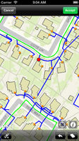
| ArcGIS for iPhone | |
|---|---|
| Author: | ESRI |
| License: | Proprietary (free of charge, for evaluation only) |
| Platform: | iPhone |
| Status: | Broken |
| Version: | 10.1.2 (2013-08-06) |
| Language: | English |
| Website: | http://itunes.apple.com/app/arcgis/id379687930 |
|
Shows just different maps | |
ArcGIS Haiti Earthquake Response
Accessing OpenStreetMap data within ArcGIS to support the Haiti Earthquake Response is article details various options for bringing in OpenStreetMap (developed in relation to Haiti mapping, but applies worldwide)
ArcGIS online
ArcGIS Online includes ArcGIS Explorer (requires Silverlight), a free online browser for ArcGIS datasets. OpenStreetMap is an available basemap through this interface.
ArcGIS OSM importer
ArcGIS can import bz2 compressed .osm files to a file geodatabase using a python script called "OSM Loader" (Version 2.0 by Dominic Stubbins) that doesn't use an XML parser! The script can be downloaded from www.arcgis.com
ArcBruTile
ArcBruTile ([1]) adds support for TMS/WMS-C servers to ArcGIS
OSM2NetworkDataset
OSM2NetworkDataset allows to import OSM network data to ArcGIS Network Analyst. Some tutorials: [2] ger
