WikiProject Belgium
| V・T・E |
| latitude: 50.536, longitude: 4.399 |
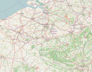
| Browse map of Belgium 50°32′09.60″ N, 4°23′56.40″ E |
| Edit map |

|
|
External links:
|
| Use this template for your locality |
Belgium is a country in Europe at latitude 50°32′09.60″ North, longitude 4°23′56.40″ East.
| WikiProject Belgium +/- | ||
| Conventions | ||
| Subprojects | ||
This page contains information relating to mapping activity that is specific to Belgium. Any guides or conventions on this page can be discussed on the discussion page, feel free to comment or help (mapping your area, tagging streets or correcting this page).
Language
For accessibility reasons, pages can be presented in four languages (en, nl, fr, de), but for practical reasons, the English version is the original version. For the other languages, choose a language at the top of the screen or choose here Nederlands or Français. The English version is the most up to date.
Belgian OpenStreetMap Community
Starting in 2013 there is an OpenStreetMap Belgium organization. We were part of OKFN Belgium as a working group until 2023, but then became an independent non-profit (VZW/ASBL). We are one of the Local Chapters recognized by the Foundation (agreement). One of the first things that was done was to create a website: https://openstreetmap.be/.
OpenStreetMap Belgium has the following goals:
- Promoting OpenStreetMap in Belgium.
- Supporting the mapping community in any way possible.
- Single point of contact for OpenStreetMap in Belgium via community@osm.be
Communication
- For communication within the community, we mostly use a high-volume real-time chat room that is synchronised (bridged) across these networks:
- Matrix
 #osmbe:matrix.org. The recommended web client is Element. Here's an overview of our channels [1]
 - IRC channel irc.oftc.net #osmbe.
- Matrix
- The the mailing list talk-be has been discontinued, but the archives are still available. For somewhat more formal discussions, this has been replaced by a channel on the new OSMF forum.
- For outreach, we use mainly use Mastodon. We have a small presence on Linkedin and keep our X-twitter account alive.
- Regular meetings are usually organized through our Meetup group.
- The OpenStreetMap Belgium Newsletter will let you know when we are organizing some event (Missing Maps, a meeting, a presentation) or when we have news. (Subscribe - Archive)
Start with OSM
Documents
- Beginners' guide Nederlandstalig / Francophone / Deutschsprachig / English
- Learn OpenStreetMap Step by Step with LearnOSM
- How to map an object Nederlandstalig / Deutschsprachig / Francophone
OpenStreetMap volunteers in Belgium
Here's an incomplete list of OpenStreetMap volunteers in Belgium that are active on the wiki. If you want to be on this list, please:
- Create an OpenStreetMap wiki account if you haven't got one yet, and log in. Note that an OpenStreetMap wiki account is not the same as an OpenStreetMap map editing account!
- Go to your personal wiki page. You can find it by scrolling to the top of any page and clicking your name.
- Edit your personal wiki page, adding the following line at the bottom:
[[Category:Users in Belgium]].
Have a look at the Communication section above for more ways to meet other mappers.
Mapping resources
See the Mapping resources page for a longer, yet incomplete list.
The most useful resources are available both in the web editor (iD) and JOSM. Make sure to have a look at the many available layers!
- Brussels
- UrbIS-Ortho most recent (selected by default)
- AGIV Flanders most recent aerial imagery
- UrbisAdm FR (includes buildings, numbers and street overlays and French names)
- UrbisAdm NL (same as above but with Dutch names)
- Flanders
- AIV Flanders most recent arial imagery (selected by default)
- AIV Flanders GRB (includes buildings, numbers and street overlays and names)
- AIV Digitaal hoogtemodel (very detailed hillshade)
- Wallonia
- SPW most recent aerial imagery (selected by default)
- SPW PICC numerical imagery (includes buildings, numbers and street overlays and names)
- SPW Relief de la Wallonie - Modèle Numérique de Terrain (MNT) 2013-2014 - Hillshade
Projects
OpenStreetMap Belgium keeps a list of long term projects at the OSM.be website.
We keep this list of projects that need your mapping help
Have a look at the subprojects above to see a longer list of projects. They may be active, defunct or just starting. Feel free to create a new subproject page if you want to work on something new.
Conventions
See the Conventions page for discussing the mapping and tagging conventions.
Goals
If you have a goal that you are working towards or one that you would like to see get done (and are maybe willing to get the ball rolling) then add it to the list here, create a section where it can be coordinated and tracked, and a way of measuring progress.
Mapping Parties/Events
Most activities are organized through the Meetup page [2].
Older discussion about activities was in the talk page.
All (new) activities should go on the Activities page. The talk page there can be used to discuss events.
External maps
- Administrative regions of Belgium - Wikipedia
- Municipalities in Belgium - Rectified version (low resolution, not usable for mapping)
A collection of links
- WalOnMap: Portail Cartographique de la Région Wallonne
- GeoPunt Catalogus: collection of Flemish data that is usually fit for mapping with OSM.
- Geo.be - federal geoportal
- Cadastre - viewer for cadastral data (compatible license)
- Geofabrik Mapcompare - nice tool to compare OSM to some other maps
- Wegnummering in België(nl) - Wikipedia
- Autoroutes et routes de Wallonie - Région wallonne
- Google books, België in kaart
- Liste des lignes de chemin de fer de Belgique - Wikipedia
- Lijst van spoorlijnen in België - Wikipedia
Quality control
- Wiki quality assurance page. On this page you can find many explanations to the tools that can be used to have better quality in OpenStreetMap


