Bergen (Norway)
| V・T・E |
| latitude: 60.38, longitude: 5.34 |
| Browse map of Bergen 60°22′48.00″ N, 5°20′24.00″ E |
| Edit map |
|
External links:
|
| Use this template for your locality |
Bergen is a city in Hordaland, Norway at latitude 60°22′48.00″ North, longitude 5°20′24.00″ East.
Map of Bergen from OpenStreetMap
Description
Bergen is Norway's second largest city, with a population of 278,121 (2016), and is situated on the west coast, with easy access to both fjords and mountains. The city itself is surrounded by smaller mountains, making the city spread out in between and around the mountains, at the same time providing easy access to mountain trips accessible from the city center by foot.
OSM Coverage
- The road network in the city center is pretty much done.
- Coverage to the outskirts is improving, with ELVEG mostly done around Bergen (2017)
- Shops and amenities are finished, but there is one new/one closing every day so its just a matter of time before its outdated
- Streetview imagery from Mapillary or OpenStreetView are very poor in the region and would benefit some love
Sub-projects
Events
There was a Mapping Party in may 2009
Local data sources
Local newspapers
Imagery
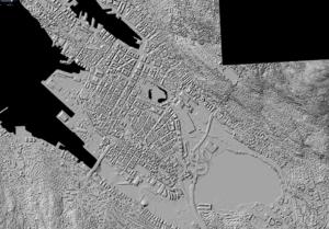
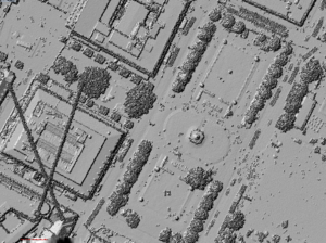
Kartverket has laser scans of all Bergen with a 10 centimeter resolution with this WMS. Available directly in JOSM with the Kartverket DOM.
Is is available through these menus:
JOSM Top menu - Imagery - Kartverket DOM Digital Surface Model - Laser - 2016 - Bergen 10 pkt 2016
Alternatively one can add this path
wms:https://wms.geonorge.no/skwms1/wms.hoyde-dom_skyggerelieff?FORMAT=image/jpeg&VERSION=1.1.1&SERVICE=WMS&REQUEST=GetMap&LAYERS=Bergen 10pkt 2016&STYLES=&SRS={proj}&WIDTH={width}&HEIGHT={height}&BBOX={bbox}
To a new/custom imagery layer go to:
1. JOSM Top menu - Imagery - Imagery Preferences - +WMS (a button down to the right)
2. And then in the box that says "Verified generated WMS URL" paste in the one shown above.
3. Select a name i.e "Kartverket laser scan 2016 10 pkt Bergen"
4. Press ok
5. Now the imagery is available through the JOSM Top menu - Imagery-menu with the name you used
Other
See Hordaland or Norway for more information about everything OSM in Hordaland and Norway.


