BlackBerry OS
BlackBerry OS is a mobile operating system used in older, business-oriented handheld devices manufactured by Research In Motion, later BlackBerry Limited. BlackBerry devices can be used to view OpenStreetMap-based maps as well as to record GPS tracks that can be uploaded to OSM to aid in editing. This page discusses only the software that runs on BlackBerry OS from 1999–2012; for a listing of software that runs on the subsequent (but also now largely obsolete) QNX-based BlackBerry 10 operating system, see Android - BB10 can run some Android software.
Software
BlackBerry OS devices (1999–2012) could run the software below as well as any J2ME software.
General information
| Name | Screenshot | Display map | Navigate | Make track | Monitor | License | Price | Languages | Version | Description |
|---|---|---|---|---|---|---|---|---|---|---|
| Aosm [1] | 
|
yes | yes | yes | no | nonfreeproprietary | free | ?
|
?
|
Development of this application seems to have stopped |
| bbTracker [2] | no | no | yes | yes | GPL | free | EN | 2008-05-02 0.5.3.1 |
simple logger | |
| GPSed Mobile Application [3] | 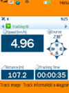
|
yes | no | yes | no | nonfreeproprietary | free | EN | ? 3.7 |
Client for gpsed.com but works without this service, too |
| GPSLogger II [4] | 
|
yes | yes | yes | yes | nonfreeproprietary | free | EN | 2013-11-01 3.3.1.8 |
The free AIO logging and tracking Solution (developed since 2009) |
| HotSpot Navigator [5] | 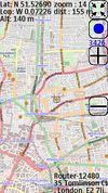
|
yes | yes | yes | no | nonfreeproprietary | nonfree15$ | EN | 2011-04-25 0.5.2 |
FON Wi-Fi Spots over OSM tiles |
| JPSTrack [6] | 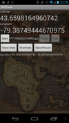
|
yes | no | yes | ?
|
BSD (source available) | free | EN | ? early release |
Track logging for OSM w/ photo, voice, text notes |
| MAPS.ME [7] | 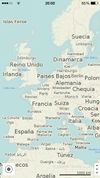
|
yes | no | no | no | nonfreeproprietary | nonfreeFree/$4.99 for Pro | EN; RU; CS; DE; ES; FR; IT; JA; KO; NL; UK; ZH-HANT; PL; PT; HU; TH; ZH-HANS; AR; DA; TR | ? 3.0.2 |
Offline maps of all countries, fast renderer, offline search, whole planet fits to 12Gb |
| Nogago [8] | 
|
yes | yes | yes | yes | nonfreeOpenSource | nonfreefree, offline maps: 4,95 Euro; licence key: 7,99 Euro | DE; EN; NE | 2012-12-22 3.14 |
Topographic Offline-Maps and Navigation for Hiking, Cycling and Biking |
| TrackMyJourney [9] | yes | yes | yes | yes | nonfreeproprietary | nonfree12/18 EUR for 6/12 months | EN | ? 0.8.0 |
Limited Free Version Available | |
| Wisepilot [10] | 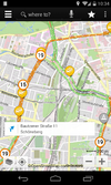
|
yes | yes | no | no | nonfreeproprietary | nonfree€1.79 monthly | EN; DE; ES; FR; SV; and much more | 2014-04-03 5.0.2 |
online turn-by-turn navigation |
This table in the past was generated automatically by a bot. Learn more.
Map display features
| Name | Shows map as vector | Shows map as bitmap | Stores map-data on-board | Stores map-data off-board (downloads from internet) | Rotate map | 3D view |
|---|---|---|---|---|---|---|
| Aosm | no | yes | yes (cache) | yes | no | no |
| GPSed Mobile Application | ?
|
?
|
?
|
?
|
?
|
?
|
| GPSLogger II | no | yes | yes | yes | no | no |
| HotSpot Navigator | no | yes | yes | yes | no | no |
| JPSTrack | ?
|
?
|
?
|
?
|
?
|
no |
| MAPS.ME | yes | no | yes | no | yes | no |
| Nogago | yes | yes | yes | yes | yes | Contour Lines |
| TrackMyJourney | yes | yes | yes | yes | yes | yes |
| Wisepilot | yes | yes | no | yes | yes | yes |
This table in the past was generated automatically by a bot. Learn more.
| Name | Navigate to point | Find location | Find nearby POIs | Navigate along predefined route | Create route manually | Calculate route | Calculate route without internet | Car routing | Bike routing | Foot routing | Turn restrictions | Navigation with voice | Keep on road | Works without GPS |
|---|---|---|---|---|---|---|---|---|---|---|---|---|---|---|
| Aosm | no | yes | yes | ?
|
?
|
?
|
?
|
no | no | no | no | no | no | ?
|
| GPSLogger II | yes | no | no | yes | ?
|
yes | yes | ?
|
?
|
?
|
no | no | no | yes |
| HotSpot Navigator | yes | no | yes | ?
|
?
|
?
|
?
|
no | no | no | no | no | no | yes |
| Nogago | yes | yes | yes | yes | ?
|
yes | yes | no | yes | yes | yes | yes | no | yes |
| TrackMyJourney | yes | yes | yes | ?
|
?
|
?
|
?
|
yes | yes | yes | ?
|
no | yes | partial |
| Wisepilot | yes | yes | yes | ?
|
?
|
?
|
?
|
yes | no | yes | yes | yes | ?
|
no |
This table in the past was generated automatically by a bot. Learn more.
Track making features
| Name | Customizable log interval | GPX format | KML format | NMEA format | All formats | Geo-tagged notes | Geo-tagged photos | Geo-tagged audio | Fast POI buttons |
|---|---|---|---|---|---|---|---|---|---|
| Aosm | ?
|
?
|
?
|
?
|
?
|
?
|
?
|
?
|
?
|
| bbTracker | yes | yes | yes | no | gpx;kml | yes | no | no | ?
|
| GPSed Mobile Application | ?
|
yes | no | no | gpx;proprietary | ?
|
?
|
?
|
yes |
| GPSLogger II | yes | yes | yes | yes | gpx;kml;nmea;gpl | yes | no | no | yes |
| HotSpot Navigator | no | no | no | no | bin | no | no | no | yes |
| JPSTrack | ?
|
?
|
?
|
?
|
?
|
?
|
?
|
?
|
?
|
| Nogago | yes | yes | yes | no | gpx;kml;csv;tcx | no | no | no | yes |
| TrackMyJourney | yes | yes | yes | yes | gpx;kml;nmea;csv;txt;ozi | yes | yes | yes | yes |
This table in the past was generated automatically by a bot. Learn more.
Monitoring features
| Name | Show current track | Open existing track | Altitude diagram | Show DOP value | Satellite view | Show live NMEA data | Send current position via SMS | Upload current position |
|---|---|---|---|---|---|---|---|---|
| bbTracker | yes | yes | yes | yes | ?
|
?
|
no | no |
| GPSLogger II | yes | yes | yes | yes | no | no | yes | no |
| Nogago | yes | yes | yes | no | no | no | yes | yes |
| TrackMyJourney | yes | yes | yes | yes | yes | yes | no | yes |
This table in the past was generated automatically by a bot. Learn more.
OpenStreetMap editing features
| Name | Add POIs | Edit / Delete POIs | Edit arbitrary tags of existing OSM objects | Edit geometries | Support imagery offset DB | Upload to OSM |
|---|
This table in the past was generated automatically by a bot. Learn more.
Libraries for developers
- Main article: Frameworks
Libraries make it easy for BlackBerry developers to incorporate OpenStreetMap in their own applications. Another benefit of using these libraries is that they respect OpenStreetMap’s tile usage policy by fetching tiles and other resources from dedicated servers instead of OpenStreetMap’s donated servers.
| Library | License | Notes |
|---|---|---|
| Nutiteq RIM SDK | Proprietary |
