Boracay
Jump to navigation
Jump to search
| V・T・E |
| latitude: 11.919, longitude: 121.93 |
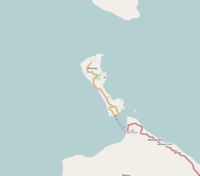
| Browse map of Boracay 11°55′08.40″ N, 121°55′48.00″ E |
| Edit map |
|
|
External links:
|
| Use this template for your locality |
Boracay is an island in the Philippines at latitude 11°55′08.40″ North, longitude 121°55′48.00″ East.
This page is a work in progress.
Users
If you are working on the Boracay map and/or this boracay page, please sign here:
- Wtmitchell - working on both
(This list should be on the talk page, and will probably eventually be moved there)
Roads and paths
- Roads and paths need to be added and corrected.
- More work needs to be done on categorization and tagging roads.
- The table below needs to be reworked to better fit with the Boracay map
Landuse
- areas need to be marked where landuse can be applied.
