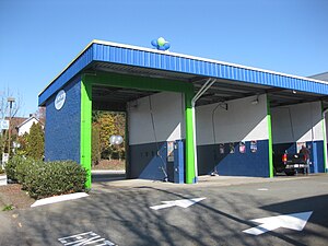
Tag:amenity=car_wash
| Description |
|---|
| A facility used to clean the exterior of motor vehicles |
| Rendering in OSM Carto |
| Group: amenities |
| Used on these elements |
| Useful combination |
|
| Status: de facto |
| Tools for this tag |
|

A car wash is a facility used to clean the exterior and, in some cases, the interior of motor vehicles. Car washes can be self-serve, fully automated, or full-service with attendants who wash the vehicle. There are also washing facilities for trucks, buses and trains.
In some cases, the same facility may also be used for washing dogs.
How to map
Set a node at the centre of the car wash or draw an area along its outline.
Tag it with amenity=car_wash and name=*.
In cases where the road intersects with the car wash building on the map, some tag the road section that passes through the building with tunnel=yes or tunnel=building_passage if such way is not indoors to indicate that the road is supposed to go through the building. Additionally, tag the road segment as highway=service and service=drive-through to indicate to routers that the road is not to be used for normal routing (e.g. as a shortcut).
Tags used in combination
- self_service=yes/no – Indicates whether an object is self service
- automated=yes/no – Indicates whether an object is operated automatically
- opening_hours=* – Describes when something is open or closed. There is a specific standard format for this data
- Payment tag family – can be used to specify how one may pay at this location
- Address tag family – can be used to specify an address
- operator=* - Company, corporation, person or any other entity who is directly in charge of the current operation of a map object
- vacuum_cleaner=yes/no – Is there a vacuum cleaner available to clean the inside of the vehicle?
- vacuum_cleaner:fee=yes/no – Do customers have to pay extra to use the vacuum cleaner, even if they already paid for the car wash?
- vacuum_cleaner:self_service=yes/no – Does the customer have to operate the vacuum cleaner themselves?
- vacuum_cleaner:opening_hours=yes/no – If the vacuum cleaner has different opening hours from the car wash.
- high_pressure_washer=* – If there is a (high-)pressure washer/cleaner available
- maxwidth=* – The legally restricted maximum width of a vehicle
- maxheight=* – The legal maximum height in metres
- truck_wash=yes/no – Indicates that the facility has a truck wash.
- tank_cleaning_truck=yes – Indicates that the facility has a tank wash.
- For bus washes (generally found in bus depots) use amenity=car_wash + access=no + bus=designated
- dog_washing=yes – Indicates that the facility has provision for washing dogs.
Similar tags
- railway=wash – A train carriage/car wash
- car_wash=yes/no – if a car wash is integrated at a gas station
- truck_wash=yes/no - if a truck washing system is available
See also
- amenity=vacuum_cleaner – A device used to clean by vacuum.
- amenity=bicycle_wash - A place where bicycles can be washed.
