Category:Maps of places in the Netherlands
Jump to navigation
Jump to search
Media in category "Maps of places in the Netherlands"
The following 30 files are in this category, out of 30 total.
- 20071007 amsterdam.jpg 629 × 480; 118 KB
- 20MB Amsterdam Details.png 640 × 960; 463 KB
- Amsterdam AND Sep2007.png 600 × 600; 472 KB
- Amsterdam osm.PNG 811 × 625; 115 KB
- Amsterdam unfinished.png 986 × 673; 628 KB
- AmsterdamDivision.jpg 765 × 678; 70 KB
- AND-SouthNetherlands.png 1,024 × 786; 180 KB
- Cyclingnodes.jpg 600 × 600; 117 KB
- Den Haag - coverage overview.jpg 1,264 × 956; 133 KB
- DenHaag-SecondMappingParty.jpg 595 × 565; 72 KB
- Deutschland vs. Holland an der Ems.jpg 932 × 646; 346 KB
- Fietskaart.jpg 723 × 595; 170 KB
- Garmin-muntplein1.jpg 176 × 220; 24 KB
- Groningen 20042007.png 500 × 500; 82 KB
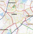
- Leiden.jpg 683 × 703; 176 KB
- Niederlande qlandkarte1.png 952 × 848; 168 KB
- Nuenen.png 845 × 647; 322 KB
- OpenRailwayMap Dutch station references.PNG 285 × 154; 36 KB
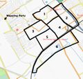
- Osm mappingparty 1 amsterdam.gif 450 × 324; 119 KB
- Roombeek compleet.png 1,500 × 1,636; 1.3 MB
- Rotterdam unfinished.png 944 × 660; 982 KB
- Rotterdam-20070321-tilesathome.png 559 × 393; 76 KB
- ScalableMapsAmsterdam.png 512 × 407; 151 KB
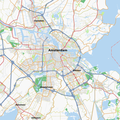
- Tracestrack Amsterdam.png 512 × 512; 317 KB
- Tramamsterdam.png 640 × 480; 362 KB
- Utrecht-20060826.png 424 × 600; 127 KB
- Utrecht-20060830.jpg 392 × 524; 56 KB
- Utrecht-20061118.png 900 × 1,400; 425 KB
- Utrecht-tilesathome-20070205.png 325 × 495; 148 KB
- Verdronken Land van Saeftringhe salt marsh.png 538 × 399; 170 KB


