Category:Maps of the Netherlands
Jump to navigation
Jump to search
Subcategories
This category has only the following subcategory.
M
Pages in category "Maps of the Netherlands"
The following 3 pages are in this category, out of 3 total.
Media in category "Maps of the Netherlands"
The following 16 files are in this category, out of 16 total.
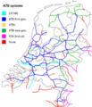
- ATB systems English.png 2,839 × 3,307; 2.99 MB
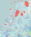
- Author density nl 20080502.png 512 × 573; 263 KB
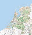
- Basiskaart Wegen A0 20211019.svg 3,179 × 4,494; 51.68 MB
- Dutch building and addresses import alt1.jpg 1,154 × 907; 241 KB
- Dutch building and addresses import alt2.jpg 1,154 × 907; 168 KB
- Dutch building and addresses import.jpg 400 × 329; 36 KB
- Kubus.mailspool.nl screenshot.png 1,280 × 805; 1.14 MB
- Milestone overpass.PNG 383 × 450; 239 KB
- Nederland-mapnik-200702.png 383 × 479; 103 KB
- Nederland-osmathome-20070319-cropped.png 348 × 434; 106 KB
- Nederland-osmathome-20070904-cropped.png 382 × 464; 167 KB
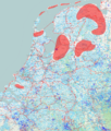
- Netwerken-nl-aug-2011.png 845 × 998; 1.66 MB
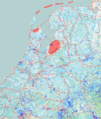
- Netwerken-nl-mrt-2013.png 855 × 1,011; 1.71 MB
- Netwerken-nl-nov-2011.png 845 × 998; 1.66 MB
- NL-Carto-countryname.png 155 × 154; 35 KB
- Osm-nl-20071117.JPG 288 × 320; 18 KB
