Clemson, South Carolina/MappingPartyFall08
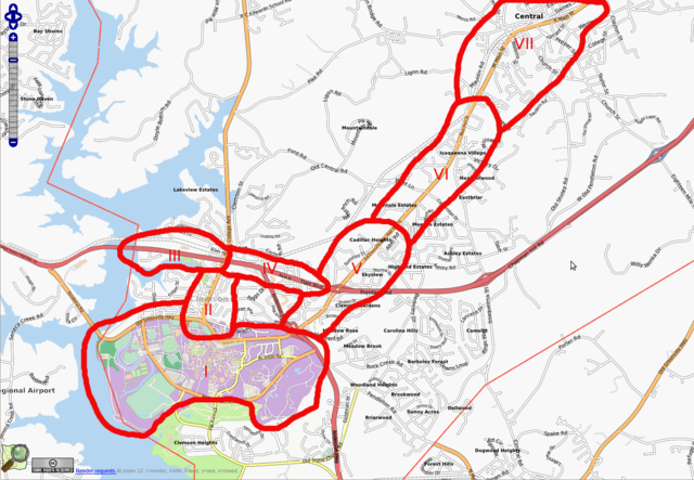
The Clemson Fall 2008 Mapping Party will occur on October 11, 2008, to map all of Clemson University and surrounding area starting at 9:30 AM. After party drinks/mingling will be held at Nick's Bar ~5 or 6 PM.
The base of operations will be Pot Belly Deli.
GPS traces for the Clemson area
Attended
sadam - Organizer
forceflow2
User:MartinJones
User:aaronrosen
User:rossimo
Accomplished
Regions II and III and some more of region I
Cake Chart
Things to Map
All stores, restaurants and cafes
Churches
Bars
Hotels
Parking lots and labels
Bus stops and routes
Gas Stations
ATMs
Things to do if you don't have a GPS
Realign roads to the center lines
Trace buildings
Trace paths
Add roads that aren't on the map (tag as highway=road if you don't know what kind of road it is)
Reclassify roads: roads in neighborhoods highway=residential other than that you get on a tertiary road to get on a secondary to get on a primary to get on a motorway
