DE:Windows Mobile
Diese Seite hat das Ziel alle nützlichen Informationen für die Benutzung eines Windows mobile Telefons oder PDA, für OpenStreetMap Zwecke zu sammeln. Nicht zu verwechseln mit dem weiter verbreitetem Windows Phone-System!
Software Liste (Gesamt)
Allgemeine Information
| Name | Screenshot | zeigt Karte | Navigation | Trackaufzeichnung | Datenkontrolle | Lizenz | Preis | Sprachen | Version | Description |
|---|---|---|---|---|---|---|---|---|---|---|
| APRSISCE/32 [1] | 
|
ja | nein | ja | ja | nonfreeproprietary | free | EN; ... | 2012-04-06 2012/04/06 |
Feature rich Amateur Radio Automatic Packet Reporting System client that uses OSM tiles as the base map. Under active development with rapid development release cycle. |
| ArcGIS Editor for OSM [2] | 
|
ja | nein | nein | nein | Apache License 2.0 | free | En | 2014-03-07 10.2 |
Allows users to download, edit, and upload OSM data in ArcMap, and/or create feature services based on OSM data in ArcGIS Server |
| Autosputnik 5 [3] | 
|
ja | ja | nein | ja | nonfreeproprietary | nonfree15€ | EN; RU; UA; BY; KZ; UZ | 2011-03-10 1.0.31970 |
Easy and nice UI, web-like search, routing, navigation. OSM support: http://openstreetmaps.ru |
| be-on-road [4] | 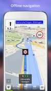
|
ja | ja | ja | ?
|
nonfreeproprietary | nonfreeFree | DE; EN; CS; NL; FR; EL; HU; IT; PL; PT; RO; RU; SK; ES; TR; UK | 2013-11-13 3.9.26385 |
Offline multi-language voice navigation app with lane-guidance assistant. Data from OSM and propietary maps. |
| BetterSoftwareGPSPDA | 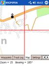
|
ja | nein | nein | ja | nonfreeproprietary | free | EN | 2008-08-08 3.5.0.2 |
|
| Bluemapia [5] | 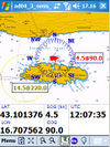
|
ja | nein | nein | nein | nonfreeproprietary | free | EN | 2009-06-01 0.9.6 |
Marine mapping app for bluemappia.com |
| BT747 [6] | 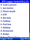
|
nein | nein | ja | ja | GPL | free | DE; EN | 2010-08-13 2.x.1769 |
MTK GPS chip sets only! |
| cachebox [7] | 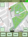
|
ja | ja | nein | nein | GPL | free | EN | 2010-08-22 500 |
Geocaching centered |
| Endomondo [8] | 
|
ja | nein | nein | nein | nonfreeProprietary | free | ?
|
?
|
An app for recording and logging workouts. It also allows seeing the position on an OSM map. |
| Find & Route [9] | 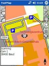
|
ja | ja | ja | nein | nonfreeproprietary | nonfree50€ | DE | 2012-03-08 2.0 |
Fast rendering, no install; easy to use |
| GeorgeMap [10] | 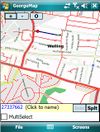
|
ja | nein | ja | ja | BSD | free | EN | 2008-02-12 ?
|
|
| GLObal PositioningUtilitieS [11] | 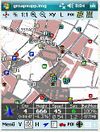
|
ja | ja | ja | ja | nonfreeproperitary | ?
|
DE | 2009-10-06 2.03.4 |
|
| Gobiz Mobile [12] | 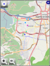
|
ja | nein | ja | ja | nonfreeproprietary | ?
|
DE; EN | ?
|
Commercial OSMTracker clone |
| GPS Tuner [13] | 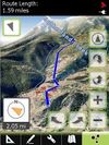
|
ja | ja | ja | ja | nonfreeproprietary | nonfree$6.99 / free | EN | 2012-05-31 1.0.10 |
Google Earth like 3D Navi with DEM |
| GPS-Mate [14] | 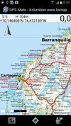
|
ja | ja | ja | ja | nonfreeproperitary | nonfree23€ | DE; EN | 2010-05-31 2.2.2 |
|
| GPS-Tracks [15] | 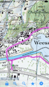
|
ja | ja | ja | ja | nonfreeproprietary | free | EN; DE; FR; IT | 2012-01-26 1.61 (iPhone); 1.52 (Windows Mobile); 1.30 (Android) |
|
| GPS2Blue [16] | 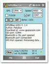
|
?
|
nein | ja | nein | nonfreeproprietary | free | EN | 2006-05-09 2.0 |
Tunnels GPS stream via virtual Comport |
| GpsCycleComputer [17] | 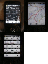
|
ja | nein | ja | ja | nonfreebsd | free | EN | 2012-05-27 4.9 |
simple tracking |
| GPSdash [18] | 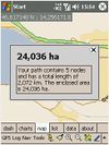
|
ja | ja | ja | ja | nonfree$ | ?
|
EN | 2007-01-06 2.5.0 |
|
| GPSed Mobile Application [19] | 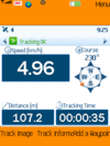
|
ja | nein | ja | nein | nonfreeproprietary | free | EN | ? 3.7 |
Client for gpsed.com but works without this service, too |
| GPSTracka [20] | 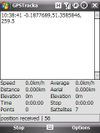
|
nein | nein | ja | nein | GPL | free | EN | 2010-06-30 0.5 |
|
| gpsVP [21] | 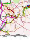
|
ja | ja | ja | ja | BSD | free | 14 | 2012-02-05 0.4.24 |
|
| gvSIG Mobile Pilot [22] | 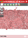
|
ja | nein | ja | nein | GPL; | free | DE; EN | 2010-08-02 0.3 |
Pocket GIS |
| KDR GPS Tracker [23] | ja | ja | ja | ja | ?
|
?
|
DE | 2010-08-10 2.68 Rev.3 |
feature-rich Logger (alarms,track convert+management,...) | |
| LocateMe [24] | 
|
ja | nein | ja | nein | nonfreeproprietary | free | EN | 2009-12-27 ?
|
Share your Position to others |
| mapFactor Navigator free [25] | 
|
ja | ja | ja | ja | nonfreeproprietary | free | CZ; DE; EN; RU; ... | 2013-05-20 12.1.10 |
professional framework for OSM-based car navigation |
| Memphis [26] | ?
|
?
|
?
|
?
|
LGPL | free | EN | 2010-06-07 0.2.3 |
map rendering application and library | |
| MoNa [27] | 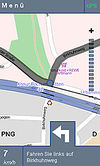
|
ja | ja | nein | ja | GPL | free | DE | 2010-07-13 1.0.6 |
MoNa ist eine unter JavaME entwickelte Ortungs- und Navigationslösung, welche sich die freien Daten des OpenStreetMap-Projektes zu nutzen macht. |
| MoNav [28] | 
|
ja | ja | ja | nein | GPL | free | EN | 2011-04-23 0.3 |
Contraction Hierarchies routing, custom speed profiles, extremely fast and resource conservative routing, can handle huge graphs like Europe on mobile devices. Only source code available for download - has to be compiled by yourself! |
| MOSME | 
|
?
|
?
|
?
|
?
|
GPL | free | EN | 2007-12-24 ?
|
discontinued |
| NAVeGIS [29] | 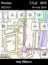
|
ja | ja | ja | ja | GPLv3 | free | EN; ES; FR; GE; GR; IT | 2014-09-19 1.8.0.6 |
|
| NaviComputer [30] | 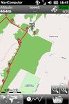
|
ja | nein | ja | nein | nonfreeproprietary | free | 7 | 2010-11-24 0.95 |
|
| Navio [31] | 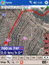
|
ja | ja | ja | ja | nonfree25$ | ?
|
EN | ? 3.15 |
|
| NaviPOWM [32] | 
|
ja | ja | ja | ja | GPL | free | EN | 2011-07-05 0.2.6 |
|
| Navitel [33] | 
|
ja | ja | ja | nein | nonfreeproprietary | nonfree17€ | EN; RU | 2011-06-10 5.0.0.1620 |
Popular in Russia |
| Noni GPSPlot for Windows Mobile [34] | 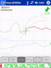
|
ja | nein | ja | ja | nonfreeproprietary | free | EN | 2010-08-22 3.0.2 |
|
| Open Car InfoTainmenT system [35] | 
|
ja | nein | ja | nein | GPL | free | EN | 2008-06-12 0.1.0-rc1 |
Navi as part of an car infotainment system |
| OpenCityMap [36] | 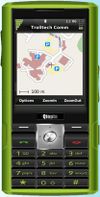
|
ja | nein | ja | nein | GPL | free | EN | 2008-06-01 0.1.1 |
|
| Osmeditor (QT) | 
|
?
|
?
|
?
|
?
|
GPL | free | EN | 2006-12-24 ?
|
discontinued |
| OSMroute [37] | ja | nein | ja | nein | GPL | free | EN | 2010-10-13 alpha |
Very early stage! | |
| OSMtracker | ja | nein | ja | nein | GPLv3 | free | DE; EN | 2010-02-08 0.10.1 |
||
| outdoor-gps [38] | 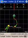
|
nein | ja | ja | ja | nonfree$ | ?
|
EN | 2009-11-14 1.3 R276 |
|
| OziExplorer [39] | 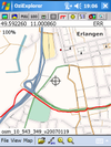
|
ja | ja | ja | ja | nonfreeproprietary | nonfree30€ | EN | 2010-05-05 3.95.5k |
Featurerich |
| PathAway GPS [40] | 
|
ja | ja | ja | ja | nonfreeproprietary | nonfree60-95$ | EN; DE | 2009-10-01 5.0 |
Deals with a lot of geo datums |
| PocketGIS [41] | 
|
ja | ja | ja | ja | nonfreeproprietary | nonfree0 | RU; | 2011-04-16 0.95/0.60 "Сейда" |
Easy and nice UI, web-like search, routing, navigation. |
| PTGMAP [42] | 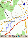
|
ja | ja | ja | ja | nonfreeproprietary | free | EN | 2010-11-16 1.2.9 |
|
| RoadMap [43] | 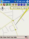
|
ja | ja | ja | nein | GPL | free | EN | 2009-02-02 1.2.1 |
|
| RoadMap Editor [44] | 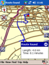
|
ja | ja | ja | nein | GPL | free | EN; HE | ?
|
Fork of RoadMap |
| Run.GPS [45] | ja | nein | ja | ja | nonfreeproprietary | nonfree20€ | DE; EN; ... | 2010-07-07 2.37 |
Sport focused logger | |
| Turbo GPS [46] | 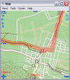
|
ja | ja | ja | ja | nonfreeproprietary | free | DE; EN; ... | 2012-09-07 2.73 |
TurboGPS is a fast all in one GPS tool. Moving maps custom or online, tracks, way points. |
| VataviaMap [47] | ja | nein | nein | nein | Artistic License;GPL | free | EN | 2011-22-03 0.0.0.3 |
Display for several map sources like OSM, Yahoo and others ... Desktop version requires .NET-Framework 2.0 or newer, tested with MONO-framework under Linux and MacOS | |
| VisualGPSce [48] | 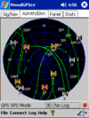
|
ja | nein | nein | nein | nonfreeproprietary | free | EN | ?
|
GPS signal analyses |
| YourPocketMap [49] | 
|
ja | nein | nein | ja | nonfreeproprietary | free | EN | 2010-11-11 0.1.3 |
This table in the past was generated automatically by a bot. Learn more.
Kartenanzeige-Funktion
| Name | Shows map as vector | Shows map as bitmap | Stores map-data on-board | Stores map-data off-board (downloads from internet) | Rotate map | 3D view |
|---|---|---|---|---|---|---|
| APRSISCE/32 | nein | ja | ja | ja | nein | nein |
| ArcGIS Editor for OSM | ja | nein | ja | ja | nein | nein |
| Autosputnik 5 | ja | nein | ja | nein | ja | ja |
| be-on-road | ja | nein | ja | nein | ja | ja |
| BetterSoftwareGPSPDA | nein | ja | ?
|
?
|
?
|
?
|
| Bluemapia | ja | ja | ja | ja | ja | nein |
| cachebox | nein | ja | ja | nein | ?
|
nein |
| Endomondo | ?
|
?
|
nein | ja | ?
|
nein |
| Find & Route | ja | nein | ja | nein | ja | nein |
| GeorgeMap | ja | ja | ja (cache) | ja | nein | nein |
| GLObal PositioningUtilitieS | ja | ja | ja | nein | ja | ja |
| Gobiz Mobile | ?
|
?
|
?
|
?
|
?
|
?
|
| GPS Tuner | ja | ja | ja | ja | ja | ja |
| GPS-Mate | nein | ja | ja | ja | ja | nein |
| GPS-Tracks | nein | ja | ja (cache) | ja | ja | nein |
| GpsCycleComputer | nein | ja | ja (cache) | ja | nein | nein |
| GPSdash | nein | ja | ja | nein | ja | nein |
| GPSed Mobile Application | ?
|
?
|
?
|
?
|
?
|
?
|
| gpsVP | ja | ja | ja | nein | ja | ja |
| gvSIG Mobile Pilot | ja | ja | ja | ja | ?
|
?
|
| KDR GPS Tracker | ja | ja | ja | ja | ?
|
?
|
| LocateMe | nein | ja | ?
|
?
|
?
|
nein |
| mapFactor Navigator free | ja | nein | ja | nein | ja | ja |
| MoNa | ja | ja | nein | ja | nein | nein |
| MoNav | nein | ja | ja | ja | ja | nein |
| NAVeGIS | ja | nein | ja | nein | ja | nein |
| NaviComputer | nein | ja | ja (cache) | ja | nein | nein |
| Navio | nein | ja | ?
|
?
|
ja | nein |
| NaviPOWM | ja | nein | ja | nein | ja | nein |
| Navitel | ja | nein | ja | nein | ja | ja |
| Noni GPSPlot for Windows Mobile | nein | ja | ja | nein | ja | nein |
| Open Car InfoTainmenT system | ja | nein | ja | nein | ?
|
nein |
| OpenCityMap | ja | ja | ja | nein | ?
|
nein |
| OSMroute | ja | nein | ja | nein | nein | nein |
| OSMtracker | nein | ja | ja | nein | nein | ?
|
| OziExplorer | ja | ja | ja | ja | ja | ja |
| PathAway GPS | ja | ja | ja | ja | ja | nein |
| PocketGIS | ja | nein | ja | nein | ja | nein |
| PTGMAP | ja | ja | ja | nein | ja | nein |
| RoadMap | ja | nein | ja | nein | ja | ja |
| RoadMap Editor | ja | nein | ja | nein | ja | ja |
| Run.GPS | nein | ja | ja (cache) | ja | ?
|
nein |
| Turbo GPS | nein | ja | ja | ja | ja | nein |
| VataviaMap | nein | ja | ja | ja | ?
|
nein |
| VisualGPSce | ?
|
?
|
?
|
?
|
nein | nein |
| YourPocketMap | nein | ja | ja (cache) | ja | ja | ja |
This table in the past was generated automatically by a bot. Learn more.
| Name | Navigate to point | Find location | Find nearby POIs | Navigate along predefined route | Create route manually | Calculate route | Calculate route without internet | Car routing | Bike routing | Foot routing | Turn restrictions | Navigation with voice | Keep on road | Works without GPS |
|---|---|---|---|---|---|---|---|---|---|---|---|---|---|---|
| Autosputnik 5 | ja | ja | ja | ?
|
?
|
?
|
?
|
ja | nein | nein | ja | ja | ja | ja |
| be-on-road | ja | ja | ja | ?
|
?
|
ja | ja | ja | nein | ja | ja | ja | yes;no | ja |
| cachebox | ja | nein | ja | ?
|
?
|
?
|
?
|
nein | nein | nein | nein | nein | nein | ja |
| Find & Route | ja | ja | ja | ?
|
?
|
?
|
?
|
nein | ja | ja | ?
|
nein | nein | ja |
| GLObal PositioningUtilitieS | ja | ja | ja | ?
|
?
|
?
|
?
|
?
|
?
|
?
|
?
|
?
|
?
|
?
|
| GPS Tuner | ?
|
?
|
?
|
?
|
?
|
?
|
?
|
ja | ja | ja | ?
|
?
|
?
|
?
|
| GPS-Mate | ja | ja | ja | ?
|
?
|
?
|
?
|
?
|
?
|
?
|
?
|
nein | ?
|
?
|
| GPS-Tracks | ja | ja | ja | nein | ?
|
nein | nein | nein | nein | nein | nein | ?
|
nein | ja |
| GPSdash | ja | ?
|
?
|
?
|
?
|
?
|
?
|
?
|
?
|
?
|
?
|
nein | ?
|
?
|
| gpsVP | ja | ja | ja | ?
|
?
|
?
|
?
|
?
|
?
|
?
|
?
|
nein | nein | ja |
| KDR GPS Tracker | ja | ja | ja | ?
|
?
|
?
|
?
|
?
|
?
|
?
|
nein | nein | ?
|
?
|
| mapFactor Navigator free | ja | ja | ja | nein | ?
|
ja | ja | ja | nein | ja | ja | ja | yes;no | ja |
| MoNa | ja | ja | ?
|
?
|
?
|
?
|
?
|
ja | nein | nein | ja | nein | ?
|
nein |
| MoNav | ja | ja | nein | ?
|
?
|
?
|
?
|
ja | ja | ja | nein | nein | ?
|
?
|
| NAVeGIS | ja | ja | ja | nein | ?
|
ja | ?
|
ja | nein | nein | ja | ja | ja | ja |
| Navio | ?
|
?
|
?
|
?
|
?
|
?
|
?
|
?
|
?
|
?
|
?
|
?
|
?
|
?
|
| NaviPOWM | ?
|
?
|
?
|
?
|
?
|
?
|
?
|
ja | ja | ja | ?
|
nein | ?
|
?
|
| Navitel | ja | ja | ja | nein | ?
|
ja | ja | ja | ja | ja | ja | ja | ja | ja |
| outdoor-gps | ja | nein | nein | ?
|
?
|
?
|
?
|
?
|
?
|
?
|
?
|
ja | ja | nein |
| OziExplorer | ?
|
?
|
?
|
?
|
?
|
?
|
?
|
?
|
?
|
?
|
?
|
nein | ?
|
ja |
| PathAway GPS | ja | ja | ja | ?
|
?
|
?
|
?
|
?
|
?
|
?
|
?
|
yes;no | ja | nein |
| PocketGIS | ja | ja | ja | ?
|
?
|
?
|
?
|
ja | nein | nein | nein | ja | nein | ja |
| PTGMAP | ?
|
?
|
?
|
?
|
?
|
?
|
?
|
ja | ja | ja | ?
|
?
|
?
|
?
|
| RoadMap | ja | ja | nein | ?
|
?
|
?
|
?
|
?
|
?
|
?
|
nein | nein | ?
|
ja |
| RoadMap Editor | ja | ja | nein | ?
|
?
|
?
|
?
|
?
|
?
|
?
|
nein | nein | ?
|
ja |
| Turbo GPS | ja | ja | ja | ?
|
?
|
?
|
?
|
?
|
?
|
?
|
?
|
?
|
?
|
ja |
This table in the past was generated automatically by a bot. Learn more.
Track-Aufzeichnungs Funktionen
| Name | Customizable log interval | GPX format | KML format | NMEA format | All formats | Geo-tagged notes | Geo-tagged photos | Geo-tagged audio | Fast POI buttons |
|---|---|---|---|---|---|---|---|---|---|
| APRSISCE/32 | ja | nein | nein | nein | none | nein | nein | nein | ja |
| be-on-road | ?
|
?
|
?
|
?
|
?
|
?
|
?
|
?
|
?
|
| BT747 | ja | nein | nein | nein | GPX, KML, CSV, HTML, PLT, TRK | nein | ja | nein | ja |
| Find & Route | nein | ja | nein | ja | gpx;nmea | ?
|
?
|
?
|
nein |
| GeorgeMap | ?
|
?
|
?
|
?
|
?
|
?
|
?
|
?
|
?
|
| GLObal PositioningUtilitieS | ja | ja | ja | ja | gpx,kml,nmea,csv | ja | nein | nein | ja |
| Gobiz Mobile | ?
|
?
|
?
|
?
|
?
|
ja | nein | nein | ja |
| GPS Tuner | ?
|
?
|
?
|
?
|
?
|
?
|
?
|
?
|
?
|
| GPS-Mate | ?
|
ja | ja | ja | gpx,kml,nmea,csv,txt,loc,tur | ja | nein | nein | ja |
| GPS-Tracks | nein | ja | nein | nein | gpx | nein | ja | nein | ja |
| GPS2Blue | nein | nein | nein | ja | nmea | nein | nein | nein | nein |
| GpsCycleComputer | ja | ?
|
?
|
?
|
?
|
?
|
?
|
?
|
ja |
| GPSdash | ?
|
?
|
?
|
?
|
?
|
ja | nein | nein | ja |
| GPSed Mobile Application | ?
|
ja | nein | nein | gpx;proprietary | ?
|
?
|
?
|
ja |
| GPSTracka | ja | ja | ja | nein | gpx;kml;csv | nein | ja | nein | ?
|
| gpsVP | ja | ja | nein | nein | gpx;ozi;plt | ja | nein | nein | ?
|
| gvSIG Mobile Pilot | ?
|
nein | nein | nein | SHP; GML; KML; GPX | ?
|
?
|
?
|
?
|
| KDR GPS Tracker | ?
|
?
|
?
|
?
|
?
|
nein | ja | nein | ja |
| LocateMe | ?
|
?
|
?
|
?
|
?
|
nein | nein | nein | nein |
| mapFactor Navigator free | ?
|
nein | nein | ja | nmea | ?
|
?
|
?
|
?
|
| MoNav | ?
|
?
|
?
|
?
|
?
|
?
|
?
|
?
|
?
|
| NAVeGIS | ?
|
nein | nein | nein | img | nein | nein | nein | ?
|
| NaviComputer | ?
|
ja | nein | nein | gpx | ?
|
?
|
?
|
?
|
| Navio | ?
|
?
|
?
|
?
|
?
|
?
|
?
|
?
|
?
|
| NaviPOWM | ja | nein | nein | ja | nmea | nein | nein | nein | nein |
| Navitel | ja | ja | nein | nein | gpx | ?
|
?
|
?
|
?
|
| Noni GPSPlot for Windows Mobile | ?
|
ja | nein | nein | gpx | ja | nein | nein | ja |
| Open Car InfoTainmenT system | ?
|
?
|
?
|
?
|
?
|
?
|
?
|
?
|
?
|
| OpenCityMap | nein | ja | nein | nein | gpx | nein | ja | nein | ja |
| OSMroute | nein | ja | nein | ja | gpx;nmea | nein | nein | nein | nein |
| OSMtracker | ja | ja | nein | ja | gpx;nmea | ja | ja | ja | ja |
| outdoor-gps | ?
|
ja | nein | nein | gpx | ja | nein | nein | ?
|
| OziExplorer | ja | ?
|
?
|
?
|
?
|
?
|
?
|
?
|
?
|
| PathAway GPS | ja | ja | ja | nein | gpx;kml | ja | nein | nein | ja |
| PocketGIS | nein | nein | nein | ja | nmea, lmt | nein | ja | nein | ja |
| PTGMAP | ?
|
ja | nein | nein | gpx;gdb;mps | ?
|
?
|
?
|
?
|
| RoadMap | ?
|
?
|
?
|
?
|
?
|
?
|
?
|
?
|
?
|
| RoadMap Editor | ?
|
?
|
?
|
?
|
?
|
?
|
?
|
?
|
?
|
| Run.GPS | ?
|
?
|
?
|
?
|
?
|
nein | ja | nein | ?
|
| Turbo GPS | ja | ja | ja | nein | gpx;kml;loc | nein | nein | nein | ?
|
This table in the past was generated automatically by a bot. Learn more.
Kontroll-Funktionen
| Name | Show current track | Open existing track | Altitude diagram | Show DOP value | Satellite view | Show live NMEA data | Send current position via SMS | Upload current position |
|---|---|---|---|---|---|---|---|---|
| APRSISCE/32 | ja | ja | nein | ja | ja | ja | nein | nein |
| Autosputnik 5 | nein | nein | nein | nein | ja | nein | ?
|
?
|
| BetterSoftwareGPSPDA | ?
|
?
|
?
|
?
|
?
|
ja | nein | nein |
| BT747 | ja | ja | ja | ja | ja | ja | nein | ja |
| GeorgeMap | ja | nein | nein | nein | ja | nein | ?
|
?
|
| GLObal PositioningUtilitieS | ja | ja | ja | ja | ja | ja | ja | ja |
| Gobiz Mobile | ja | nein | ja | ja | ja | ja | nein | nein |
| GPS Tuner | ?
|
?
|
?
|
?
|
?
|
?
|
?
|
?
|
| GPS-Mate | ja | ja | ja | ja | ja | ja | nein | nein |
| GPS-Tracks | ja | ja | nein | ja | nein | nein | nein | nein |
| GpsCycleComputer | ?
|
?
|
?
|
?
|
?
|
?
|
nein | ja |
| GPSdash | ja | ja | ja | ja | ja | ja | nein | nein |
| gpsVP | ja | ja | nein | ja | nein | nein | nein | nein |
| KDR GPS Tracker | ja | ja | ja | ja | ja | ja | nein | nein |
| mapFactor Navigator free | ja | ja | ?
|
?
|
ja | ?
|
nein | nein |
| MoNa | ?
|
?
|
?
|
?
|
ja | ?
|
nein | nein |
| NAVeGIS | nein | nein | nein | nein | ja | ?
|
?
|
?
|
| Navio | ja | ja | ja | ja | ja | ?
|
?
|
?
|
| NaviPOWM | nein | nein | nein | ja | ja | nein | nein | nein |
| Noni GPSPlot for Windows Mobile | ja | ja | ja | ja | ?
|
?
|
?
|
?
|
| outdoor-gps | ja | ja | ja | ja | ja | ja | nein | nein |
| OziExplorer | ja | ja | ja | ja | ja | ?
|
nein | nein |
| PathAway GPS | ja | ja | ja | ja | ja | ja | ja | ja |
| PocketGIS | ja | ja | nein | nein | ja | ja | nein | nein |
| PTGMAP | ja | ja | ?
|
?
|
?
|
?
|
?
|
?
|
| Run.GPS | ?
|
?
|
?
|
?
|
?
|
?
|
nein | ja |
| Turbo GPS | ja | ja | ja | ja | ja | ja | nein | ja |
| YourPocketMap | nein | nein | nein | nein | nein | nein | ?
|
?
|
This table in the past was generated automatically by a bot. Learn more.
OpenStreetMap Bearbeitungs-Funktionen
| Name | Add POIs | Edit / Delete POIs | Edit arbitrary tags of existing OSM objects | Edit geometries | Support imagery offset DB | Upload to OSM |
|---|---|---|---|---|---|---|
| ArcGIS Editor for OSM | ja | ja | ja | ja | ?
|
ja |
| Bluemapia | ja | ?
|
?
|
?
|
?
|
ja |
| GeorgeMap | nein | nein | ja | nein | ?
|
ja |
| gvSIG Mobile Pilot | ?
|
?
|
?
|
?
|
?
|
?
|
| MOSME | ?
|
?
|
?
|
?
|
?
|
?
|
| Osmeditor (QT) | ?
|
?
|
?
|
?
|
?
|
?
|
| OSMtracker | ?
|
?
|
?
|
?
|
?
|
?
|
This table in the past was generated automatically by a bot. Learn more.
Datenaufzeichnung
Es sind eine Vielzahl von Programmen für die Aufzeichnung von GPS-Tracks verfügbar:
Freie Software/Open Source
- gpsVP (http://gpsvp.com/ ) Navigation und Referenzierung (Einschließlich OSM: Mapnik vorinstalliert, weitere Vektor-Karten können eingebettet werden) Karten Support, Windows-Smartphone, PDA und Desktop Support, Trackaufzeichnung. (BSD-Lizenz)
- NaviPOWM Zeigt die aktuelle Position auf einer OSM-basierenden Karte. Zeichnet Track Daten im NMEA-Format. (GPL)
- Bluemapia Mobile (sourceforge) Windows Mobile (PDA und Smartphone) freier und Open Source Client für "bluemapia.com". GPS-Karten Navigator für Outdooraktivitäten unterstützt mehrere Karten inklusive OSM. Zeichnet Track-Daten in NMEA und GPX-Format auf. (GPL)
- OSMtracker (GPLv3, PocketPC und Smartphone)
- BT747 Nützlich für MTK Mapper - Möglichkeit zum Aufzeichnen von speziellen Wegpunkten auf 'mobilen Platformen' wie PDA und Java Phone. (GPLv3)
- GeorgeMap (BSD) Displays OSM tiles, with nodes / ways overlaid. Currently can edit way name tag / split ways and upload back to server. GPS Support.
- RoadMap (http://roadmap.sourceforge.net/). Development has started again and merged some of the features from RoadMap Editor. Support for OSM is ongoing, no route planning yet (GPL >=v2 license). Not yet available as a download for window mobile.
- RoadMap Editor (http://www.freemap.co.il/roadmap/) - based on Roadmap sources, still in development by Ehud Shabtai, available for Linux/GTK2, Windows mobile, Windows XP and Java ME devices, localization possible through plain-text language file, route planning, built in map editor. (GPL >=v2 license). It is not yet available as a download for Window Mobile.
- Gosmore - will log a GPX trace, and allow you to add OSM features, as well as displaying the map, and performing routing.
- Gpsmid can be run on Windows Mobile / CE devices, see http://wiki.openstreetmap.org/wiki/Software/Mobilephones#JavaME_Midlets_on_Windows_Mobile
- Navit cross-platform Windows/Linux/iphone/WinMobile application with offline (!) routing http://wiki.navit-project.org/index.php/Navit_on_WinCE/Windows_Mobile
Nicht-Kommerziell
- Mobile OSM Editor ist angekündigt.
Freeware
- GPS Sport Tracker GPX log and OSM rendering
- BSGPSPDA (out now and contributing to the map)
- VisualGPSce (visualgps.net) from VisualGPS llc. It saves data as NMEA logs.
- Noni GPSPlot Moving-Map, GPX export. Map download tool for OpenStreetMap available.
- TurboGPS Fast all-in-one GPS tool. Moving maps custom or online, tracks, waypoint, there is a PC and Windows Mobile Version. Map Download tool for OpenStreetMap available.
- PTGMAP Moving / rotating map / tracklog, and GPS navigation. By using Mkgmap you can create an .img file and load it to PTGMAP. You can define hardware buttons to create a waypoint at the current position. This is really helpful for OSM tracking.
- Cachebox - for Windows Mobile 5 Professional (PDA). Geocaching software that uses OSM tiles for displaying the map.
- OfflineCacher - for Windows Mobile Standard (Smartphone). Geocaching software that uses OSM tiles for displaying the map.
- NaviComputer for Windows Mobile with ver. 6.1 or above, requires .NET Compact Framework 3.5, tile download for each zoom level from many sources like OSM or others, also for offline-use when no Internet connection is available, save tracklogs in GPX format. The app has been blocked for Tile Abuse (though maybe not the latest version Anyone know?)
- Mobbyway for Windows Mobile with ver. 6.1 or above, needs .NET Compact Framework 3.5. French solution to upload tracklogs in GPX format and more.
- OpenMobileMaps Description needed, needs .NET Compact Framework 3.5
Kommerziell
- Gobiz Mobile ([50]) Display and save OpenStreetMap for offline use! Georeference your photos, videos, audio, POIs, tracks; view your tracks in Google Earth in 3D with 3D data types; runs on Windwos Mobile 5.x, 6.x (~upon request ???)
- GPS-Mate (gps-mate.com) Displays the OpenStreetMap and other - even georeference your own - topographic maps; record, manage, plan and export GPS tracks (various formats); available for Windows Mobile PDA + Windows CE PNA's + Windows PC; English/German (~23 ???)
- Glopus (glopus.de) 3D map, track log, etc., only German (Shareware, 20 ???)
- GPS Data Logger 2005 (geoaps.com) (commercial, $ 70)
- GPSGate (franson.com) will record a GPS log, and will also allow you to share one GPS between several GPS applications running at the same time. (Commercial, US$ 30)
- BeeLine GPS (visualgps.net/BeeLineGPS) Also has a log recording function. (Shareware, US $ 30.)
- GPSDash (wimobi.com/gpsdash) (Shareware, 23 ??? ~ 27.6 $.)
- Navio (tinystocks.com/gps) (Shareware, 23 ??? ~ 24.9 $) I have found it quite practical and reliable for OSM tracking (on an iPaq 6915). Logs are in NMEA format. You have to buy a licence to make logs. Waymarking facilities are poor. Can display position on a downloaded PDF or JPEG map image, but I haven't tested that.
- CartoType (cartotype.com) - Available now for Windows, Windows Mobile, Symbian OS, and Palm OS 5. CartoType is owned and developed by Graham Asher of Cartography Ltd
- Run.GPS (rungps.net) (Shareware, 25.95 ??? ~ 33.99 $) is software for Windows Mobile Pocket PCs and smartphones that can synchronise multiple tracks directly to OSM through Wi-Fi, GPRS or UMTS
- GPS Tuner (gpstuner.com) ($34 - With one-year free upgrade). Can directly download OSM maps or use the free map calibrator.
- MioMap/IGO My way (mio-tech.be) Quite expensive, depending on the maps you buy. But if you already have this software, it can record tracks and export them as GPX.
- OziExplorerCE ($ 95 / ??? 69 for life-time license). Runs on various handheld devices starting with Windows CE 3 through Windows Mobile 6+ and CE.net. An unregistered version will require manual GPS communication restart every 20 or 10 minutes. Can be used with any raster map - scanned or converted. Track logs and POIs are compatible with GPSBabel. The GPS recordings will be in NMEA format. If you need the recorded track as a GPX file (for example when you want to upload the recorded tracks directly to the OSM-server) have a look at converting NMEA to GPX.
- Further details can be found on Making_Tracks_with_Homebrew-ware#Windows_Mobile.
- PathAway ([51]) (Commercial, Standard $60) - For Windows Mobile, Symbian, and PalmOS. Can directly download OSM maps ($95 Professional version only), or use your own raster maps using the calibration tool. Can record tracks and export them as GPX.
- odgps (outdoor-gps.de) GPX track logging, waypoint navigation and statistics. There is also a German manual.
- I have quite good experience with this program. Only after 60 to 90 min., the memory fills up, so I save, restart and go on. Works.
- Well with 240x240 screen resolution. --Georg 07:09, 28 April 2007 (BST)
- Moved here from Freeware, because it has become shareware ... but with a reasonable price --Chaosben 13:05, 10 September 2010 (BST)
Nutzung von OSM-Daten
BSGPSPDA Freeware - Zeichnet Deine Position auf gedownloadeten Osmarender-Ausschnitten (Zoomfaktor 10-17) auf. Sofortige Sichtbarkeit von fehlenden Wegen, POI's, u.s.w.. Zeichnet Tracks in GPX und sprachnotierten Wegpunkten sowie POI-Beschreibungen auf.
PocketMV is a shareware program which will display Garmin img files on a Windows Mobile device, and then if you have a GPS connected will display your position on the map. It features a search facility allowing you to search for roads and points of interest. Suitable img files can be created using Mkgmap. The following image shows a screen shot from an HP Ipaq in the area of Ryde, Isle of Wight:
OZIexplorerCE, siehe Oziexplorer für weitere Details:
gpsVP is an open-source (BSD license) that supports using Garmin .img map format files and shows online OSM maps (Mapnik is preconfigured, it is possible to add a configuration file for other online raster maps like Osmarender) on Windows Mobile devices (smartphone or PDA) and also on Windows Desktop computers. By using Mkgmap you can create an .img file and load it to gpsVP.
Gosmore ist eine Navigations-Anwendung welche OSM-Daten nutzt:
Run.GPS ist ein Shareware-Programm welches OSM-Daten anzeigen und Kartenausschnitte auf Anforderung, über eine mobile Internetverbindung (GPRS, UMTS), laden kann:
PDA TileManager ist eine Software mit der man OSM-Ausschnitte entlang eines GPX-Tracks herunterladen kann. Für Windows Mobile mit installiertem ".NET CF 2.0" oder neuer. Es arbeitet perfekt mit "Run.GPS" zusammen:
Map Calibrator erstellt OSM-Karten. Es wurde bereits in dem GPS-Tuner und in dem Turbo-GPS auf einem WinPDA genutzt:
locr GPS Photo for Windows Mobile Version 2 Alpha 1 is a free client application for Windows Mobile 5 and Windows Mobile 6 PDAs to geotag photos which uses OSM maps for orientation purposes.
OpenMobileMaps is a moving map application similar to Google Maps, but it is using OSM data instead. If a data connection is available, it automatically downloads tiles and allows to search for places. In offline mode it shows cached map-tiles. If a GPS device is available, the current position can be shown on the map and the map automatically moved.
Tonaufnahme/Sprachaufzeichnung
- OSMtracker direkte Aufnahme in der Anwendung
- BSGPSPDA (Freeware, trägt zur Karte bei)
- BT747 kann genutzt werden um mit einem Telefon, PDA oder Smartphone eine Audio- oder Sprachaufzeichnungen zu machen und an einen aufgezeichneten Track angefügt werden. MTK Aufzeichnung, NMEA, GPX oder CSV.
- Siehe PDA Voice Recording für weitere Informationen zum Aufzeichnen von Audios auf dem Windows Mobile-Gerät während des Mappens.
Port-Teilung
Wenn man zeitgleich mehr als eine Anwendung ausführen will, welche Zugriff auf das GPS haben sollen, dann benötigt man eine "Port-Splitter-Software".
- GPS Intermediate Driver Built-in solution for Windows Mobile 5 and up.
- GPSGate Share one GPS port between several GPS applications running at the same time.
- Port Splitter Freeware software useful to split COM port on a PDA.
- HandyGeocaching Porter CZ - HandyGeocaching Porter, freeware, but it is beta
JavaME Midlets on Windows Mobile
(Including Windows CE)
In the table above we have many Java-Midlets that can handle OSM data. These midlets are running not in Java, but in Java Micro Edition (Java ME).
The phoneME project is Sun Microsystems' reference implementation of the Java virtual machine and associated libraries of Java ME with source, licensed under the GNU General Public License.
There is an adaption of phoneME for devices with Windows Mobile at http://davy.preuveneers.be/phoneme/?q=node/1
Since release "2009-01-03: pMEF rev 16539", the author included support for the JSR179 (the Location API). You can define your specific COM port through a configuration file called lapi.cfg.
Anyone who managed to run an OSM-related midlet on a Windows Mobile device can help when he lists his succesful combination of software and hardware here:
- Software: Gpsmid from http://gpsmid.sourceforge.net/cgi-bin/countdown.cgi?GpsMidHel-Helsinki-0.5.09.jad / JAR file
- Platform: WinCE Core 5.0, phoneME Feature - MIDP rev19166 (zip) from http://www.cs.kuleuven.be/~davy/phoneme/index.php?q=node/10
- Hardware: PhotoNav 4.3", see http://www.verkkokauppa.com/popups/prodinfo.php?id=11150 (this might be the hardware: http://www.ecvv.com/product/1099864.html)
- Configuration: SerialPort = comm:7;baudrate:4800;bitsperchar:8;stopbits:1;parity:none in phoneme/lib/lapi.cfg
- Status (updated 2009-09-08): Occasionally gets a one-time GPS fix, map browsing works nicely, voice navigation works with WAV files (no support for AMR in phoneme apparently) when the call to volCtrl.setLevel(100) is taken away or included in an if (volctrl!=null), responsiveness is quite nice, some error message about configuration at startup, some clumsiness with switching to the virtual on-screen keyboard (no hardware keyboard on the device)
- further information on progress can be found at https://sourceforge.net/apps/mediawiki/gpsmid/index.php?title=Platforms#WinCE_.2F_WindowsMobile
- I was able to get GPSMid working on Windows Mobile 6 on my iPAQ hx4700. I did not try to get GPS (via bt/jsr82) working. It was very responsible, but as mentioned above, some error messages and on the whole not really usable IMHO (but better than nothing, if you don't have anything else to display an offline map!)
- phoneme: MIDP-phoneme_feature_mr4-win32_arm_wm6-bin-rev20524.cab
- gpsmid: custom created map/gpsmid with Osm2GpsMid-0.6.jar and an .osm saved by josm
- I have GPSMid working on a Nokia 5800 with integrated GPS, to launch with Nokia OVI manager installed. You need to right click and select run with Java, select a small area. I can't get more than 25 square miles to render. Select the generated file and install in OVI software. It displays and tracks GPS progress as long as you stay on the map.


