Data Transport : We Improve African Mobility Through Data
Data Transport, is a non-profit organization working to improve African mobility through transport data Accelerating and boosting the digital transformation of transport and mobility . Data Collection, Mapping, GTFS Standardization, visualization,API,Dev.
We Improve African Mobility Through Data
How far do you live from your place of work? Was your answer a distance or was it a duration dependent upon a specific mode of transport? The question of how far you can go, and how long it takes to go from one location to another, is key to identifying the opportunities you and your family can take advantage of. The amount of data an application could use to support an answer to this question is beyond imagination. Details of road networks, live public transport timetables, and even wheelchair accessibility of public buildings, are just a few of the applicable datasets.
Urban planners, real estate developers, travel application developers, and even manufacturers of autonomous vehicles, all need this kind of information to make their services better.
Data Transport, is a nonprofit organization working to improve African mobility through transport data. It provides a concrete response by developing tools and methodologies adapted to the African context to make transport data available.
Data Collection and Digital Mapping
we collect public and private transit data based on open source and free mobile technologies. This is essential for the data collection of existing data in various ways.
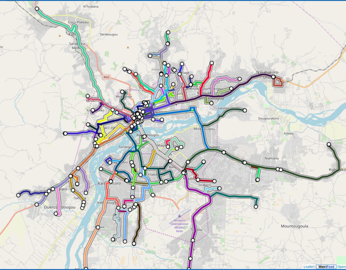
We digitalize data collected through OpenStreetMap, an open source digital mapping system.
Open Data Portal : WatriData
WatriData is an open data portal in the field of transit and mobility in West Africa.
The aim is to make accessible data associated with transit and mobility in Africa. Several datasets related to transport and mobility are available. Publish, Download data Openly .
Visit open Data Portal : WatriData
GTFS Datasets : WatriFeed GTFS Manager
GTFS allows transit agencies and operators to publish data in a format that can be exploited and used in applications in an interoperable mode.
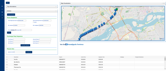
We developed WatriFeed GTFS Manager a web-based collaborative GTFS data editor to support the standardization of transport data for easy reuse in transport, mobility applications and services.
Create your own GTFS : WatriFeed GTFS Manager
Transit Data Visualization : TransitViz
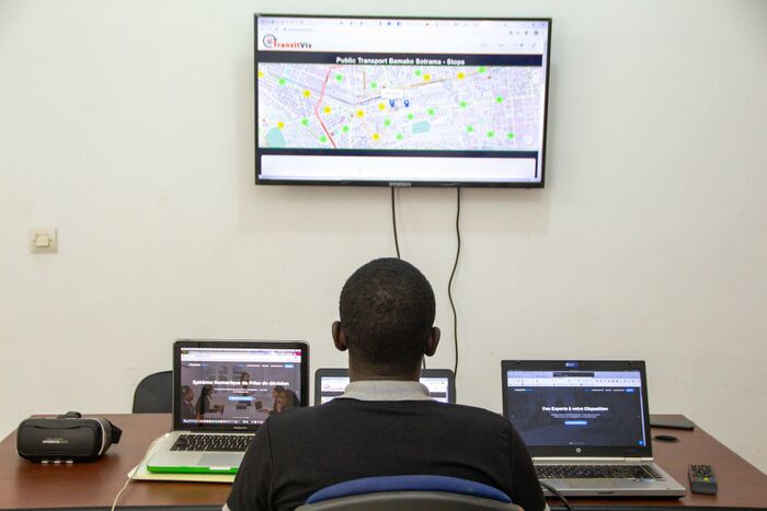
Digital transit data mining and analysis through graphs, interactive web maps is an excellent way to tackle the growing complexity of the available data, and to learn from it in a unifying way. We have a dedicated application named TransitViz, exclusively dedicated to the visaulization of transport data.
We have an exclusive application dedicated exclusively to the visaulization of transport data, which is called TransitViz.
Visualize your Transit Data : TransitViz
Mobile & Web Application Development : WatriFeed-API
WatriFeed-API provides a Application Programming Interface (API) which allows developers to build their own applications using specific transport data. We also supports enterprises, organisations and institutions in designing and developing web and mobile applications for mobility services
We also support organizations and institutions designing and developing web and mobile applications focused on mobility.
Develop your own Transit app : WatriFeed Api
Documentation
- WatriFeed GTFS Manager: How to create a GTFS datasets with Watrifeed GTFS manager by exploiting OpenStreetMap data
- WatrifFeed API : How to create a transit application using WatriFeed API
- Transit mapping project : How to map a transit bus line.
Community
1. Mailing list
2. Website : www.data-transport.org
3. Direct contact : labs@data-transport.org


