Featured images/Oct-Dec 2015
Jump to navigation
Jump to search
These are featured images, which have been identified as the best examples of OpenStreetMap mapping, or as useful illustrations of the OpenStreetMap project.
If you know another image of similar quality, you can nominate it on Featured image proposals.
| ← from October to December 2014 | ← from July to September 2015 | from January to March 2016 → | from October to December 2016 → |
Gallery of featured images, from October to December 2015
Details and captions
Week 40 (from Monday 28 September 2015 to Sunday 4 October 2015) [Edit]
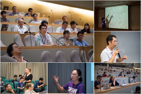
- English : State Of The Map Taiwan took place in Taipei this month. Crisis response and urgency mapping is the main topic of the conference.
Week 41 (from Monday 5 October 2015 to Sunday 11 October 2015) [Edit]
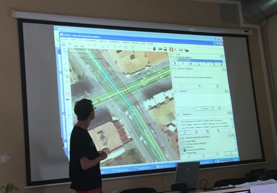
- English : SOTM Catalonia conference took place in Barcelona last week, with talks such as this one on public transport mapping
Week 42 (from Monday 12 October 2015 to Sunday 18 October 2015) [Edit]
- English : State of the Map Scotland 2015 took place over five days in Edinburgh recently
Week 43 (from Monday 19 October 2015 to Sunday 25 October 2015) [Edit]
- English : The Bangladesh OpenStreetMap community (facebook group) together with the Red Cross have been mapping the dense district of Gandaria in Dhaka
Week 44 (from Monday 26 October 2015 to Sunday 1 November 2015) [Edit]
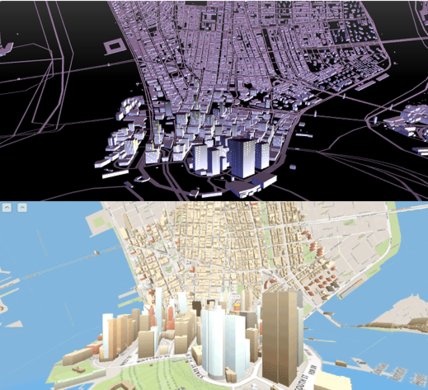
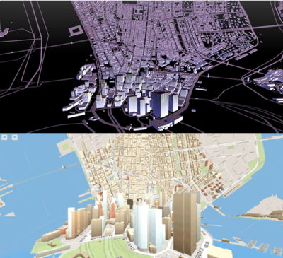
- English : Taking a flat map at the top, and bending it to form a street level 3D map at the bottom of the view. This effect is similar to the disturbing warped cityscapes in the movie 'Inception'. Here are two implementations running in the browser using tiled OpenStreetMap vector data with Tangram and with OSMBuildings. Read more on the googlemapsmania blog.
Week 45 (from Monday 2 November 2015 to Sunday 8 November 2015) [Edit]
- English : The 'standard' OpenStreetMap style was recently changed to represent major roads types with a steady progression of hue and lightness, helping to make them visible over other land types colour. Read more on the blog
Week 46 (from Monday 9 November 2015 to Sunday 15 November 2015) [Edit]
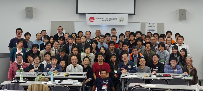
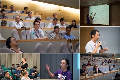
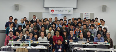
- English : The State of the Map Japan OpenStreetMap conference was held in Hamamatsu City last week
Week 47 (from Monday 16 November 2015 to Sunday 22 November 2015) [Edit]
- English : One of many visualisations by Martin Dittus from his slides full of stats & charts about humanitarian mapping projects. This shows tasks.hotosm.org projects by HOT and the recent Missing Maps Project, each with their own horizontal timeline, kicking off one after the other. Spikes of editing activity include the spectacular 2015 Nepal earthquake response. Read more here
Week 48 (from Monday 23 November 2015 to Sunday 29 November 2015) [Edit]
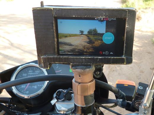
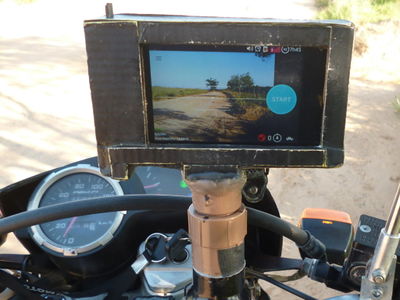
- English : A DIY motorbike mount by ProjectRGM in Brazil. All set up for serious data capture, running Mapillary to record a sequence of street level photos for easy OpenStreetMap data capture.
Week 49 (from Monday 30 November 2015 to Sunday 6 December 2015) [Edit]
- English : The map on this Italian government website shows trips made by Prime Minister Renzi. A simple but stylish Leaflet web map with black & white styled OpenStreetMap basemap by wikimedia Foundation
Week 50 (from Monday 7 December 2015 to Sunday 13 December 2015) [Edit]
- English : The stylish shopping boutiques of Via Monte Napoleone, Milan, now mapped out in lots of detail thanks to user:Alecs01
Week 51 (from Monday 14 December 2015 to Sunday 20 December 2015) [Edit]
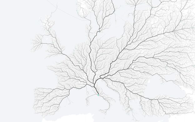
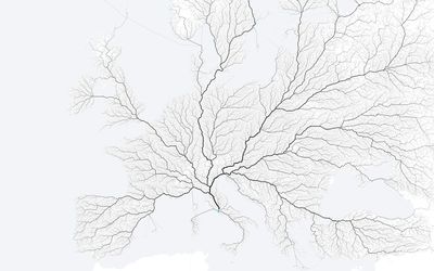
- English : All roads lead to Rome. So the saying goes, and so this image illustrates. See this and other great OSM routing powered images on roadstorome.moovellab.com
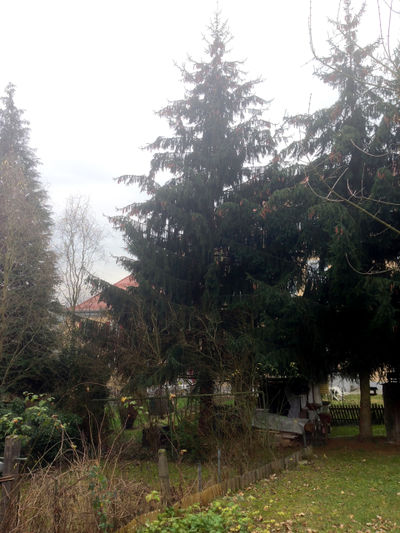
Week 52 (from Monday 21 December 2015 to Sunday 27 December 2015) [Edit]
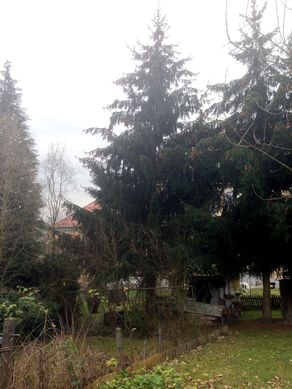
- English : User te_mark found out that the node 1
 node 1 in its 13th version is just a kilometer away from him, so he went and made a photo of the tree it represents. It's a Christmas tree! (or a leaf_type=needleleaved at least)
Week 53 (from Monday 28 December 2015 to Sunday 3 January 2016) [Edit]
- English : 'Simulacro Nacional' (National Earthquake Drill) took place in Mexico City, with a variety of digital disaster preparedness activities including a big OpenStreetMap training session

