File:BorderITSLO.jpg

From OpenStreetMap Wiki
Jump to navigation Jump to search

Original file(1,024 × 768 pixels, file size: 455 KB, MIME type: image/jpeg)

View on Wikimedia Commons
This file and its description are from Wikimedia Commons.
Description
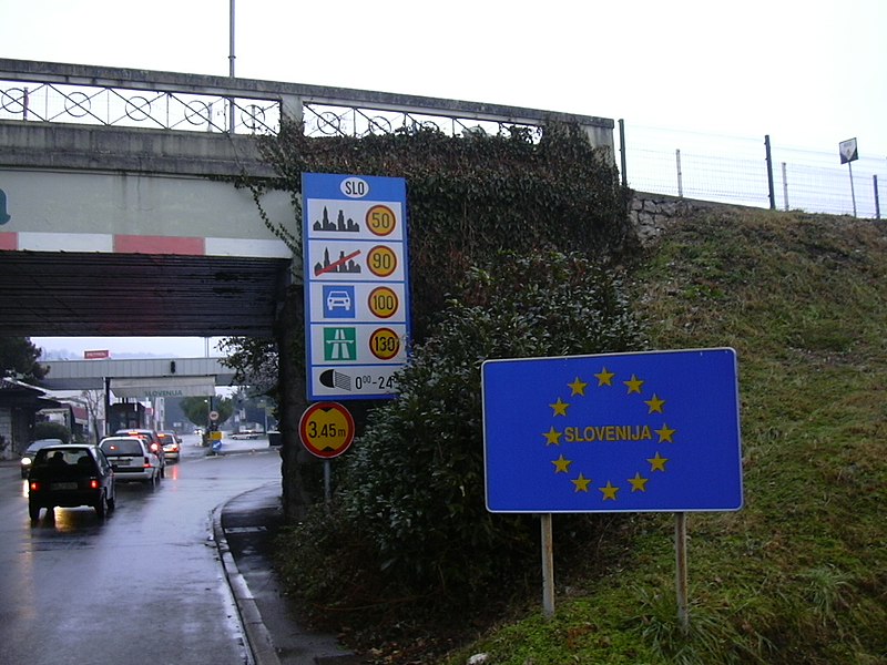
English: The border between Italy (Gorizia) and Slovenia (Nova Gorica).
Italiano: il valico di Casa Rossa: il confine di stato tra Gorizia (Italia) e Nova Gorica (Slovenia)
Deutsch: Grenze zwischen Gorizia (Italien) und Rožna Dolina, Nova Gorica (Slowenien) vor Inkrafttreten des Schengen-Abkommens
Date
Source Own work
Author User:Dantadd
Permission
(Reusing this file)
Public domain I, the copyright holder of this work, release this work into the public domain. This applies worldwide.
In some countries this may not be legally possible; if so:
I grant anyone the right to use this work for any purpose, without any conditions, unless such conditions are required by law.
Camera location45° 56′ 30.62″ N, 13° 38′ 09.42″ E  Heading=90° Kartographer map based on OpenStreetMap.View this and other nearby images on: OpenStreetMapinfo

Captions

Add a one-line explanation of what this file represents

Items portrayed in this file

depicts

January 2006

45°56'30.624"N, 13°38'9.420"E

heading: 90 degree

0.02624338624338624338 second

5.8 millimetre

image/jpeg

4fdf338b26d29ecdfe3c9bbf627c41d52b787620

466,136 byte

768 pixel

1,024 pixel

File history

Click on a date/time to view the file as it appeared at that time.

Date/TimeThumbnailDimensionsUserComment
current23:55, 1 December 2006Thumbnail for version as of 23:55, 1 December 20061,024 × 768 (455 KB)wikimediacommons>DantaddThe border between Italy (Gorizia) and Slovenia (Nova Gorica), january 2006 (taken by myself) Category:Gorizia Category:Slovenia Category:Road signs

There are no pages that use this file.

Metadata