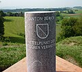
File:Brütten Vermessungspunkt 1912.jpg
Jump to navigation
Jump to search


Size of this preview: 682 × 600 pixels. Other resolutions: 273 × 240 pixels | 546 × 480 pixels | 873 × 768 pixels | 1,164 × 1,024 pixels | 1,346 × 1,184 pixels.
Original file (1,346 × 1,184 pixels, file size: 866 KB, MIME type: image/jpeg)
File history
Click on a date/time to view the file as it appeared at that time.
| Date/Time | Thumbnail | Dimensions | User | Comment | |
|---|---|---|---|---|---|
| current | 15:57, 9 October 2011 |  | 1,346 × 1,184 (866 KB) | wikimediacommons>Paebi |
File usage
The following 10 pages use this file:
- Historic.Place/Map Properties
- Pl:Historic.Place/Map Properties
- Pt:Historic.Place/Características do mapa
- User:Saerdnaer/Tag/test
- User:Zecke/Objets historiques
- DE:Historic.Place/Karteneigenschaften
- DE:User:Saerdnaer/Tag/test
- FR:Historic.Place/Attributs
- RU:Исторические объекты/Свойства карты
- JA:Historic.Place/Map Properties