File:ConnectivityExample4.png

Original file (690 × 616 pixels, file size: 666 KB, MIME type: image/png)
Summary
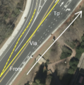
Esri World Imagery of this location: https://www.osm.org/#map=19/35.90426/-79.05485
Licensing
ISC
The iD editor software is published under ISC License – Copyright iD Contributors.
Permission to use, copy, modify, and/or distribute this software for any purpose with or without fee is hereby granted, provided that the above copyright notice and this permission notice appear in all copies.
THE SOFTWARE IS PROVIDED "AS IS" AND THE AUTHOR DISCLAIMS ALL WARRANTIES WITH REGARD TO THIS SOFTWARE INCLUDING ALL IMPLIED WARRANTIES OF MERCHANTABILITY AND FITNESS. IN NO EVENT SHALL THE AUTHOR BE LIABLE FOR ANY SPECIAL, DIRECT, INDIRECT, OR CONSEQUENTIAL DAMAGES OR ANY DAMAGES WHATSOEVER RESULTING FROM LOSS OF USE, DATA OR PROFITS, WHETHER IN AN ACTION OF CONTRACT, NEGLIGENCE OR OTHER TORTIOUS ACTION, ARISING OUT OF OR IN CONNECTION WITH THE USE OR PERFORMANCE OF THIS SOFTWARE.Esri (ArcGIS.com): "(...) Esri and its imagery contributors grant Users the non-exclusive right to use the World Imagery map to trace features and validate edits in the creation of vector data. Users that create vector data from the World Imagery map may want to publicly share that vector data through a GIS data clearinghouse of its own or through another open data site. This public sharing could be achieved through ArcGIS Open Data or the OpenStreetMap (OSM) Initiative. For ArcGIS users that want to contribute such vector data to OSM, Esri provides applications and services directly accessible from ArcGIS platform. Users acknowledge that any vector data contributed to OSM is then governed by and released under the OpenStreetMap License (e.g. ODbL).
Except for the additional limited rights granted above, any and all other uses of the World Imagery map remain subject to the terms and conditions set forth in the Esri Master Agreement or Terms of Use, as applicable. Esri and its imagery contributors retain all right, title, and interest in and to their respective imagery data contributed to the World Imagery map." (→ source)
"For More Info, visit: https://goto.arcgisonline.com/maps/World_Imagery "
This image is a relatively minor extract of the (worldwide) Esri imagery, used for illustrative purposes on the OpenStreetMap wiki, to help document ways of using and interpreting the imagery in the OpenStreetMap mapping process.

|
Contains map data © OpenStreetMap contributors, made available under the terms of the Open Database License (ODbL).
The ODbL does not require any particular license for maps produced from ODbL data, produced maps may be subject also to other licences. |
File history
Click on a date/time to view the file as it appeared at that time.
| Date/Time | Thumbnail | Dimensions | User | Comment | |
|---|---|---|---|---|---|
| current | 16:37, 2 June 2019 |  | 690 × 616 (666 KB) | LeifRasmussen (talk | contribs) | Better road alignment to encourage correct mapping. |
| 18:30, 23 May 2019 |  | 852 × 856 (994 KB) | LeifRasmussen (talk | contribs) | Esri World Imagery of this location: https://www.osm.org/#map=19/35.90426/-79.05485 |
You cannot overwrite this file.
File usage
There are no pages that use this file.
