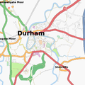
File:DurhamMap.png
Jump to navigation
Jump to search
DurhamMap.png (400 × 400 pixels, file size: 185 KB, MIME type: image/png)
File history
Click on a date/time to view the file as it appeared at that time.
| Date/Time | Thumbnail | Dimensions | User | Comment | |
|---|---|---|---|---|---|
| current | 12:06, 30 December 2008 |  | 400 × 400 (185 KB) | Philipcullen (talk | contribs) | |
| 19:18, 9 May 2008 |  | 400 × 400 (109 KB) | Philipcullen (talk | contribs) | ||
| 23:05, 2 March 2008 |  | 400 × 400 (96 KB) | Philipcullen (talk | contribs) | ||
| 15:29, 29 January 2008 |  | 400 × 400 (90 KB) | Philipcullen (talk | contribs) | http://tah.openstreetmap.org/MapOf/?lat=54.773&long=-1.5666&z=13&w=400&h=400&format=png |
You cannot overwrite this file.
File usage
There are no pages that use this file.
