File:Ffm qlandkarteGT.png
Jump to navigation
Jump to search


Size of this preview: 800 × 546 pixels. Other resolutions: 320 × 218 pixels | 640 × 437 pixels | 1,024 × 699 pixels | 1,409 × 962 pixels.
Original file (1,409 × 962 pixels, file size: 1.6 MB, MIME type: image/png)
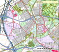
Screenshot der Daten vom 19.11.2008 in QLandkarteGT V0.9
- This media file was uploaded by author of the work and its copyright holder.
This work is licensed under the Creative Commons Attribution-ShareAlike 4.0 License.
Attribution: Computerteddy
Attribution: Computerteddy
Contains map data © OpenStreetMap contributors, made available under the terms of the Creative Commons Attribution-ShareAlike 2.0 (CC-BY-SA-2.0).
File history
Click on a date/time to view the file as it appeared at that time.
| Date/Time | Thumbnail | Dimensions | User | Comment | |
|---|---|---|---|---|---|
| current | 09:02, 21 June 2011 |  | 1,409 × 962 (1.6 MB) | Computerteddy (talk | contribs) | Neue Version mit Kartendaten Juni 2011 |
| 08:57, 21 June 2011 |  | 1,920 × 1,015 (1.61 MB) | Computerteddy (talk | contribs) | Neue Version mit Kartendaten Juni 2011 | |
| 09:38, 26 November 2008 |  | 809 × 719 (666 KB) | Computerteddy (talk | contribs) | Screenshot aus QLandkarteGT: Frankfurt am Main West mit den Daten vom 19.11.2008 | |
| 09:33, 26 November 2008 |  | 1,014 × 763 (733 KB) | Computerteddy (talk | contribs) | Screenshot der Daten vom 19.11.2008 in QLandkarteGT V0.9 |
You cannot overwrite this file.
File usage
The following page uses this file: