File:Hedge End.png
Jump to navigation
Jump to search


Size of this preview: 643 × 599 pixels. Other resolutions: 257 × 240 pixels | 515 × 480 pixels | 856 × 798 pixels.
Original file (856 × 798 pixels, file size: 479 KB, MIME type: image/png)
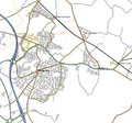
map of Hedge End and Botley, Hamsphire, UK
Licensing
This screenshot contains OpenStreetMap Carto rendering.
The OpenStreetMap Carto map style is made available under the Creative Commons CC-0 1.0 Universal Public Domain Dedication.
- Attribution to the map data:
Contains map data © OpenStreetMap contributors, made available under the terms of the Creative Commons Attribution-ShareAlike 2.0 (CC-BY-SA-2.0).
File history
Click on a date/time to view the file as it appeared at that time.
| Date/Time | Thumbnail | Dimensions | User | Comment | |
|---|---|---|---|---|---|
| current | 11:40, 29 September 2011 |  | 856 × 798 (479 KB) | Deanna Earley (talk | contribs) | Updated with the latest data from 09/2011 with Mapnik rendering. |
| 10:28, 6 January 2007 |  | 732 × 684 (242 KB) | Deanna Earley (talk | contribs) | Hedge End as of the 6th of January 2007 | |
| 17:01, 5 November 2006 |  | 727 × 615 (217 KB) | Deanna Earley (talk | contribs) | Updated as of 2006-11-05 | |
| 22:02, 20 October 2006 |  | 726 × 615 (201 KB) | Deanna Earley (talk | contribs) | Hedge End as of 20/10/2006 | |
| 23:26, 7 September 2006 |  | 701 × 587 (190 KB) | Deanna Earley (talk | contribs) | Hedge End as of 7th of Septeber, 2006 | |
| 02:07, 20 July 2006 |  | 688 × 615 (160 KB) | Deanna Earley (talk | contribs) | Updated as of 19th of July 2006 | |
| 23:55, 4 July 2006 |  | 688 × 616 (134 KB) | Deanna Earley (talk | contribs) | Hedge End as of ~~~~~ | |
| 21:31, 18 June 2006 |  | 730 × 605 (101 KB) | Deanna Earley (talk | contribs) | Updated map | |
| 23:08, 1 June 2006 |  | 665 × 603 (77 KB) | Deanna Earley (talk | contribs) | OSMARender map of Hedge End and Botley, Hamsphire, UK |
You cannot overwrite this file.
File usage
The following 2 pages use this file: