Recording GPS tracks
| Record tracelog | Convert | Modify | Upload | Accuracy | Device reviews | |||||||||||||||
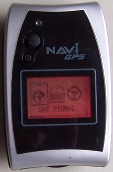
 A NaviGPS receiver. Recording GPS tracks requires a GNSS Receiver (like GPS, Galileo, GLONASS, etc.) with the ability to save your location. Satellite Receiver is a device which allows you to accurately pinpoint your position, by receiving radio signals from satellites. To record tracks and/or waypoints, you will need to select a sat unit with this function — a specialized unit, but also a smartphone are both good candidates.
Types of GNSS (or satellite) receiversThere are many types of satellite receivers, from a simple logger to smartphones with embedded GNSS chip(s). The most useful for OpenStreetMap listed below.
See GPS Reviews for a list of reviews of receivers by OSM contributors. How-to guideWith hundreds of receiver devices available, providing detailed instruction for all of them is infeasible. The following guide therefore provides generic advise to help you get started. Not all the steps may be necessary (or possible) on your particular device. If you need any help, please ask questions on the Mailing lists or IRC. Prerequisites
Record the track GPS traces of hiking trails recorded during a mapping party in Slovakia (watch video). Go for a walk or a cycle ride or a drive (or whenever you take any kind of journey)
Frequently asked questionsCan I use a smartphone?Yes, but the accuracy may not be as good as a dedicated hand held unit. Almost all smartphones do include GPS receivers and you can record track logs using one of the numerous available apps. Unfortunately the accuracy between phones can vary greatly and it is difficult to work out the technical accuracy of a track. A good test is to compare your results to other sources. Have a go at recording a track and check that it is smooth (does not jump all over the place) and is roughly in line with GPS tracks recorded by other people/devices (preferred) or aerial imagery (least preferred due to inaccuracy of aerial imagery in hilly areas). See Software/Mobile for a list of software for your smartphone; for most platforms there is a table comparing the "Track making features" of the apps. Don't forget that you can also take geo-located photos with your smartphone which can be used in OSM (e.g. in JOSM editor). Not all car SatNavs include an option to record GPS tracks, and if it does it may be within a hidden service menu. Try searching for your particular model number online or ask in the mailing lists or IRC. Be aware, that battery life can be short (less than 3 hours if the screen remains on when recording). Furthermore, some devices have a "lock to track" mode that cannot be disabled and are only useful away from all mapped tracks or roads. To test this, walk away from a road at 45° and watch if your recorded path follows the road and then suddenly jumps away when you are several 10's of meters away. What to record?Anything, as long as it reflects a real world feature. For example, try to avoid tracklogs of flights, as these could be distracting or confusing to other map contributors. Don't worry if you don't have the time to edit the map features after uploading a GPS track - the track on its own is helpful for others. Also tracklogs of roads that have already been mapped are also useful, as they can help to validate the true path of a road by providing more sample points. Marking unreachable objectsGPS offset method
When there is a structure or object that you want to GPS but is inaccessible (like a cell tower surrounded by a large fence) then you can use the 'GPS Offset Method' to get its coordinates. To do this you will need your GPS, compass, optionally a range finder and a way to record your data like a notebook or voice recorder. (Instead of using a range finder you can just estimate the distance but this will usually be less accurate.)
Aimed straight segments methodAnother method (much more simple, a little less accurate) is to "draw" two straight segments by GPS traces (walk right towards the object twice from different locations) both pointing at that distant object and then draw two lines through them. The lines will intersect in the object's location. For added accuracy, walk towards two objects at once, keeping yourself in line with both of them. This helps you walk straight. InterpolationIdentify two reference objects in the background, such as prominent buildings or power poles, which have already been mapped (or which you will map e.g. from aerial imagery). For each reference object, mark a GPS position where the target object is between yourself and the reference object. Draw a line from each of these GPS positions to the corresponding reference object. The target object is where the lines cross. For best accuracy, pick reference objects that are close to the target object but far away from each other (ideally at a 90 degree angle). Counterintuitively, the further away you are from the target object, the more accurate your measurement is, because any errors in your own position are less significant. EstimationIf the unreachable object is not critical, you can simply estimate where it should be on the map, but make sure to mark it with fixme=*, so that others know and possibly position it better later. See also
| ||||||||||||||||||||
| ||||||||||||||||||||||||||||||||||
