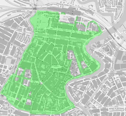
Haarlem, NL
Jump to navigation
Jump to search
| V・T・E |
| latitude: 52.3863, longitude: 4.6378 |
| Browse map of Haarlem 52°23′10.68″ N, 4°38′16.08″ E |
| Edit map |
|
External links:
|
| Use this template for your locality |
Haarlem is a City in Noord-Holland at latitude 52°23′10.68″ North, longitude 4°38′16.08″ East.
http://www.informationfreeway.org/?lat=52.38638550771551&lon=4.63780639151714&zoom=13&layers=B000F00
Floris Looijesteijn is working on getting housenumbers on the map for the city center.
This is the current status:
The project should be finished somewhere in April 2011.
