IT:Tag:sport=climbing
| Descrizione |
|---|
| Indica gli elementi che rappresentano un sito di arrampicata sia naturale (falesia, zona d'arrampicata, settore, singola via isolata, cascata di ghiaccio, etc.) che artificiale (parete artificiale attrezzata, palestra d'arrampicata etc.) |
| Gruppo: Sports |
| Applicabile agli elementi |
| Combinazioni utili |
| Vedi anche |
| Stato: de facto |
| Strumenti |
Se comprendi l'originale in tedesco aiuta a completare questa traduzione in italiano. Leggi le istruzioni su come tradurre questa wiki.
Sembra che nessuno stia lavorando a questa traduzione al momento, se vuoi puoi prenderla in carico tu.
Il tag sport=climbing indica gli elementi che rappresentano un sito di arrampicata sia naturale (Sito d'arrampicata, sectors, falesia, halls, Cascata di ghiaccio, etc.) che artificiale (climbing walls, Arrampicata indoor etc.)
Please note, that this is a translation of the German version of this page, which aims at mapping climbing sites like climbing areas, sectors, crags/boulders/... and of course halls. It also contains a JOSM-preset.
For more detailed mapping like tagging single routes, pitches etc see climbing
Link descrittivo su Wikipedia
Vedi anche:
- Tagging discussion in the english or german forum.
- playground=climbingwall (typically without the sport tag) for small climbing walls for children, often on playgrounds
- High ropes course proposal
- via ferrata proposal -
![Wikipedia [W]](/w/images/2/24/Wikipedia-16px.png) Via ferrata
Via ferrata - bare rock proposal - Approved
- Talk:Proposed_features/Playground_Equipment#Put_new_objects_here_to_find_good_names
Tagging
This scheme should be preferably applied to ![]() nodes for artificial climbing walls. It may be applied to
nodes for artificial climbing walls. It may be applied to ![]() ways in conjunction with cliffs natural=cliff or for climbing halls with building=yes. The scheme also applies to boulders attached to bedrock natural=rock and free standing boulders natural=stone.
ways in conjunction with cliffs natural=cliff or for climbing halls with building=yes. The scheme also applies to boulders attached to bedrock natural=rock and free standing boulders natural=stone.
Basic tags
| Tag = Value | Description |
|---|---|
| sport=climbing | Qui è possibile arrampicare. |
| name=* | Nome della falesia, settore o via, se ne ha uno. |
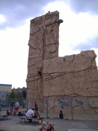
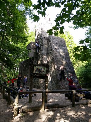
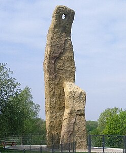
| leisure=sports_centre | Artificial climbing wall. In combination with building=yes or similar it is indoors, otherwise outdoors. For tower-like structures, man_made=tower and tower:type=climbing can be added. |
Stili di arrampicata
Se uno qualsiasi di questi tag non è presente, si da per scontato che il suo valore sia 'no'.
| Tag | Value | Description |
|---|---|---|
| climbing:sport=* | yes / no / <Numero di vie> | Sport_climbing (relies on permanent, fixed anchors) is possible. |
| climbing:boulder=* | yes / no / <Numero di vie> | Bouldering is possible. |
| climbing:toprope=* | yes / no / <Numero di vie> | Arrampicata con corda dall'alto, Top rope, o Moulinette (approach at the route top and letting the rope down) is possible. Fixed or natural anchors may be placed at the top, but routes may not have protection for leading. |
| climbing:trad=* | yes / no / <Numero di vie> | Arrampicata Trad (non vi sono ancoraggi fissi, occorre sistemare delle protezioni durante la salita) is possible. |
| climbing:multipitch=* | yes / no / <Numero di vie> | Sono vie multi tiro multi-pitch. |
| climbing:ice=* | yes / no / <Numero di vie> | Icefalls or the like enable Ice climbing. In contrast to mixed climbing, no rock climbing is involved here. |
| climbing:mixed=* | yes / no / <Numero di vie> | mixed climbing on partially iced rocks is possible. |
| climbing:deepwater=* | yes / no / <Numero di vie> | Steeps cliffs with deep enough water below permit Deep-Water-Soloing. |
Gradazione vie
Solitamente le singole vie sono gradate in base alla loro difficoltà. Se non sono mappate le singole vie ma piuttosto un settore o una falesia, dobbiamo specificare un intervallo di difficoltà. This scheme takes account of numerous grading systems by including the system's name within the key. The proposal for climbing routes includes common names or acronyms for other grading systems such as "yds_class" for the Yosemite Decimal System class and "hueco" for the V-scale used with bouldering in the United States.
| Tag | Description |
|---|---|
| minimum/maximum/average grade according to the UIAA grading system. | |
| minimum/maximum/average grade according to the french grading system. | |
| minimum/maximum/average grade according to the saxon grading system, predominantly used in the Saxon Switzerland, Germany. | |
| ... | ... |
Additional information
| Tag | Value | Description |
|---|---|---|
| ele=* | Average elevation (height above sea level) at the bottom of the routes in meters. This is not the length of a route. | |
| climbing:length=* | Average, minimum and maximum length of routes in meters (for other units refer to Units overview).
Please note, that the length of routes may significantly differ from wall height! This values is important for deciding, which rope to take. | |
| climbing:rock=* |
etc. |
For rock climbing this tag describes the kind of rock available. This information is irrelevant for e.g. ice climbing. |
| climbing:quality=* |
etc. |
Quality of the rock/ice. |
| climbing:bolted=* | yes / no / <average bolt distance in meters> | Are there fixed anchors? If so, what is their average distance? |
| climbing:orientation=* |
etc. |
Orientation of the rock/wall face. Helps to asses at what hour of the day it might be sunny and how long it takes a wall to get dry after rain. |
| climbing:summit_log=* | yes | The climbing feature has a summit log (summit register, de:Gipfelbuch). This tag is clearer in describing the purpose than summit:register=yes. |
| climbing:routes=* | Integer number | Number of routes on this crag (if not tagged in the climbing styles). |
| indoor=*
outdoor=* |
yes / no | Artificial climbing structures can have routes indoor, outdoor or both. In the absence of this tag, outdoor should be assumed default. |
| website=* | URL | Official website |
| url=* | URL | Unofficial website with useful information like topos |
| opening_hours=* |
etc. |
Artificial walls often have fixed opening hours. For rocks there might be restrictions due to breeding beards, etc. |
| fee=* | yes / no / interval | Artificial walls or climbing halls may charge an entrance fee or a membership in a club. |
Pictogram Examples
A pictogram for Rock climbing
An icon for Rock/Sports climbing and bouldering
An icon for Rock/Sports climbing
Photo Examples
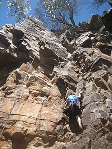
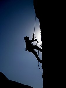
Joshua Tree National Park Climbing Illusion Dweller 5.10b route on The Sentinel Rock at The Real Hidden Valey.
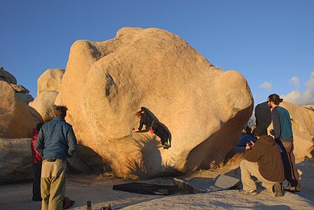
Climber on Stem Gem a classic V4 boulder problem in Joshua Tree National Park in Hidden Valley Campground
Renderer
Like other specialised sports, these tags are not rendered on the general map. Therefore, these engines visualise them:
- http://openclimbingmap.bstegmaier.de/#14/48.3943/9.7821 (live data through openpass API; only for zoom levels 12 and up)
- http://martinkoeller.github.io/ClimbingMap/example1.html (manually synced data; current data: 11-05-2014; all zoom levels)
- https://tsac.climbing.nl/map?layers=4 (almost live data (cached for 24 hours); all zoom levels)
The following renderer display these tags
- mapsforge Theme Elevate, usable e.g. in Android apps
