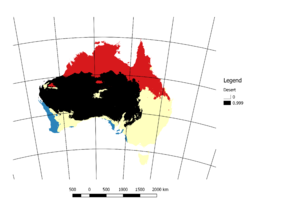
Import/Australian Delineated Desert Areas
There was a discussion on the talk-au mail list about adding the desert areas of Australia to OSM. As noted on the Tag:natural=desert page there a problem with the verifiability of this tag. This page is a description how the desert areas were delineated such that some other mapper would be able to understand and check where these areas came from.
Defining Deserts
To quote the USGS there are as many ways to define deserts as there are deserts. The simplest definition of a desert is an area that receives less than 250mm of rainfall per year. A more sophisticated approach is the Köppen–Geiger climate classification system which varies the rainfall criterion based on mean temperature and which season it falls in.
Input Data
To classify areas as being deserts under the Köppen–Geiger climate classification system requires the following data:
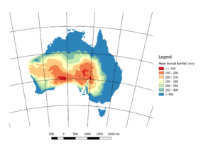
- Mean annual rainfall
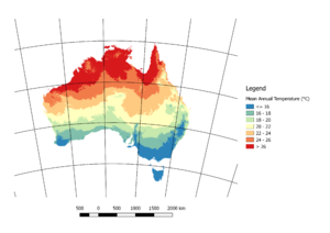
- Mean annual temperature
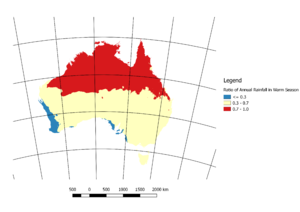
- Mean rainfall in the high sun season (in the Southern Hemisphere this is October to March).
Gridded data for the above variables are available from the BOM for temperature and rainfall
Note copyright.
Hot Season/Cool Season Rainfall
The rainfall threshold for classifying desert areas depends on the rainfall distribution through the year. If the rainfall is mostly in the hot season then more will be required than if it fell uniformly throughout the year. Likewise if the rainfall is mostly in the cool season then the threshold is even lower than for the uniform case.
Based on the ratio of the mean October-March to the annual rainfall Australia can be divided in to warm or cool season dominated if the ratio is outside the range of 0.3-0.7 and uniform if within.
Rainfall Threshold For Desert
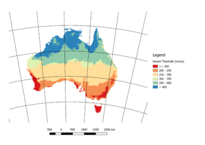
The rainfall threshold for classifying desert areas can then be calculated from:
- Warm Season Dominated Rainfall
- Pthreshold = 10Tmean + 140 (mm/a)
- Cool Season Dominated Rainfall
- Pthreshold = 10Tmean (mm/a)
- Uniform Rainfall
- Pthreshold = 10Tmean + 70 (mm/a)
Desert Area
Based on the rainfall threshold we can then calculate which parts of Australia are desert.
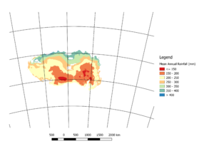
You can mask the map of mean annual rainfall to produce a map of the rainfall in the desert areas of Australia.
Vectorising and Smoothing
The results of these calculations results in a raster of yes/no covering Australia. To put this into OSM the following processing was carried out:
- Convert raster to vector.
- Delete any islands or holes of less than 250km2.
- Smooth the vectors using the SAGA-GIS Gaussian Filter with sigma set to 5 (or to 1 where the vector was too small for the value of 5 to work).
Result
See 8043873![]() 8043873
8043873
