JA:Openrouteservice
英語版の記事の内容が分かる方は、翻訳の完成にご協力ください。このウィキの翻訳方法についての説明をお読みください。
現時点では、誰もこの記事の翻訳に取り組んでいないようですので、あなたが取り組めます。
HeiGIT • JA:Openrouteservice • Ohsome
Ohsome API • OSHDB • Ohsome Dashboard • OhsomeHeX • Ohsome quality analyst
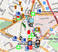
Openrouteservice (Website - short ORS) is much more than a website with a route service for cars, pedestrians and bicycles based on Open Standards and Open Geodata. Several Location Based Services (LBS) created from OSM data are available, developed by HeiGIT - Heidelberg Institute for Geoinformation Technology. For example :
- Directions Service
- Matrix Service
- Geocoding Service
- Locations Service
- Isochrones Service
| Openrouteservice | |
|---|---|
| 作者: | GIScience |
| ライセンス: | Creative Commons Attribution-ShareAlike 2.0 |
| 動作環境: | API および Web |
| 版数: | 24.1 |
| 言語: | チェコ語、 ドイツ語、 英語、 スペイン語、 フランス語、 イタリア語、 オランダ語、 ポーランド語、 ハンガリー語、 ロシア語 および ウクライナ語 |
| ウェブサイト: | http://openrouteservice.org/ |
|
Easy to use, nice UI | |
全般的な情報
| オンライン開始: | 2008年4月 |
|---|---|
| 開発者: | Pascal Neis, 追加開発は Maxim Rylov, Enrico Steiger ほか |
| 原案: | Pascal Neis & Alexander Zipf University of Heidelberg GIScience (Geoinformatics) Research Group ([1]) |
| 現在サポートしている国々: | ヨーロッパ、アジア、アフリカ、オセアニア全体(経路案内および地理情報)
Worldwide: Directory Service (POI-search)] |
| RouteInstructions 用のサポート言語 (Route Service): | Openrouteservice/Instructions 参照 |
| API インタフェース | www.opengeospatial.org/standards/ols |
| 新ウェブサイト | http://openls.geog.uni-heidelberg.de/ on github[2] (Timothy <ellersiek, Carina Lannig, Oliver Roick 他による開発) |
| データ更新(新しいアップデートの仕組みが開発され、2014年6月に開始しました) | Enrico Steiger, Maxim Rylov, Lukas Loos, http://www.geog.uni-heidelberg.de/gis/mitarbeitende_en.html |
機能要望、一般的なフィードバック、コメント、提案、バグ、その他の質問は openrouteserviceATgeog.uni-heidelberg.de 宛てのメールでお願いします
ORS で何ができるか?
Openrouteservice.org は単なる経路案内サービス以上のものです: 他のアプリケーション及びシナリオでも使える OSM データに基づく広域のサービスを使っています。現在、次のサービスが OSM データに基づくOpenrouteservice.org の枠内に実装されています:
- ディレクトリサービス は指定されたあるいは最も近い場所、製品あるいはサービスの位置を探すオンラインディレクトリへのアクセスを提供するサービスです。
- 位置ユーティリティサービス はジオコーダ/逆ジオコーダを提供します; ジオコーダは場所の名前、住所あるいは郵便番号といった位置の説明を、Point geometryを持つノーマライズされた位置の説明に変換します。
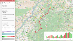
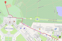
- 経路サービス は様々な基準に従って旅行経路およびナビゲーション情報を決定します。以下のもの向けに実現されています:
- 車: 最速、最短、推奨
- 道具やトンネルを避ける様々なオプション
- 大型車に関する同様の多くのオプション
- 車いすの経路(ベータ版)
- 車: ドイツ向けには、リアルタイムの交通状況(TMC)を使います
- 自転車
- 歩行者
- さらなる拡張(異なる種別の自転車のための特別なオプション等。) が計画または作業中です
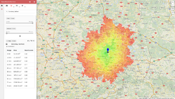
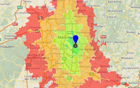
- アクセシビリティ分析サービス (AAS) は与えられた位置周辺の道路ネットワークに基づく所定の時間・距離内に到達可能なエリアを表現するポリゴンを計算します。
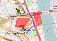
- 緊急ルートサービス 内で、あなたのルートで避けるべきエリアを指定することができます。
- ...
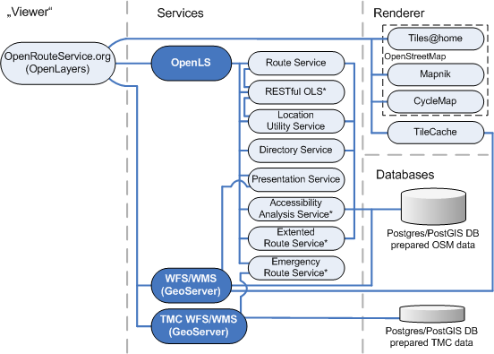
OSS のコンポーネント
Components of ORS from Neis (2008)
経路案内に使われているOSM タグ
車、歩行者、自転車の経路探索に使われる OSM タグ
| 車の経路探索 | 歩行者の経路探索 | 自転車の経路探索 | |||
|---|---|---|---|---|---|
| キー | 値 (km/h -> ORSで使われる速度) | キー | 値 (km/h -> ORSで使われる速度) | キー | 値 (km/h -> ORSで使われる速度) |
| highway | motorway (110 km/h) & motorway_link (90 km/h), trunk (90 km/h) & trunk_link (70 km/h), primary (70 km/h) & primary_link (60 km/h), secondary (60 km/h) & secondary_link (50 km/h), tertiary (55 km/h) & tertiary_link (45 km /h), unclassified (50 km/h), residential (40km/h), living_street (10 km/h), service (30 km/h)* | highway | (trunk & trunk_link till october) primary & primary_link, secondary & secondary_link, tertiary & tertiary_link, unclassified, residential, living_street, service, track, pedestrian, cycleway*, footway, bridleway*, steps, path (on all ways 6 km/h) | highway | (trunk & trunk_link till october) primary & primary_link, secondary & secondary_link, tertiary & tertiary_link, unclassified, residential, living_street, service, track, cycleway, footway*, bridleway*, pedestrian*, path (on all ways 16 km/h) |
| access | yes, no | ||||
| motorcar | yes, no | foot | yes, no | bicycle | yes, no |
| oneway | yes, true, 1, no, false, -1 | oneway | yes, true, 1, no, false, -1 | ||
| junction | roundabout | cycleway | opposite, opposite_lane, opposite_track, track | ||
| route | ferry | route | ferry | route | ferry |
| maxspeed (in work) | 値が数値、例えば'30'といった場合のみ。'30 km/h' あるいは類似のものはサポートしていません!さらに、5 から 130 km/h の間の速度だけが使われています。mph は変換されるでしょう。 | ||||
| * 許可されている場合 | |||||
車いすの経路探索に使われる OSM タグ
The wheelchair routing profile uses a mixture of static filtering, dynamic filtering and prioritisation.
- Static Filtering means that OSM features having the listed tags are taken in or out of the routing graph independent of which preferences the users of the profile specify
- Dynamic Filtering means that the OSM features having the listed tags are taken in or out of the routing graph dependent on which preferences the of the profile specify (such as, incline, surface/smoothness, height of dropped kerbs)
- Prioritasation means that some OSM features having certain listed tags are getting higher (or lower) priority in route planning over other features, which may result in little detours in favour of a more suitable route
OSM Tags used for Static Filtering of Ways/Nodes Independent on User Preferences
The following table shows a list of tags that are used for static filtering. Depending on whether they are "accepted" or "non accepted", they are part of the graph or are completely taken out of the graph, independent on any user setting, and will NOT be available for any route computation. If they are "accepted" they will be available for any route computation.
Ways
| Key | Values for Accepted Ways | Values for Non Accepted Ways |
|---|---|---|
| highway | "footway", "pedestrian", "living_street", "residential", "unclassified", "service",
"trunk", "trunk_link", "primary", "primary_link", "secondary", "secondary_link", "tertiary", "tertiary_link", "road" "path", "track" "bridleway", "cycleway" (exception, if the way has the attributes bicycle/horse="designated", "official") (on all ways 4 km/h) |
"steps", "ford"
"trunk", "trunk_link", "primary", "primary_link", "secondary", "secondary_link", "tertiary", "tertiary_link", "road" (if explicitely tagged as sidewalk = "no"|"none") |
| route ("ferry", "shuttle_train"), public_transport("platform", railway ("platform") | (for "ferry" 10km/h is set) | foot|wheelchair = "no", "restricted", "private" |
| foot | "yes", "designated", "official", "permissive", "limited" | "no", "restricted", "private" |
| wheelchair | "yes", "designated", "official", "permissive", "limited" | "no", "restricted", "private" |
| sac_scale | -- | "hiking", "mountain_hiking", "demanding_mountain_hiking", "alpine_hiking", "demanding_alpine_hiking", "difficult_alpine_hiking" |
| motorroad | "no", (exception, if the way has the attributes sidewalk = "yes", "both", "right", "left") | "yes" |
| bicycle|horse | all other values | "designated", "official" |
| sidewalk | "yes", "right", "left", "both" | "no" (exception for highway = "footway", "pedestrian", "living_street", "residential", "unclassified", "service" |
Nodes
| Key | Values for Accepted Nodes | Values for Non Accepted Nodes |
|---|---|---|
| barrier | "gate", "bollard", "lift_gate", "cycle_barrier", "entrance", "cattle_grid", "swing_gate", "chain", "bump_gate" (exception, if locked = "yes" | "fence", "wall", "hedge", "retaining wall", "city_wall", "ditch", "hedge_bank", "guard_rail", "wire_fence", "embankment"
"stile", "block", "kissing_gate", "turnstile", "hampshire_gate" |
OSM Tags applied for Dynamic Filtering of Way/Nodes Depending On User Preferences
The following features are accepted/not accpeted depending on the preferences the users set in the User Interface of Openrouteservice.
Ways
For the keys surface and smoothness following logic applies for sidewalks:
If sidewalk=left|both|right exists, evaluate whether also "sidewalk:surface:left", "sidewalk:surface:both", "sidewalk:surface:right", "sidewalk:smoothness:left", "sidewalk:smoothness:both", "sidewalk:smoothness:right" exist. If so use these values for surface and smoothness of the sidewalks, if not fall back to surface and smoothness of the way, even for the sidewalks
| Key | route option "concret, asphalt" | route option "flattened cobblestone and better" | route option "cobblestone and better" | route option "compacted" | all traversable surfaces |
|---|---|---|---|---|---|
| surface
(also: sidewalk:left|both|right:surface) |
"paved", "asphalt", "concrete" | "paving_stones", "concrete_plates", "cobblestone:flattened" (+better) | "concrete:lanes", "cobblestone" (+better) | "unpaved", "fine_gravel", "compacted" | "metal", "ice", "grass_paver", "sand", "dirt", "earth", "grass", "gravel", "ground", "mud", "pebblestone", "salt", "snow", "wood", "woodchips" |
| smoothness
(also: sidewalk:left|both|right:smoothness) |
"excellent", "good" | "excellent", "good" | "intermediate" (+better) | "bad" (+better) | "bad" (+better) |
| tracktype | "grade1" | "grade1" | "grade1" | "grade2" (+better) | "grade4" (+better) |
| Key | route option "up to 3%" | route option "up to 6%" | route option "up to 9%" | route option "up to 12%" | all inclines |
|---|---|---|---|---|---|
| incline | incline <= 0.03 | incline <= 0.06 | incline <= 0.09 | incline <= 0.12 | incline <= 0.31
(note: due to a restriction of attribute storage all incline values > 0.31 are mapped to 0.31) |
The values "up", "down" and "yes" are mapped to incline = 0.1
The value "steep" is mapped to incline = 0.15
The value "no" is mapped to incline = 0
| Key | route option "up to 3cm" | route option "up to 6cm" | route option "up to 10cm" | route option "any" |
|---|---|---|---|---|
| kerb:height | kerb:height <= 0.03 | kerb:height <= 0.06 | kerb:height <= 0.10 | kerb:height <= 0.15
(note: due to a restriction of attribute storage all kerb:height values > 0.15 are mapped to 0.15) |
| kerb | "lowered", "yes", "flush", "unknown", "dropped", "rolled" | (+better) | (+better) | "none", "raised", "no" (+better) |
| sloped_curb | "yes", "both", "at_grade", "flush", "low" | (+better) | (+better) | "no", "one" (+better) |
| curb | "lowered", "flush;lowered", "sloped", "lowered_and_sloped", "flush", "flush_and_lowered" | (+better) | (+better) | "regular", "none", (+better) |
The values "at_grade", "flush", "flush;lowered" and "flush_and_lowered" are mapped to kerb:height = 0.0
The values "yes", "both", "low", "lowered", "dropped", "rolled", "sloped" and "lowered_and_sloped" are mappend to kerb:height = 0.03
The values "no", "one", "raised", "none" and "regular" are mapped to kerb:height = 0.15
Nodes
| Key | route option "up to 3cm" | route option "up to 6cm" | route option "up to 10cm" | route option "any" |
|---|---|---|---|---|
| kerb:height | kerb:height <= 0.03 | kerb:height <= 0.06 | kerb:height <= 0.10 | kerb:height <= 0.15
(note: due to a restriction of attribute storage all kerb:height values > 0.15 are mapped to 0.15) |
| kerb | "lowered", "yes", "flush", "unknown", "dropped", "rolled" | (+better) | (+better) | "none", "raised", "no" (+better) |
| sloped_curb | "yes", "both", "at_grade", "flush", "low" | (+better) | (+better) | "no", "one" (+better) |
| curb | "lowered", "flush;lowered", "sloped", "lowered_and_sloped", "flush", "flush_and_lowered" | (+better) | (+better) | "regular", "none", (+better) |
The values "at_grade", "flush", "flush;lowered" and "flush_and_lowered" are mapped to kerb:height = 0.0
The values "yes", "both", "low", "lowered", "dropped", "rolled", "sloped" and "lowered_and_sloped" are mappend to kerb:height = 0.03
The values "no", "one", "raised", "none" and "regular" are mapped to kerb:height = 0.15
OSM Tags used for Prioritisation/Weighting of Features Indpendent of User Preferences
Ways (and also some nodes) get higher weights (positive prioritisation) as well as lower weights (negative prioritisation) depending on their tags. Also combinations of positive and negative features are possible. Segments that have higher weights are more probably to be used in the wheelchair routing.
| Key | Positive Prioritisation | Negative Prioritisation |
|---|---|---|
| tunnel | "yes" | |
| sidewalk | "yes", "both", "right", "left" | |
| foot | "designated", "yes", "official", "permissive", "limited" | |
| bicycle | "official" | |
| highway | "footway", "pedestrian", "living_street", "crossing" | "path", "track" (if no further information about surface|smoothness|incline|tracktype is available)
"trunk", "trunk_link", "primary", "primary_link", "secondary", "secondary_link", "tertiary", "tertiary_link", "road (if no sidewalk is tagged) |
| maxspeed | if maxspeed > "50" | |
| footway | "crossing" |
Further Routing Profiles/Applications
additional project on adding wheelchair routing: http://wiki.openstreetmap.org/wiki/DE:Rollstuhlfahrer-Routing
it is also used for haiti emergency routing: http://openls.geog.uni-heidelberg.de/osm-haiti/
経路命令
命令と数多くの翻訳の改善を手助けしてください! (まもなく40の言語と方言をサポートします!)
経路サービス比較マトリックス
A comparison matrix is available at Routing/OnlineRouters#Route service comparison matrix
経路案内向けのデータ適合性評価
ORS ヒット数、ルートリクエスト及びそのコース・時間の道路ネットワークのエラーによる失敗数 (Schmitz, Zipf & Neis (2008))
Openrouteservice API
| OpenLS Services | Status 01.09.2015 |
|---|---|
| Description: Through the OpenLS interface requests can be generated to the appropriate services without further query limitations. The offered API's are only valid for ' one ' year.
In case you plan a long-term use of the interfaces within your projects or high volume or for commercial applications , please contact openrouteservice AT geog.uni-heidelberg.de | |
| OpenLS Routing Services* | |
| Restful Webservice route request: | http://openls.geog.uni-heidelberg.de/routing |
| testclient with meta information and schema file for routing service: | http://openls.geog.uni-heidelberg.de/routing&help |
| direct route request via URL + parameter: | http://openls.geog.uni-heidelberg.de/route |
| graph routing profile update information: | http://openls.geog.uni-heidelberg.de/routing?info |
| *currently the maximum request limitation is 1000/hour and user. We kindly ask you to not use the service excessively. In case the server performance will be affected we reserve us the right to block individual service user. | |
| OpenLS Geocoding Service | |
| Restful Webservice geocode request: | http://openls.geog.uni-heidelberg.de/geocoding |
| testclient with meta information and schema file for geocoding service: | http://openls.geog.uni-heidelberg.de/geocoding&help |
| direct geocoding route request via URL + parameter: | http://openls.geog.uni-heidelberg.de/geocode |
| OpenLS Directory (POI Search) Service | |
| Restful Webservice directory request: | http://openls.geog.uni-heidelberg.de/directory |
| testclient with meta information and schema file for directory service: | http://openls.geog.uni-heidelberg.de/directory&help |
| direct directory request via URL + parameter: | http://openls.geog.uni-heidelberg.de/direct |
| OpenLS Acessbility Analysis service* | |
| Restful Webservice accessbility analysis request: | http://openls.geog.uni-heidelberg.de/analysis |
| testclient with meta information and schema file for analysis service: | http://openls.geog.uni-heidelberg.de/analysis&help |
| direct accesbility analysis request via URL + parameter: | http://openls.geog.uni-heidelberg.de/analyse |
| *for performance reasons only 30 minutes are currently supported |
直接経路検索リクエスト(GET を使用)
パラメータ
additional Parameter only for HeavyVehicle route profile
optional Parameters only Bicycle route profile
Response surface list {Unknown = 0, Paved = 1, Unpaved = 2, Asphalt = 3, Concrete = 4, Cobblestone = 5, Metal = 6, Wood = 7, CompactedGravel = 8, FineGravel = 9, Gravel = 10, Dirt = 11, Ground = 12, Ice = 13, Salt = 14, Sand = 15, Woodchips = 16, Grass = 17, GrassPavel = 18 } Response waytype list {Unknown = 0, StateRoad = 1, Road = 2, Street = 3, Path = 4, Track = 5, Cycleway = 6, Footway = 7, Steps = 8, Ferry = 9, Construction = 10} |
直接ジオコーディングリクエスト(GET を使用)
Parameters
|
直接アクセシビリティ解析リクエスト(GET を使用)
Parameters
|
| サンプルURL |
位置リンク
In order to show just the map in a certain position and zoom level you may skip the start and end parameters and use the permalink parameters.
Parameters
|
|
サンプルURL |
経路リンク
In order to show the map with a calculated route result use the same parameters then for routing.
Parameters
|
対応ブラウザ
| ブラウザ | Firefox | Opera | Safari | InternetExplorer | Google Chrome |
|---|---|---|---|---|---|
| バージョン | Linux 31 ESR Linux 33 Win 31 ESR Win 33 |
Linux 9.63 Linux 10 alpha Win 9.63 Win 10 alpha |
Win 3.2.1 Win 4 beta |
Win 7.0.5730.11 | Win 2.0.174.0 |
| 検索 | はい | はい | はい | はい | はい |
| マップ対話 | はい | はい | はい | はい | はい |
| 経路案内 | はい | はい | はい | はい | はい |
| エリア回避 | はい | パーシャル* | パーシャル* | パーシャル* | はい |
| POI | はい | はい | はい | はい | はい |
| アクセシビリティ分析 | はい | はい | はい | はい | はい |
- 現在、エリア回避の削除にだけ問題があります。
解像度1280x1024 あるいはそれ以上に最適化されています。
評価
期限切れ:
- The Openrouteservice doesn't interpret OSM JA:Relation:restrictions, which can be a severe limit to the usefulness for traffic routing in some cities. This route is incorrect for example, because the a turn restriction relation is in place shown on this map.
- Clicking the map often leads to an unintentional change in the start or end location marker.
- Barriers are not taken into credit. Try a route between the two towns Bremm and Dohr. Openrouteservice would give you the former road which is still accessible but with a barrier that you can't pass with the car. YourNavigation takes the mapped barrier into credit and takes the far longer road (which is the shortest road for cars for about 5 years now) if you choose car navigation. Can somebody please add the recognition of barriers into Openrouteservice.
Ways tagged with construction=* or proposed=* are not taken into credit. See for example [8]. This is bad if the map is not up to date. Possible solution: additional permanent RouteLink which enables it.These tags are deprecated.
- Another example which does not route the shortest way: [9]
- Example where pedestian routing works well: [10], but the designated cycleway is ignored [11] when routing for bicycles.
参考
我々のアプリケーション及びプロジェクト Openrouteservice, OpenLS+OSM に言及した資料: cmp.: http://www.geog.uni-heidelberg.de/gis/publikationen_journals.html http://www.geog.uni-heidelberg.de/gis/publikationen_conference.html
- Steiger, E. and Zipf, A.(2015): Enriching OSM road networks with TMC LCL information. RICH-VGI: enRICHment of volunteered geographic information (VGI): Techniques, practices and current state of knowledge. 18th AGILE Conference on Geographic Information Science. Lisbon, Portugal.
- Barron, C., Neis, P. & Zipf, A. (2013): A Comprehensive Framework for Intrinsic OpenStreetMap Quality Analysis. , Transactions in GIS, DOI: 10.1111/tgis.12073.
- Ballatore, A. and Zipf, A. (2015): A Conceptual Quality Framework for Volunteered Geographic Information. COSIT - CONFERENCE ON SPATIAL INFORMATION THEORY XII. October 12-16, 2015. Santa Fe, New Mexico, USA. Lecture Notes in Computer Science, pp. 1-20.
- Neis, A. & Zielstra, D. (2014): Generation of a tailored routing network for disabled people based on collaboratively collected geodata. Applied Geography. Vol. 47, pp. 70–77.
- Neis, P. (2014): Measuring the Reliability of Wheelchair User Route Planning based on Volunteered Geographic Information. Transactions in GIS.
- Goetz, M. & Zipf, A. (2012): Using Crowdsourced Indoor Geodata for Agent-Based Indoor Evacuation Simulations. ISPRS International Journal of Geo-Information. Vol.1(2), pp.186-208. MDPI. DOI:10.3390/ijgi1020186.
- Neis, P. & Zipf, A. (2012): Analyzing the Contributor Activity of a Volunteered Geographic Information Project – The Case of OpenStreetMap. ISPRS International Journal of Geo-Information. Vol.1(2), pp.146-165. MDPI. DOI:10.3390/ijgi1020146 .
- Steiger, E. Zipf, A.(2015): Erstellungs eines OSM Graphen mit TMC LCL Informationen In: Strobl, J., Blaschke, T., Griesebner, G. (Hrsg.): Angewandte Geoinformatik 2015. Berlin
- Neis, P., Zielstra, D. & Zipf, A. (2012): The Street Network Evolution of Crowdsourced Maps - OpenStreetMap in Germany 2007-2011. Future Internet. Special Issue "NeoGeography and WikiPlanning" (Eds: B. Murgante, G. Borruso, M. Gibin), Vol.4, pp.1-21 (DOI 10.3390/fi4010001). ISSN 1999-5903.
- Sun, Y., Fan, H., Bakillah, M. & Zipf, A. (2013): Road-based Travel Recommendation Using Geo-tagged Images. Computers, Environment and Urban Systems (CEUS). Elsevier.
- Neis, P., Zielstra, D. & Zipf, A. (2013): Comparison of Volunteered Geographic Information Data Contributions and Community Development for Selected World Regions. Future Internet. Vol. 5, pp. 282-300.
- Goetz, M. & Zipf, A. (2011): Formal Definition of an User-adaptive and Length-optimal Routing Graph for Complex Indoor Environments. Geo-spatial Information Science (GSIS). Vol.14(2). Springer.
- John, S., Hahmann, S., Zipf, A. (2015): Automatisierte Ableitung des Gefälles von Straßen und Wegen aus OpenStreetMap GPS-Tracks. 59. Deutscher Kongress für Geographie (DKG 2015). Berlin, Germany. (accepted as presentation).
- Neis, P. and Zipf, A. (2008): Generating 3D Focus Maps for the (mobile) Web - an interoperable approach. In: International Journal of Location Based Services (JLBS). Vol. 2, Issue 2.
- Neis, P. and Zipf, A. (2007): Realizing Focus Maps with Landmarks using OpenLS Services. 4th International Symposium on LBS and Telecartography 2007. Hongkong.
- Neis, P., A. Zipf, R. Helsper, Kehl, A. (2007): Webbasierte Erreichbarkeitsanalyse - Vorschläge zur Definition eines Accessibility Analsysis Service (AAS) auf Basis des OpenLS Route Service. REAL CORP 2007. Wien, Austria.
- Schmitz S., Zipf A. and Neis P. (2008): New Applications based on Collaborative Geodata - the Case of Routing. XXVIII INCA International Congress on Collaborative Mapping and SpaceTechnology, Gandhinagar, Gujarat, India
- Zipf, A., Neis, P. und Fellner M. (2008): Wirbelstürmer - Freie Mapping- und Routing-Services mit von Usern erzeugten Karten. In: LINUX Magazin (Professoren-.Ausgabe). 01/09 (erschienen 12/2008). S 34-39. http://www.linux-magazin.de/heft_abo/ausgaben/2009/01/wirbelstuermer
- Neis P. and A. Zipf (2008): LBS_2.0 - Realisierung von Location Based Services mit user-generated, collaborative erhobenen freien Geodata. In: J. Roth (Hrsg.): 5. GI/ITG KuVS Fachgespräch Ortsbezogene Anwendungen und Dienste, 4.-5. September 2008, Nürnberg. Sonderdruck Schriftenreihe der Georg-Simon-Ohm-Hochschule Nürnberg Nr. 42, ISSN 1867-5433
- Schmitz, S., Zipf, A. and Pascal Neis (2008): Proposal to define common resources for OpenGIS Location Services. 5th International Symposium on LBS & TeleCartography. Salzburg. Austria.
- Haase M., A. Zipf , P. Neis , V. de Camargo (2008): Interoperable Routing Services in the Context of Evacuation Schemes due to Urban Flooding. EnviroInfo 2008 Conference. Environmental Informatics and Industrial Ecology. Lueneburg, Germany.
- Neis, P., Zipf, A (2008): OpenRouteService.org is three times “Open”: Combining OpenSource, OpenLS and OpenStreetMaps. Accepted for: GIS Research UK (GISRUK 08). Manchester.
- Brinkhoff,T., M. BERTLING, J. BIERMANN, T. GERVENS, R. KÖNIG, D. KÜMPER, P. NEIS, B. STOLLBERG, C. ROLFS, A. WEISER, J. WEITKÄMPER, A. ZIPF (2008): Offenes Katastrophenmanagement mit freiem GIS Zur interoperablen Kopplung von Leitstellensystem, mobilen Clienten und GDI mit Prozessierungsdiensten. AGIT 2008. Symposium für angewandte Geoinformatik. Salzburg. Austria.
- Weiser, A., P. Neis, A. Zipf (2006): Orchestrierung von OGC Web Diensten im Katastrophenmanagement - am Beispiel eines Emergency Route Service auf Basis der OpenLS Spezifikation. In: GIS - Zeitschrift für Geoinformatik. 09/2006. pp. 35-41.
- Neis, P. und Zipf, A. (2008): OpenStreetMap – Grundlagen und Potentiale der freien Wiki-Weltkarte. GIS Report 2008/2009. Harzer Verlag. Karlsruhe.
- Neis, P. und Zipf, A. (2008): LBS 2.0 mit OpenRouteService.org - die OpenGIS-konforme Routing-Plattform auf Basis der freien Geodaten von OpenStreetMap. GIS Report 2008/2009. Harzer Verlag. Karlsruhe.
- Neis, P., A. Schilling, A. Zipf (2007): 3D Emergency Route Service (3D-ERS) based on OpenLS Specifications. GI4DM 2007. 3rd International Symposium on Geoinformation for Disaster Management. Toronto, Canada.
- Neis, P., A. Zipf (2007): A Web Accessibility Analysis Service based on the OpenLS Route Service. AGILE 2007. International Conference on Geographic Information Science of the Association of Geograpic Information Laboratories for Europe (AGILE). Aalborg, Denmark.
- Bauer, M., P. Neis, C. Weber, A. Zipf (2007): Kontextabhängige Landmarken für mobile 3D Navigationsanwendungen. In: 4. Fachgespräch: Ortsbezogene Anwendungen und Dienste. LMU München.

