Key:area:aeroway
Jump to navigation
Jump to search
| Description |
|---|
| The shape of a runway or taxiway area which is also mapped as a linear way |
| Group: aeroways |
| Used on these elements |
| Useful combination |
|
| Status: in use |
| Tools for this tag |
|
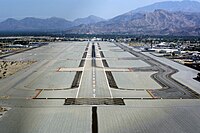
area:aeroway=* describes the shape, i.e. the two-dimensional outline of the area of an aeroway=* which is also mapped as a linear way. It is used as a form of Micromapping in addition to the routable, linear way tagged as aeroway=runway or aeroway=taxiway.
Usage
The tag is applied to an area drawn as closed way or to a multipolygon relation, in addition to mapping the runway or taxiway with a linear way along the centreline.
Values
Inconsistencies
- It remains unclear if the tag should be used for the full shape of a taxiway or split into functional sub-areas at intersections with other taxiways.
- For runways and taxiways with constant width, mapping a polygon representation of linear road can be considered unnecessarily redundant to the linear aeroway=* mapping and a width=* tag and in violation of one feature, one OSM element.
