Key:corners
| Description |
|---|
| Corners that – geometrically speaking – must be driven when passing through a barrier. |
| Group: restrictions |
| Used on these elements |
| Useful combination |
|
| Status: approved |
| Tools for this tag |
|
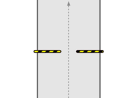
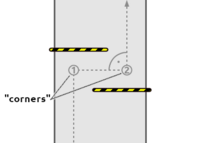
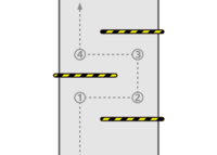
corners=* indicates how many turns/corners – geometrically speaking – must be driven when passing through a multi-stage or chicane shaped barrier like cycle barriers. This key is mainly intended to describe special barrier designs geometrically in more detail and normally doesn't have to be mapped. corners=* counts hard, right-angled turns with effects on passability (~ 90°, see the numbers in the schematic figures below), but not soft ones like you may drive on diagonal barriers with little or no effects on passability.
corners on cycle barriers
When using on cycle barriers, the corners=* value corresponds to default values depending on the type/design of the barrier.
| cycle_barrier=* | Picture | Schematic illustration | corners=* default value |
|---|---|---|---|
| single |  |
 |
0 |
| double |  |
 |
2 |
| triple |  |
 |
4 |
| diagonal |  |
 |
0 |
| tilted |  |
 |
0 |
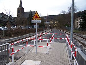
Example
Note: As this type of barrier only differs in the angle of entry from "normal" cycle barriers of the type "triple", it is not necessary to define a special type – simply "triple" can be used. corners=* provides more detailed information on the geometry of the driving line. |
See also
- barrier=cycle_barrier - A barrier along a path that slows or prevents access for bicycle users
