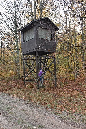
Key:hunting_stand
Jump to navigation
Jump to search
| Description |
|---|
| Specifies the type of hunting stand. |
| Group: properties |
| Used on these elements |
| Requires |
| Status: in use |
| Tools for this tag |
|
The key hunting_stand=* is added to amenity=hunting_stand to specify the type of hunting stand.
Without this tag amenity=hunting_stand is likely to be treated as a raised stand, so applying the tag is more important for other types. In the UK the predominant type of hunting stand is a shooting butt, usually called a grouse butt, and use of this tag is particularly important in a UK context. Shooting/Grouse butts themselves come in various forms: ranging from a simple pillar to an area enclosed by a shoulder-height wall (types illustrated below).
Values in use include:
| Tagging | Example | Remarks | Taginfo |
|---|---|---|---|
| hunting_stand=grouse_butt | Can be mapped as a way | ||
| hunting_stand=raised_hide | Consider including | ||
| hunting_stand=hide | |||
| hunting_stand=tree_stand |


