Key:open_water
| Description |
|---|
| Exposure of a feature to open water. |
| Used on these elements |
| Useful combination |
|
| Status: in use |
| Tools for this tag |
|
open_water=* is an attribute tag that specifies if a feature is exposed to open water. "Open water" is somewhat subjective and tagging may depend on the context, but a good rule of thumb is 500 metres (1,600 ft) from a shoreline. This tag is critical for canoes and other small boats, where open water can pose significant danger.
Background
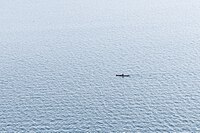
![]() Wind fetch is the length of unobstructed water over which wind can blow. The larger a body of water, the longer the fetch and the greater the waves. Even relatively small waves can swamp a small boat and put a boater in mortal peril far from shore. Boaters may reasonably cross short segments open water to reach destinations when conditions are calm, but there is still inherent danger. Tagging open_water=* enables boaters be informed of this potential danger when planning trips.
Wind fetch is the length of unobstructed water over which wind can blow. The larger a body of water, the longer the fetch and the greater the waves. Even relatively small waves can swamp a small boat and put a boater in mortal peril far from shore. Boaters may reasonably cross short segments open water to reach destinations when conditions are calm, but there is still inherent danger. Tagging open_water=* enables boaters be informed of this potential danger when planning trips.
How to map
Observe the distance of a feature in a body of water from the nearest shoreline or breakwater and add the appropriate open_water=* tag.
- open_water=yes – the feature is exposed to open water on all sides; any nearby structures do not offer appreciable protection
- open_water=partial – the feature is exposed to open water but is protected on at least one side
- open_water=no – the feature is not directly exposed to open water
This tag is most useful in large lakes, reservoirs, bays, estuaries, inland seas, and the ocean. Use the tag on routable waterways such as waterway=fairway, waterway=flowline, and waterway=link. Minor watercourses such as waterway=stream and waterway=drain are assumed to be open_water=no by default.
Useful combinations
Examples
- 1243308688
 1243308688 – paddle traverse to an island in Lake Champlain (open_water=yes)
 - 1251359847
 1251359847 – paddle route along the tidal Delaware River shoreline (open_water=partial)
 - 1280397834
 1280397834 – tidal stream outlet protected by breakwaters (open_water=no)
