Mapping Of Bamako Urban Public Transport
Describes the Urban Transport Mapping (Sotrama) project in Bamako funded by the World Bank. This wiki is updated as the project grows.
Background
The population of Bamako has grown exponentially in the last 40 years. Jumping from under 500 thousand inhabitants in 1990, to more than a million in 2000, the population is estimated at approximately 3.3 million today. This translated in the rapid urban expansion of the city. A major constraint to advancing economically and increase livability, is the city’s lacking mobility, as was highlighted by the 2019 World Bank analysis “Bamako – Engine of Growth” The number of daily trips per person is one of the lowest in the region with only 3 trips a day. What constrains accessibility is how the road infrastructure is being used. In Bamako, roughly 9% of trips are made using a car and 17% using buses. More than half the trips in the city (57%) are made by walking – suggesting a somewhat limited geographical range of movement and thus limited access to the opportunities and services that the city can offer. Public passenger services in Bamako are operated by small minibuses and taxis only. While the service is critical for urban commuters, minibuses, operated by the transit union SOTRAMA, are the main source of congestion and pollution in the city. The SOTRAMA network, which is composed of privately-owned buses traveling on different routes, covers most of the city. However, according to customers the quality of the service is poor in terms of frequency, speed and comfort. There are no designated stops, and frequency of the service is unpredictable with often lengthy wait times (up to an hour for certain lines).
Against this background, this Technical Assistance (TA) will support the Government of Mail (GoM) in taking measures to increase access and mobility in the city. The World Bank provides support to the urban development of Bamako in different capacities, such as Mali Urban Local Government Support Project (P116602) and the Analytical and Advisory Services “Bamako Engine of Growth” (P171658) and is planning to support a new Bamako urban project, proposed by the regional counterpart.
Scope Of Work
Bamako is a very large city by its size and population. It is served mainly by several modes of public transport such as mini-cars with a capacity of 12 - 25 seats called "SOTRAMA". The SOTRAMA network serves the city with buses of 12-25 people capacity on certain assigned routes and certain unofficial, tolerated routes. The price for a trip ranges between 175 FCFA and 350 FCFA. The current network is mapped in some capacity but not sufficiently. The planned OpenStreetMap coverage of the transit network will cater two main objectives:
- to identify possibilities for improvement of the transit system in the Malian capital, and
- to make data about the SOMATRA network accessible to users in the city and the municipal administration and the union itself.
Additionally, this activity will also cater to the following collateral objectives:
- to build capacity on (open data) mapping in the city and iv) to create awareness and encourage coordination between transit stakeholders in Bamako. The consultancy is therefore expected to collect the relevant data for the whole city / SOTRAMA
network and put them at the disposal of end users and the client. The data to be collected should include the following aspects of the network:
- Stops (large intersections, landmarks)
- Trip data (start/end-trip, trip time, associated costs for different sections of the travel)
- Data sets in Shapefile and GTFS formats
Stakeholders involved in the project
WORLD BANK
The World Bank through GFDRR (the Global Facility for Disaster Reduction and Recovery) is the institution that started and is funding the public transport mapping project in Mali.
Billet Express Mali
Startup working in the digital transformation of road transport in West Africa, is the firm in charge of the implementation of the project.
OpenStreetMap Mali
OpenStreetMap Mali, a community active in the free digital mapping of Mali, cooperates with the startup Billet Express Mali in the data collection and mapping of Sotrama lines.
The Project Manager
- Emmanuel BAMA (Data Transport / Billet Express Mali)
Methodology
The methodology document is available for download. : Download doc
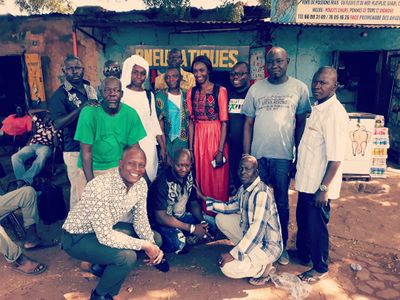
Discussions with SOTRAMA's syndicates
The purpose of these meetings is to provide information to the transit associations and operators about the data collection project and to obtain information from them such as: the number of lines, the number of sotrama on the way, the time and frequency of travel, the operators and the zonal distribution of sotrama in Bamako.
Collection Agent Recruitment
A call for applications is launched to hire collectors, details of the call for applications available online.
Mobile data collection training
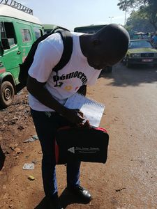
Recruited collectors were trained to collect data related specifically to urban transport, OSM Tracker is the tool used for the collection.
Data Collection
First, we identified lines that constitute the urban transport network of Bamako specific to Sotrama.
Then the collectors are deployed in the city of Bamako on the basis of the existing Sotrama lines for data collection.
The collectors are divided by line, make 2 trips on the same line (round trip/peak hour and round trip/light hour).
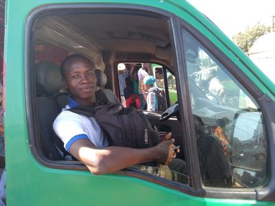
The collectors deployed on the sotrama will be exceptionally positioned with the driver near the windshield to allow good reception of satellite signals and to ensure good accuracy of the collected data.
Types of data to be collected
- Departure points sotrama
- Sotrama operator (company name, address)
- Stops of each of the sotrama lines
- Destinations (arrival points)
- On traffic days.
- Time of course between 2 courses of a line. A trip is a distance between the starting point and the destination, between 2 stops, one station and the final destination.
Schedules (rush hour and off-peak hour) for running to stop points
- Transportation line (name of the line)
- GPS traces (geo-referenced polyline)
- The direction of the roads (round trip)
- The cost of transport on all lines and stops
- Collect data: the segments that cannot be used in rain, the time period, the stopping time by sotrama drivers during this period
The collected information is being used to digitalize the sotrama transport network in OpenStreetMap and to create the open data format GTFS (General Transit Feed Specification).
Data editing with JOSM
Data editing is performed with JOSM ( JAVA OpenStreetMap ), a presset is designed to facilitate this editing. Useful JOSM plugins : Pt Assistant, Public Transport, Relation toolbox, autotools, todo list.
Quality assurance performed by OSMOSE, OSM Inspector , PT Assistant.
Dataset creation
Shapefile Data
QGIS the GIS software highlighted for the shapefiles production.
The Bamako Sotrama Lines and Stops Shapefile is Downloadable : https://store.data-transport.org/dataset/shapefile-sotrama-public-transport-bamako
GTFS Dataset
-Watrifeed : is an OpenSource and collaborative web editor designed to standardize transport data in GTFS format developed by Billet Express via Data Transport has been used for the production of GTFS data for the Bamako Public Transport called SOTRAMA.
The Bamako Sotrama Public Transport GTFS is Downloadable: https://store.data-transport.org/dataset/gtfs-bamako-public-transport-sotrama
Tools
| Process | Tools | Descriptions |
|---|---|---|
| Data Collection | OSM Tracker | -GPS track recording and data collection.
-Note taking -Photo shooting -Customization via preset |
| Data Editing | JOSM | JAVA Editor for OpenStreetMap
Loads GPX tracks, background images and OSM data from local and online sources and allows editing of OSM data. |
| Quality Assurance | -OSMOSE
-OSM Inspector -PT Assistant - GTFS Validator |
-Quality assurance tools to detect issues and show them on the OSM
-Web debugging tool -Validation of the public transport routing -GTFS Data Quality Assurance |
| GTFS ET Shapefile | -QGIS | -QGIS: Free GIS for spatial data editing and analysis, map production, data export.
-Watrifeed : is a web and collaborative editor designed to standardize transport data in GTFS format developed by Data Transport |
| Data visualization | TransitViz | A web-based transport data visualization software developed by Data Transport |
Summary of the Sotrama Transit lines
| Lines | Depature | Arrival |
| 01 | Rail da | Sangarebougou |
| 02 | Rail da | Marseille |
| 03 | Rail da | Fombabougou_ |
| 04 | Rail da | Titibougou |
| 05 | Rail da | Doumanzana/Bandjanbougou |
| 06 | Rail da | Doumanzana/Nafadji |
| 07 | Rail da | Fadjiguila/Zèrèbatou |
| 08 | Rail da | Fadjiguila fèrè |
| 09 | Rail da | Moribabougou droit |
| 10 | Rail d | Banconi/Kognoumani wèrèda |
| 11 | Rail da | Banconi/Razel |
| 12 | Rail da | Djalakorodji/Konimaitou |
| 13 | Rail da | Djalakorodji plaque |
| 14 | Rail da | Sikoro/Sourakabougou |
| 15 | Rail da | Sikoro/Gabakoro |
| 16 | Rail da | Sikoro/Hippordrome 2 |
| 17 | Sougounikoura | Diagunebougou-Kognoumani |
| 18 | Sougounikoura | Diamissabougou |
| 19 | Sougounikoura | Gabakoro |
| 20 | Sougounikoura | NGomi |
| 21 | Sougounikoura | Sourakabougouni |
| 22 | Sougourounikoura | Artisanat |
| 23 | Railda | Sotuba |
| 24 | Railda - Worocouru | Taliko |
| 25 | Maison du combattant | Lafiabougou terminus |
| 26 | Railda - Worocourou | Djissouroutou |
| 27 | Maison du combattant | Lafiabougou Koda |
| 28 | Gabriel Toure | Koulouba |
| 29 | Gabriel Toure | Magnambougou Projet |
| 30 | Cathédrale | Diallacorobougou |
| 31 | Cathédrale | Sénou |
| 32 | NV marché | Fadjiguila Nafadji |
| 33 | NV marché | Sans fil |
| 34 | Vox da | Mamaribougou bougoudaba |
| 35 | Vox da | Sébénikoro wèrèda |
| 36 | Worocourou | Djissouroutou bougoudani |
| 37 | Wororcourou | Sirakoro |
| 38 | Worocourou | Lassa |
| 39 | Worocourou | Kati |
| 40 | Worocourou | Samé |
| 41 | Worocourou | Djissouroutou |
| 42 | Worocourou | Lafiabougou taliko |
| 43 | Maison du combattant | Hamdallaye ACI |
| 44 | Maison du combattant | Badialan |
| 45 | NV marché | Moribabougou droit |
| 46 | Rail da | Lafiabougou |
| 47 | voxda | Konibabougou |
| 48 | Woro Kourou | Kati Koko Plateau |
| 49 | Hopital Gabriel TOURE | Sokonafing |
| 50 | Tour de l’Afrique | Dialakoroba |
| 51 | Tour de l’Afrique | Banankoroni |
| 52 | Tour de l’Afrique | Sanankoroba |
| 53 | Palais de la culture | Garantiguibougou |
| 54 | Sabalibougou près du marché | Guana |
| 55 | Woro Kourou | Kalaban Coura ACI |
| 56 | Woro Kourou | Kalaban-Coro Koulouba |
| 57 | NM | Baguineda à refait |
| 58 | Woro Kourou | ATTbougou 759 lgts |
| 59 | Woro Kourou | Sogoniko |
| 60 | Missirabada | Sablibougoukourani |
| 61 | Woro Kourou | ATTbougou 108 logts |
| 62 | Woro Kourou | Niamakoro-kourani |
| 63 | Woro Kourou | N’golobougou |
| 64 | Woro kourou | Mangnabougou |
| 65 | Worokourou | Bacodjicoroni Golf |
| 66 | Worokourou | Faladié |
| 67 | Worokourou | Daoudabougou |
| 68 | Worokourou | Garantigibougou |
| 69 | Worokourou | Banankabougou |
| 70 | voxda | Kalabanbougou |
| 71 | Raida | Yirimadjo |
| 72 | Grande Moquée | MIssabougou |
| 73 | Place de Guana | Guana |
| 74 | Pharmacie IOTA | Banconi Plateau |
| 75 | voxda | Kanadjiguila |
| 76 | voxda | Samaya |
| 77 | voxda | Djicoronikourou |
| 78 | Voxda | Marché Medine |
| 79 | Voxda | Ouenzinbougou |
| 80 | Ministère de l’economie | Kalaban Coura Diallo Bougou |
| 81 | Direction de la BDM | ATTbougou NIAMAN |
| 82 | Direction des concours | Kabala |
| 83 | Tour d’afrique | Banankoroni |
| 84 | CICB | Mamaribugou |
| 85 | CICB | Sebenicoro |
| 86 | CICB | Djicoroni Para |
| 87 | CICB | Sebenicoro SEMA 2 |
| 88 | CICB | Djicoroni Coura |
| 89 | CICB | Samaya |
| 90 | CICIB | kanadjiguila |
| 91 | Marapha plaque | Sabalibougou |
| 92 | Marapha plaque | Kalabancoro |
| 93 | Marapha plaque | Daoudabougou |
| 94 | Marapha plaque | Yirimadjo |
| 95 | Place coro | Tour d’Afrique |
| 96 | Place coro | Niamakoro |
| 97 | Place coro | Senou terminus |
| 98 | Tour d’Afrique | Farako |
| 99 | Worocourou | Djicoroni ACI |
| 100 | Worocourou | Hotel Sanga |
| 101 | Worocourou | Kalabancoro Plateau |
| 102 | Worocourou | Heremankono |
| 103 | Worocourou | Nerecoro |
| 104 | Worocourou | Sirakoro Neguetana |
| 105 | Worocourou | Kalaban heremankono ACI |
Data repository
Documents, script, source code, data ... are/will be accessible via : Project repository
- GPX tracks downloadable : https://www.openstreetmap.org/traces/tag/Sotrama_Bamako
- Bamako Public Transport GTFS Sotrama Downloadable : https://store.data-transport.org/dataset/gtfs-bamako-public-transport-sotrama
- Bamako Sotrama bus lines and bus stop Shapefiles Downloadable : https://store.data-transport.org/dataset/shapefile-sotrama-public-transport-bamako
Visualisation of Bamako's Public Transport Data " SOTRAMA
-All data can be visualised via our online web application TransitViz. : https://transitviz.org
-Download SOTRAMA's line and stop maps : https://store.data-transport.org/dataset/maps-bamako-public-transport-sotrama
API (Application Programming Interface)
To develop your own software solution, access the Bamako Public Transport Data Programming Interface (API) to develop your applications : https://watrifeed.ml/watrifeed-api
Example of Maps Using Bamako Public Transit Data

