MyTrails
Jump to navigation
Jump to search
It has been proposed that this page be deleted or replaced by a redirect. See the discussion page for further information.
The given reason is: Impact on the historic development of OSM does not seem to exist. The app was removed from Google play and cannot be downloaded any more. --Nakaner (talk) 09:26, 9 October 2024 (UTC).
The given reason is: Impact on the historic development of OSM does not seem to exist. The app was removed from Google play and cannot be downloaded any more. --Nakaner (talk) 09:26, 9 October 2024 (UTC).
| MyTrails | |
|---|---|
| Author: | Pierre-Luc Paour |
| License: | Proprietary (free;paid) |
| Platform: | Android |
| Status: | Broken |
| Version: | 2.1.10 (2020-03-23) |
| Languages: | German, English, French, Italian, Spanish, Portuguese, and Dutch |
| Website: | http://www.frogsparks.com |
| Programming language: | Java |
|
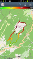
MyTrails is an Android application that makes it easy and fun to view online and offline maps, and to record and share GPS tracks. It is designed to offer an uncluttered map area, and the smoothest map navigation (drag, pinch-zooming, etc.) on a mobile device. | |
MyTrails is an Android application that makes it easy and fun to view online and offline maps, and to record and share GPS tracks. It is designed to offer an uncluttered map area, and the smoothest map navigation (drag, pinch-zooming, etc.) on a mobile device.
It also offers several premium map sources with high-quality scanned topographic maps, in addition to a very large collection of online maps.
Features
- Topo maps
- Full-screen trail map oriented with the built-in compass
- OpenGL Rendering
- Offline maps
- Offline map creation
- Record GPS tracks
- Display multiple GPS tracks at once
- Colorized tracks
- Directions
- Waypoints
- Share and archive tracks (My Trails, GPSies, Dropbox)
- Gestures
- Full tablet support
