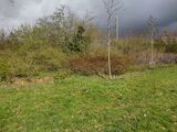
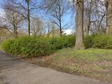
Tag:natural=shrubbery
| Description |
|---|
| An area of woody shrubbery that is actively maintained or pruned by humans. A slightly wilder look is also possible. |
| Group: natural |
| Used on these elements |
| Useful combination |
| See also |
| Status: in use |
| Tools for this tag |
|
The tag natural=shrubbery is used to map areas of woody shrubs, bush and shrubbery that is manicured or otherwise actively maintained (e.g. clipped box hedges or decorative shrubbery). These shrubbery areas typically fulfill ornamental roles, or are used as barrier areas between urban features such as roads and recreation areas. Shrubbery may also be planted and maintained by humans but kept more wildly (see examples below). This in contrast to natural=scrub which is intended for wild, uncultivated scrublands with no to minimal human intervention.
This tag has been proposed twice — as this natural=shrubbery and as an extension of natural=scrub — but was rejected for a variety of reasons. However, its usage continues to grow organically as an alternative for natural=scrub for mapping manicured and maintained shrubbery. The proposal summary provides an in-depth explanation of the various standpoints, and why no single proposal is likely to succeed for this topic.
How to map
Draw an area ![]() and tag it with natural=shrubbery. Any additional tags are optional. Note that area=yes is not needed because natural=shrubbery is an area by definition, and should only be tagged on areas
and tag it with natural=shrubbery. Any additional tags are optional. Note that area=yes is not needed because natural=shrubbery is an area by definition, and should only be tagged on areas ![]() .
.
Due to the current lack of rendering in the standard tile layer, some mappers prefer using natural=scrub for both shrubberies and wild scrubland. See the documentation of natural=scrub for further details. See Rendering for render support for the various OSM based maps.
When not to use
- For wild, uncultivated scrublands, use the tag natural=scrub. If some overgrown branches of the shrubs in a scrubland are sometimes trimmed to keep for example a road clear, still use the tag natural=scrub.
- For individual bushes, use the tag natural=shrub on a node
 .
. - For heath. Heath[1] is a distinct type of habitat that has its own tag natural=heath. Also see the example section below.
- For grasses or other non-woody plants. See possible alternatives like landuse=flowerbed or landuse=grass or natural=grassland.
- For small groups of stunned or freshly planted trees. For those, see either natural=wood or landuse=forest.
- For linear hedges that are too small to be mapped as an area, use barrier=hedge.
Additional tags
The mapped area of shrubbery can be further detailed with multiple tags as explained below.
Effective density
While natural=shrubbery should be considered an impassable object for most traffic unless a highway=* is mapped through it (unlike, say, a grass lawn), the effective density of these areas when mapped serves a number of purposes. For orienteering oneself using a map, this detail can be useful, and may be employed by renderers to highlight it. shrubbery:density=dense in particular is useful to indicate that a natural=shrubbery area acts as a hedge.
Note that the following descriptions are (of course) just a rule of thumb for a rough, general categorisation. Mappers should not barge through shrubberies to figure out its density.
| Value | Definition |
|---|---|
| sparse | Sparsely planted shrubbery. Generally speaking able-bodied persons could walk through them (although this is usually not desirable). |
| medium | Shrubbery with a medium density. Able-bodied persons might be able to barge through it, but it takes some effort and might result in scratches or soiled clothing. |
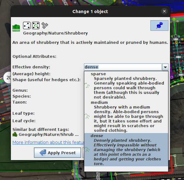
| dense | Densely planted shrubbery. Effectively impassible without damaging the shrubbery (which at this point often acts as a hedge) and getting your clothes torn. |
This table is a wiki template with a default description in English. Editable here.
Plant-life and shape tags
Shrubberies can be enriched with the usual plant-life tags such as genus=*, species=* and leaf_type=*, similar to natural=scrub.
height=* can be added to all shrubby areas as well; it may be particularly useful for hedges which act like a barrier.
For natural=shrubbery which fall in the category of a neatly clipped hedge or a topiary on Wikipedia, shrubbery:shape=* can be used to indicate its shape. For a typical box-hedge this will be a basic shrubbery:shape=box, but any fanciful shape one might prune a topiary into can be described (e.g., shrubbery:shape=dragon or shrubbery:shape=spiral).
Hedges
Before natural=shrubbery the tagging of hedges (i.e., dense shrubby areas that act as a physical (and often visual) barrier) as an area was often done with barrier=hedge together with area=yes. Because this practice is deemed controversial[2], the shrubbery:density=* key was developed as way to mark the effective density of a shrubby area. For hedges a combination of natural=shrubbery with shrubbery:density=dense and height=* can be used a replacement.
This use of natural=shrubbery can also be combined with shrubbery:shape=* — e.g., shrubbery:shape=box for a box hedge.
For hedges mapped as a linear feature, use barrier=hedge.
Examples
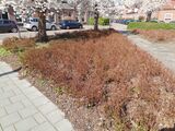
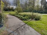
Below, some examples of natural=shrubbery are illustrated.
And a few examples of natural features that are not shrubbery.
Editing with JOSM
In JOSM natural=shrubbery is rendered in a green hue in the default colour scheme. If desired, the Map Paint Style Greenery details can be used to also visualize the values of the shrubbery:density=* and height=* tags:

Since 2023, JOSM has a preset for natural=shrubbery built-in:
Rendering
This tag is currently supported by various renderers:
- Tracestrack Topo https://www.openstreetmap.org/#layers=P
- OpenMapTiles[4]
- Organic Maps[5].
- Osmand
- Preset in JOSM, see section above
- Preset in Vespucci
Not supported:
- OSM Carto: A proposed change to add this feature was rejected in June 2022.
- Preset in iD: open issue
See also
References
- ↑ Heat, Wikipedia
- ↑ For example: https://github.com/gravitystorm/openstreetmap-carto/issues/4111
- ↑ https://nl.wikipedia.org/wiki/Maasheggen
- ↑ Render natural=shrubbery #4530, OpenMapTiles GitHub
- ↑ [styles Render natural=shrubbery #3548], Organic Maps GitHub
Possible tagging mistakes
| ||||||||||||||||||||||||||||||||




![natural=scrub Even though some overgrowth is sometimes trimmed away to keep the road clear [3].](https://upload.wikimedia.org/wikipedia/commons/thumb/c/c2/Maasheggen_bij_oeffelt_2.jpg/160px-Maasheggen_bij_oeffelt_2.jpg)
