Newcastle Mapping Event 2007
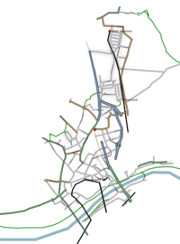
This was a mapping party event which took place in Newcastle in December 2007.
Review
Newcastle Mapping Event Review By Ru Anderson
On Saturday 8th December, an OpenStreetMap (OSM) mapping party came together in the Cassie Building at Newcastle University. With the aim of collecting as much of the missing street data for the main Newcastle region, there was much to do. The weather forecast also stated heavy rain for the whole of the weekend.
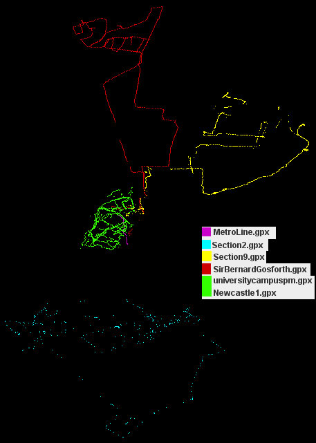
The rain didn’t put everyone off, and the start of the mapping began at around 10am. Starting at the north of the city (Gosforth) and working downwards was the plan. The city had been sectioned into walk able areas with print outs of each section available for the field. This proved to be essential as many new people to OSM turned up and needed any guidance they could get. After an introduction to the project and the equipment, they were sent out manned with the handheld GPS receiver, section map and a quick guide to using the receiver. 6 new mappers in total went out and completed parts of their section. The heavy rain made notes very difficult to read and write but all the tracks were uploaded successfully to the server. 2 OpenStreetMap members also attended, each having there own plans for the day. As a result, parts of Newcastle University have been mapped along with a few of its buildings. One member attempted the metro system, however after all the effort, the track did not show the correct path to allow for accurate mapping. Overall, everyone who took part contributed to OSM. Due to the amount of new mappers and Internet connections, very little data processing occurred at the end of the day but all the data has now been used.
On Sunday, the day followed the same plan as Saturday. However, the concentration was on the south of the city. 6 colleagues collected good data after making some small changes from the Saturday. Each of their sections were completed and uploaded to the server. No OSM members were available on the Sunday. Rain and snow came in the afternoon and the day finished early afternoon.
Every track collected over the weekend was used to add new information for the Newcastle region. No particular region was mapped in great detail or completed but Newcastle is now a better-mapped area than before the weekend.
Thank you to those who contributed.
Old organisational info
Where and when
Area
| V・T・E |
| latitude: 54.95, longitude: -1.60 |
| Browse map of Newcastle 54°57′00.00″ N, 1°36′00.00″ W |
| Edit map |

|
|
External links:
|
| Use this template for your locality |
Newcastle is a city in Northumberland, England, United Kingdom at latitude 54°57′00.00″ North, longitude 1°36′00.00″ West.
Places
The event will take place on the second floor of Newcastle Universities 'Cassie Building'. See: (Newcastle University,Cassie Building [2]). This will have relevant power supplies and perhaps a few laptops set up. Wi-Fi may also be operational.
Date & Time (firm)
8-9th December 2007 (Saturday & Sunday). Daylight hours: 09:00-16:00. There will be a short introduction and a more solid plan put together in the morning for the early birds.
What you need
- A GPS: recommended, but not essential. I will have around 8-10 handheld Garmin receivers for the weekend. A form of i.d (passport/driving license) will need to be provided in exchange.
- Laptop/PDA: again recommended, but not essential. Just your usual stuff.
- A camera: useful for mapping
Activities
This schedule is just a proposal, feel free to suggest any ideas. Add them on here or get on the Newcastle forum thread
I would like to get an area (University Campus/city Centre) done in great detail. I am also looking into mapping the university campus buildings. Apart from that, anything goes.
Practical info
How to get there
- Newcastle University online page for travelling to Newcastle: [3]
By coach:
- National Express go to Newcastle - http://www.nationalexpress.com
- Also see StageCoach - http://www.stagecoachbus.com/newcastle/
By train:
- Newcastle train station is on the main line, and is a central station. Approx 15mins from Durham.
- See http://www.nationalrail.co.uk
By plane:
- Newcastle International Airport is 15min metro from city centre.
Public transport information:
- Local buses and timetables http://www.nexus.org.uk
- Blueline Taxi' : 01912626666
Accommodation
- Holiday Inn situated in the city centre http://www.HolidayInn.co.uk
- Jesmond area hotels, situated 15 minute walk from city centre [[4]]
Who
If you are interested in attending to the mapping party, you can sign down here. Please add which day(s) your interested in and what equipment you will bring.
- User:Ru_Anderson
- User:LastGrape (Gregory) of LivingWithDragons.com - both days probably(sunday not till 10pm) - Laptop, BTGPS & PDA/phone, load of random wires perhaps.
- User:Proterra Certainly Saturday, volunteer to complete Metro, Nokia N800,BTGPS and Zycast datalogger as backup
Contact
- Ru Anderson
- Email: Contact me through the OpenStreetMap Messaging service
- Telephone: 07817772550
