NoniMapView
NoniMapView ([1]) is a windows application for downloading areas of map tiles. It stitches tiles together to create a single JPEG image as output. It is provided alongside (for working with) software called NoniGPSPlot
Virtual Earth,OMS CycleMap, OMS mapnik
Tile services
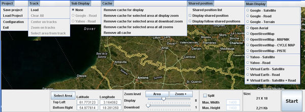
Supported tile services can be see in the right-hand dropdown in the above screenshot. This includes built-in support for...
- The main OpenStreetMap Mapnik tile server
- OpenCycleMap - OSM renderings on Andy Allan's server
- OpenPisteMap - OSM renderings on someone else's server
In addition to Google, Yahoo, and Virtual Earth Maps
Tile abuse?
Like some other tools such as BigMap, this app appears to support automated downloading only at one zoom level with the intention of stitching to form a large image. It's not a full-on "tile downloading" app (See Category:Tile downloading)
Usage of the app with OpenStreetMap's main Mapnik server could in breach of our Tile Usage Policy if you request a lot of tiles. This would happen if you ask this app to generate a very large image.
Note that different policies may be enforced by OpenCycleMap and OpenPisteMap.
Interface
- Select Area let us draw bounding box then select the Area button
- The download slider change size of the same bounding box
- Use the mouse to move the map
- Use the first slider of name Display to zoom between 1 to 20
- Use the second slider to define the size area and thus the size in Kb or Mb
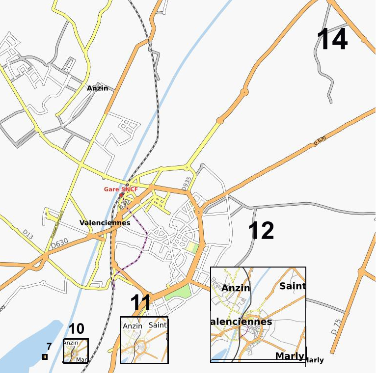
- Download set to 7 to10 and 14 change size 6*6/216 to 48*48/13.5Kb to 768*768/3.37Mo
Output
It outputs JPEG files

