North Carolina/Union County GIS
Jump to navigation
Jump to search
Union County is a county in the state of North Carolina.
Imagery
Union County GIS department provides aerial imageries covering the entire county via GoMAPS 4.0.
License
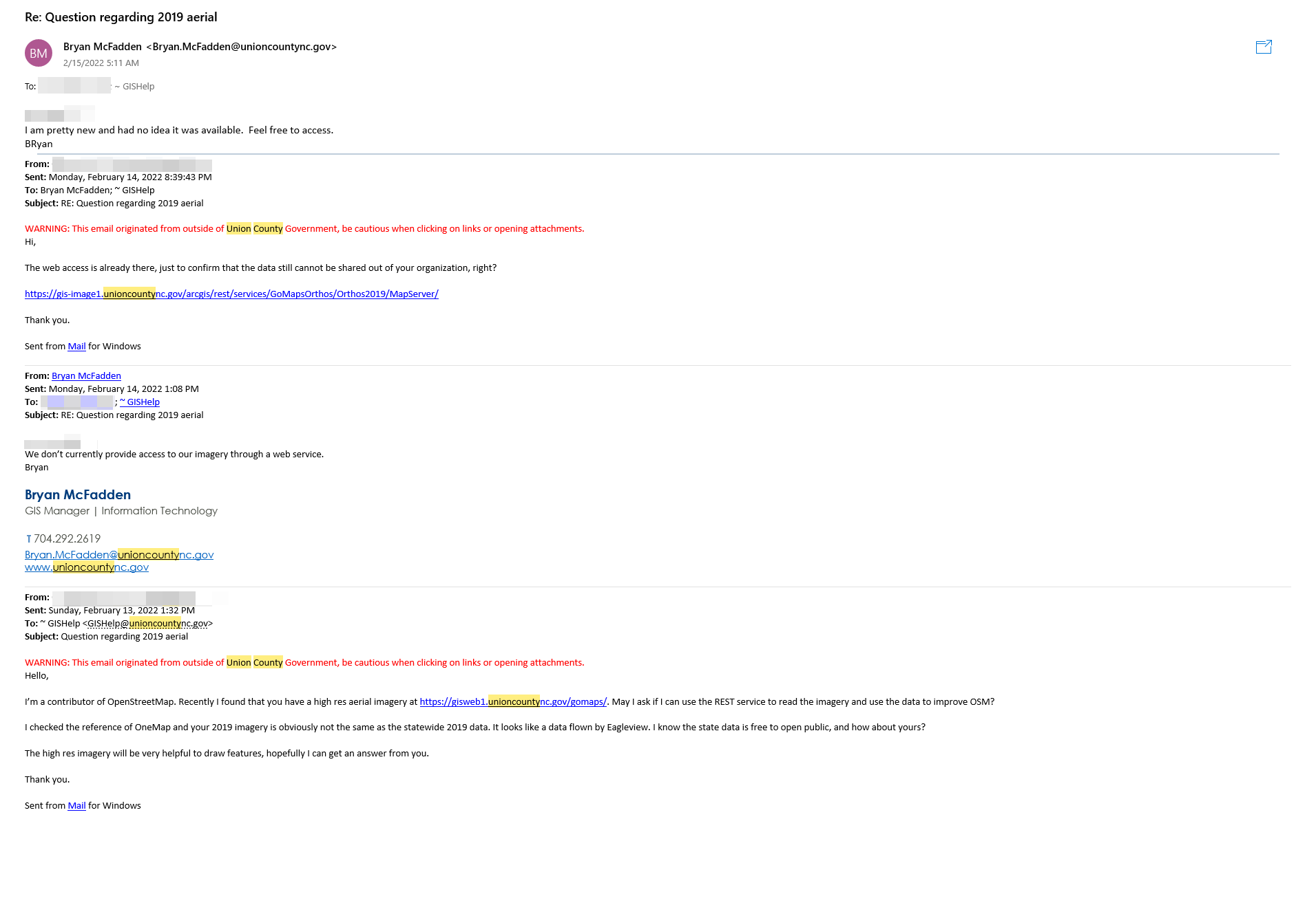
Union County GIS Manager Bryan McFadden has approved the imagery usage in OpenStreetMap. A proof has been obtained and uploaded to the OpenStreetMap Wiki. 
Usage
If you wish to use this imagery out of iD, please follow the instruction at https://github.com/osmlab/editor-layer-index.