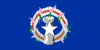
Northern Mariana Islands
| V・T・E |
| latitude: 16.705, longitude: 145.78 |
| Browse map of the Northern Mariana Islands 16°42′18.00″ N, 145°46′48.00″ E |
| Edit map |

|
|
External links:
|
| Use this template for your locality |
The Commonwealth of the Northern Mariana Islands is an unincorporated territory in the United States at latitude 16°42′18.00″ North, longitude 145°46′48.00″ East.
The Northern Mariana Islands is an unincorporated territory of the United States in the Pacific Ocean. The territory includes the 14 northernmost islands of the Mariana Archipelago; the southernmost island is Guam, another United States territory.
Municipalities
- Northern Islands Municipality
- Saipan Municipality
- Tinian Municipality
- Rota Municipality
Languages
Besides English, the following indigenous languages are spoken in the Northern Mariana Islands. They are listed with a link to the tag info page for name:<xx> with their respective language codes. Keep an eye out for features that can be tagged with names in these languages.
Additionally, the following languages are spoken and/or have historical significance to some on the islands:
| Oceania – Countries and territories | |
|---|---|
| Australia · Fiji · Kiribati · Marshall Islands · Micronesia · Nauru · New Zealand · Palau · Papua New Guinea · Samoa · Solomon Islands · Tonga · Tuvalu · Vanuatu · | |
| North America – Countries and territories | |
|---|---|
| The Bahamas · Antigua and Barbuda · Barbados · Belize · Canada · Costa Rica · Cuba · Dominica · Dominican Republic · El Salvador · Grenada · Guatemala · Haiti · Honduras · Jamaica · Mexico · Nicaragua · Panama · Saint Kitts and Nevis · Saint Lucia · Saint Vincent and the Grenadines · United States | |
