Nottingham/Mapping Meetup/New Year 2020
2020 New Year Meeting : Date: 27th December 2019
Meet at The Horseshoes, Long Lane, Derbyshire at 10:30 (mapping) or between 12:30 and 13:00 (social & lunch) also at The Horseshoes. 519176552![]() 519176552
519176552
See the Doodle Poll used to choose the date.
Event Details
The New Year mapping meeting will be in the same format of the initial meeting, and again will be focussed on mapping footpaths and other rights of way. A lunch time pub stop also gives other interested people a chance to join the group. This time we will returning to the same part of Derbyshire as Nottingham/Mapping Meetup/New Year 2019 last year, W of the city of Derby, and S of, the former roman road, Long Lane. This area of rolling countryside has an extensive network of paths, but is poorly mapped with the exceptions of a couple of long-distance trails. It seems to have a fair amount of pasture (fewer muddy ploughed fields perhaps), and is surprisingly rural given it's proximity to Derby.
The settlements of the area (Lees, Long Lane etc) have more of a feel of hamlets than villages, so there is less opportunity to tackle a village than last year. Most footpaths, with the exceptions of one long-distance path are missing or lack detail.
- Morning Meeting Point: Horseshoes pub, Long Lane
- Lunch & Afternoon Meeting Point: Horseshoes pub (519176552
 519176552)
The format is as follows, with 3 discrete activities which allows people to participate in 1 or 2 if they wish:
- 10:30: Meet for morning footpath session (either together or splitting up to maximise area covered)
- 12:30-13:00: Pub lunch (pub lunch, some walkers may arrive a bit after 12:30). The Horseshoes is a fairly upmarket (gastro) pub, but has tiled & wooden floors at least in part. It has vegetarian options (and possibly gluten free. The Horseshoes is run by the same people as the Cow at Lees where we lunched last yar
- 14:00-14:30: Further footpath or other mapping sessions.
Mapping Objectives
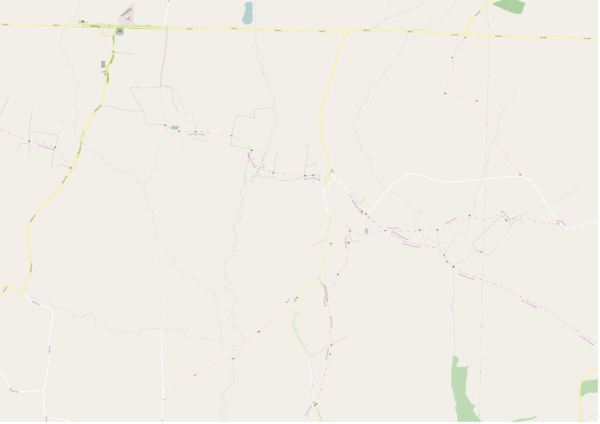
- Public Rights of Way. See map below:
The principle area of work is to the SW of Long Lane. However there are a couple of other areas to consider:
- NE of Lees there are two paths which meet about 1 km to NW, neither path has actually been surveyed. They have been mapped as viewed from the village and close to the Severn Trent pumping station to the S. In particular how the network of paths meet in this area is unknown. There is also a connecting path from the junction with Long Lane.
Specific path groups
- S of Thurvaston is a good network of paths of which only the Bonnie Prince Charlie Way is mapped. Suitable for a half-day survey.
- Immediately W of the Ostrich Inn towards Longford there is a stub footpath which leads to a small, but intricate network of paths on the E side of the stream near Longford.
- Churchbalk. A number of paths around this hamlet. Parking in the area may be difficult (and specifically NOT at the tight corner outside Russells Old Place).
- S of Long Lane towards Osleston some paths need connecting up.
- From Osleston a path runs SE towards Trusley from were a path runs due N connecting to a path which leads back to Osleston. There are broad verges (albeit possibly muddy) just N of the farm at Osleston which are suitable for parking.
- W of Longford Lane. There is a continuous path parallel to Longford Lane with numerous side paths, some going back to Longford Lane. This could make a circular walk returning the other side of the Lane (a couple of options), but would probably need to be brisk.
Other things:
- Road classification. There are still a number of roads marked as tertiary in the S of the area, many of which are probably unclassified.
- Farmland type. It would be nice to mark farmland as pasture or arable if surveyed. We may actually look at some grassy areas in more detail too.
Possibly dodgy paths:
- Osleston and Thurvaston FP 31 starts at Cottage Farm, but the designated route seems to pass straight through a number of farm buildings. I suspect the path does not exist.
There's plenty elsewhere in the direction of Longford. Some known paths have been mapped as stubs from the road.
I suggest we largely concentrate on the areas S of Long Lane between Long Lane Village & Longfor in the morning & then individually knock off some of the other targets in the afternoon.
- Settlements. will_p did the two main settlements of Long Lane & Lees last year. Thurvaston & Longford buildings have been mapped from imagery, but lack further detail. There are some council houses in Thurvaston which it would be nice to identify.
- Better Photos, Mapillary sequences to assist interpretation of aerial imagery, maps for remote mapping of the area.
- Countryside detail, hedges , watercourses, woodland etc. Feel free to add detail before the event as it will be cross-checked on the ground.
Useful sources of Info
- Wikipedia account of civil parish: Dalbury Lees
![Wikipedia [W]](/w/images/2/24/Wikipedia-16px.png) Dalbury Lees
Dalbury Lees
What happened on the day
Attendees
tbd
What got surveyed
tbd
What got mapped
tbd
Comparison before & after maps using SomeoneElse's AJT version of Carto-CSS (scale 1:20k at 254 dpi):
After: tbd

