OpenStreetBrowser/Archive-2.3
| OpenStreetBrowser is no longer active. It has been closed in January 2016. |
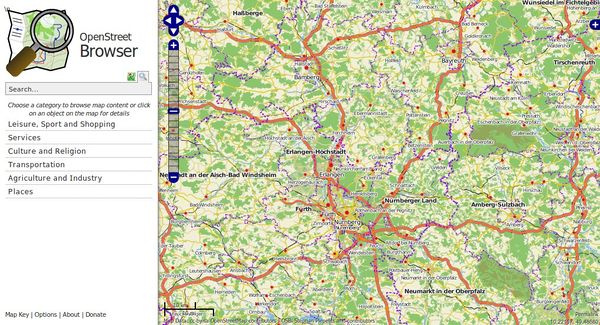
The OpenStreetBrowser was an application to 'browse' through the information in the displayed part of the map. The aim of the project was to provide a highly dynamic map that makes every mapped feature easily available to the user. It used to provide a worldwide coverage and a (mostly) uptodate database. The project shut down in January of 2016. The source code is still available, but there is no running instance anymore.
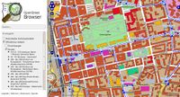
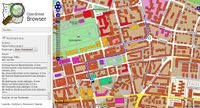
Similar to common Wikis and also the main page of http://www.openstreetmap.org the Openstreetbrowser website showed a narrow menu on the left side, most of the page being used for the display of the map. In contrast to most Wikis the menu was not static, but rather the content of the map could be browsed in categories. For the map a special style was developed (sorry guys, I neither like the default Mapnik nor Osmarender styles), and special overlays were displayed to support the current browsed categories. When you click on the map (left or right click is settable), you got a context menu with the option to select an object to show detailed information or to place a marker.
Full instructions are available.
Note: OpenStreetBrowser did not work with all internet browsers (in particular Internet Explorer failed). See further notes below.
Features
Features
For ordinary map users
- Click on objects on the map (perhaps a road, a building, or a lake) to see what details have been recorded for them.
- View brief Wikipedia article photos and details if available.
- Use the 'categories' system to get clear views on the map of lots of useful things: public transport systems, cafes, public telephones, cultural sites, walking routes, cycle routes, pipelines, a list of streets, administrative areas, websites, and very much more.
- Calculate routing.
- Work with more than one map style as a base, there are also some useful overlays.
For specialist map users
- Set up new categories to display or search for specific information if interest to you.
For OpenStreetMap editors
- Click on objects to inspect the full set of tags.
- Quick links to OpenStreetMap browsing or editing (Potlatch) functions.
- Inspect map completeness or the use of specialist tags with category system.
Multi-language supprt
- Default base map provides English names where available
- Data view shows names in your preferred language.
- OpenStreetBrowser interface is available in many languages. You can help improving those or adding more.
Other features
- Public API
Status (old information)
(![]() Check the ChangeLog for new features) - this is out of date, see blog below.
Check the ChangeLog for new features) - this is out of date, see blog below.
![]() For more information about the development have a look at blog.openstreetbrowser.org.
For more information about the development have a look at blog.openstreetbrowser.org.
![]() Current data version: no older than about 10 mins
Current data version: no older than about 10 mins
![]() Available parts of the planet: worldwide
Available parts of the planet: worldwide
![]() Working with some browsers only (e.g. up to date Firefox, Opera (tested briefly), Safari on ipad, ...please test others and list...) but NOT Internet Explorer.
Working with some browsers only (e.g. up to date Firefox, Opera (tested briefly), Safari on ipad, ...please test others and list...) but NOT Internet Explorer.
Got a question? Check OpenStreetBrowser/FAQ first.
About
People involved
Helping Hands:
- Lesewesen (Web design)
- Higa4 (Japanese translation)
- PierZen (French translation)
- Invisible (Ukrainian translation)
- Vanchester (Russian and Czech translation)
- Avila.gas (Spanish translation)
- Hunsly (Hungarian translation)
- Xuacu (Asturian translation)
How to help
![]() Good at designing icons? We could need some help on the Stylesheet.
Good at designing icons? We could need some help on the Stylesheet.
![]() Help translating.
Help translating.
![]() Report bugs.
Report bugs.
![]() You have a good idea? Suggest new features.
You have a good idea? Suggest new features.
![]() You have knowledge in PHP, JavaScript, CSS and/or HTML? Please contact one of us.
You have knowledge in PHP, JavaScript, CSS and/or HTML? Please contact one of us.
![]() We need more hardware! Do you have a server (at university or somewhere else) for us?
We need more hardware! Do you have a server (at university or somewhere else) for us?
![]() Help to get the browser working with Internet Explorer.
Help to get the browser working with Internet Explorer.
Used software
- Mapnik
- osm2pgsql and Osmosis
- Cascadenik
- OpenLayers
- Ubuntu Linux
- PostgreSQL
- Apache (with mod_tile), PHP, ...
- Git (for software version management) [1]
Background rendering
- OpenStreetBrowser-basemap using pgmapcss v0.10.0 with Overpass API.
People write about the OpenStreetBrowser
- myself: http://plepe.at/2009/03/24/84/
- on OSMBonnBlog: english german
- on Mapperz: http://mapperz.blogspot.com/2009/03/openstreetbrowser-view-maps-metadata.html
- Karsten Kompakt: http://karsten.ei07.de/wordpress/2009/03/mehr-externe-seiten-bei-osm/
Download Source
The source of OpenStreetBrowser is available in a neat Gitorious-Repository on http://gitorious.org/openstreetbrowser. There's a master-branch which contains the "stable" version, the version-branches containing the different version. There might be other branches too. If you have problems to get it to run, please tell me, I'll try to improve the documentation. Have fun!


