PDC InaWARE Indonesia Project Tagging Guidelines
Jump to navigation
Jump to search
Administrative Boundary
There are 4 administrative boundary that has been mapped (add and/or update) during this project.
- City/Regency Boundary
- Municipality Boundary
- Village Boundary
- Community Group (RW) Boundary
| No. | Object Name | Object Type | Description | Key | Value | OSM Rendering |
|---|---|---|---|---|---|---|
| 1. | City/Regency Boundary | A Boundary for City/Regency areas | admin_level | 5 | ||
| 2. | Municipality Boundary | A boundary for Municipality areas | admin_level | 6 | ||
| 3. | Village Boundary | A boundary for Village areas | admin_level | 7 | ||
| 4. | Community Group Boundary | A boundary for Community Group areas | admin_level | 9 |
Critical Facilities
There are 11 critical facilities that become priority objects for PDC-InaWARE Indonesia Project:
- Finance
- Communication
- Transportation
- Water Supply System
- Electrical Power System
- Fuel Storage
- Public Institution
- Sport Facilities
- Health Facilities
- Emergency Services
- Government Establishments
Finance
| No. | Object Name | Object Type | Description | Key | Value | OSM Rendering | Sample Picture |
|---|---|---|---|---|---|---|---|
| 1. | Bank | A place that provides financial services for people, such as money deposit, money saving and credit for financial services. | amenity | bank |
Communication
| No. | Object Name | Object Type | Description | Key | Value | OSM Rendering | Sample Picture |
|---|---|---|---|---|---|---|---|
| 1. | Communication Tower | Tower to provide and deliver communication signal | man_made | communications_tower |
Transportation
| No. | Object Name | Object Type | Description | Key | Value | OSM Rendering | Sample Picture |
|---|---|---|---|---|---|---|---|
| 1. | Airports | A place for planes to arrived and departed | aeroway | aerodrome | |||
| 2. | Ferry Terminal | A place for ships to arrived and departed | amenity | ferry_terminal | |||
| 3. | Train Station | Rail passenger only station | public_transport | station | |||
| 4. | Bus Station | A place for buses to arrived and departed | amenity | bus_station |
Water Supply Systems
| No. | Object Name | Object Type | Description | Key | Value | OSM Rendering | Sample Picture |
|---|---|---|---|---|---|---|---|
| 1. | Fire Hydrants | An active fire protection measure, and a source of water provided in most urban, suburban and rural areas with municipal water service to enable firefighters to tap into the municipal water supply to assist in extinguishing a fire. | emergency | fire_hydrant | |||
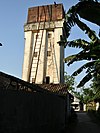
| 2. | Water Towers | An elevated storage container for drinking water. | man_made | water_tower | |||
| 3. | Pumping Station | A station that manage and deliver water from river/land | man_made | watermill |
Electrical Power Systems
| No. | Object Name | Object Type | Description | Key | Value | OSM Rendering | Sample Picture |
|---|---|---|---|---|---|---|---|
| 1. | Generators | A device used to convert power from one form to another. | power | generator | |||
| 2. | Tower | tower that used to support an overhead power line. | power | tower | |||
| 3. | Substations | a large facilities (up to several acres) for very high voltage transmission lines or just small buildings or kiosks near the street for low voltage distribution lines. | power | substation | |||
| 4. | Power Plant | A place/industrial facility where power is generated. | power | plant |
Fuel Storage
| No. | Object Name | Object Type | Description | Key | Value | OSM Rendering | Sample Picture |
|---|---|---|---|---|---|---|---|
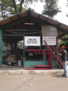
| 1. | Gas Station | Petrol station; gas station; marine fuel; … | amenity | fuel |
Public Institution
| No. | Object Name | Object Type | Description | Key | Value | OSM Rendering | Sample Picture |
|---|---|---|---|---|---|---|---|
| 1. | Kindergarten | Place for kids to learn (5-6 years old) | amenity | kindergarten | |||
| 2. | Sekolah Dasar (SD) / Madrasah Ibtidaiyah (MI) | Elementary School |
|
|
|||
| 3. | Sekolah Menengah Pertama (SMP) / Madrasah Tsanawiyah (MTs) | Junior High School |
|
|
|||
| 4. | Sekolah Menengah Atas (SMA) / Madrasah Aliyah (MA) | Senior High School |
|
|
|||
| 5. | College | A place for further education, usually a post-secondary education institution | amenity | college | |||
| 6. | University | An educational institution designed for instruction, examination, or both, of students in many branches of advanced learning. | amenity | university | |||
| 7. | Mosque / Mushala | Place of worship for moslem | |||||
| 8. | Church / Capel | Place of worship for christian | |||||
| 9. | Hindu Temple | Place of worship for hindu | |||||
| 10. | Buddhist Temple | Place of worship for buddhist | |||||
| 11. | Supermarket | A large store for groceries and other goods. | shop | supermarket | |||
| 12. | Pasar | A place where trade is regulated and traditionally, e.g. a square. | amenity | marketplace |
Sport Facilities
| No. | Object Name | Object Type | Description | Key | Value | OSM Rendering | Sample Picture |
|---|---|---|---|---|---|---|---|
| 1. | Stadion | A building which was built as stadium. Mostly for sport activities and big events | leisure | stadium | |||
| 2. | Sports Centre | TA distinct facility where a range of sports take place within an enclosed area. | leisure | sports_centre | |||
| 3. | Pitch | An area designed for playing a particular sport, normally designated with appropriate markings. | leisure | pitch |
Health Facilities
| No. | Object Name | Object Type | Description | Key | Value | OSM Rendering | Sample Picture |
|---|---|---|---|---|---|---|---|
| 1. | Clinic | A medium-sized medical facility or health centre. | amenity | clinic | |||
| 3. | Hospital | institutions for health care providing treatment by specialised staff and equipment, and typically providing nursing care for longer-term patient stays. | amenity | hospital |
Emergency Services
| No. | Object Name | Object Type | Description | Key | Value | OSM Rendering | Sample Picture |
|---|---|---|---|---|---|---|---|
| 1. | Police Station | A station from which the police operates. | amenity | police | |||
| 2. | Fire Station | A station from which the fire brigade operates. | amenity | fire_station |
Government Establishment
| No. | Object Name | Object Type | Description | Key | Value | OSM Rendering | Sample Picture |
|---|---|---|---|---|---|---|---|
| 1. | Kantor RW | Community Group Office | |||||
| 2. | Kantor Desa/Kelurahan | Village Government Office | |||||
| 3. | Kantor Kecamatan | Subdistrict Government Office | |||||
| 4. | Kantor Bupati/Walikota | District Government Office | |||||
| 5. | Kantor Gubernur | Province Government Office | |||||
| 6. | Government Office | An office of a (supra)national, regional or local government agency or department | office | government | |||
| 7. | Kedutaan Besar | A representation of a country in another country. | amenity | embassy |
Required Key and Value for Any Building Objects for Critical Facilities
| No. | Information | Key | Value | Description | |
|---|---|---|---|---|---|
| 1. | Building Type | building | User Defined meaning that the value is determined by the user in accordance with the information of the building. | For example our object is school then we can add tag building=school. For further information please see here | |
| 2. | Building levels | building:levels | User Defined meaning that the value is determined by the user in accordance with the information of the building. | For example our object has 3 floors then we can add tag building:levels=3. For further information please see here | |
| 3. | Building Structure | building:structure |
|
the value is determined by the user in accordance with the information about the building structure. For example, the building has reinforced masonry structure then we can add tag building:structure=reinforced_masonry to the building. For more information please click here | |
| 4. | Building Addresss | addr:full | User Defined meaning that the value is determined by the user in accordance with the information of the building. | For example, our building located at Jalan MH.Thamrin then we can add tag addr=Jalan M.H Thamrin to the building. For more information please see here | |
| 5. | Building's Name | name | User Defined meaning that the value is determined by the user in accordance with the information of the building. | For example our building name Kafe Enak then we can add tag name=Kafe Enak to the building. For more information please see here | |
| 6. | Building Wall | building:walls |
|
Determined by what wall that the building has. For example the building builded with brick wall so we can add tag building:walls=brick to the building. For more information please see here | |
| 7. | Building Roof | building:roof |
|
Determined by what roof that the building has. For example the building has tile roff so we can add tag building:roof=tile to the building. For more information please see here | |
| 8. | Roof Access | access:roof |
|
If the building has an access to the roof then we have to add tag access:roof=yes and vice versa. For more information please see here |
Roads, Railway and Waterway
There are 11 categories of road that has been mapped (add and/or edit) in this project.
- Motorway
- Trunk
- Primary
- Secondary
- Tertiary
- Residental
- Pedestrian
- Path
- Services
- Living Street
- Unclassified
| No. | Object Name | Object Type | Description | Key | Value | OSM Rendering | Sample Picture |
|---|---|---|---|---|---|---|---|
| 1. | Motorway | Free Way. Only for cars and it is paid road | highway | motorway | |||
| 2. | Trunk | Roads that connected administrative area. It can be city level, regency level or province level. | highway | trunk | |||
| 3. | Primary Road | Primary way in the mapping area. | highway | primary | |||
| 4. | Secondary Road | Secondary way in the mapping area. Connected with primary way | highway | secondary | |||
| 5. | Tertiary Road | Tertiary way in the mapping area. Connected with secondary way | highway | tertiary | |||
| 6. | Residential | Ways that located in residential area | highway | residential | |||
| 7. | Pedestrian | Ways for pedestrian. Any vehicles can not passing this way. Usually found in tourism area or shopping area | highway | pedestrian | |||
| 8. | Path | Way that can only passing by motorcycle and by foot. It width around < 1.5 meter. | highway | path | |||
| 9. | Service Way | Service way. Usually found in commercial building, mall and rest area. | highway | services | 
|
||
| 10. | Living Street | Small way in residential area. it's width around 1.5 - 2 meter. | highway | living_street | |||
| 11. | Track | Small way. Usually for hiking route or found in rice fields. | highway | track | |||
| 12. | Unclassified way | Unknwon way based on its category. | highway | road | |||
| 13. | Railway | Path / way for train | railway | rail | |||
| 14. | River | The linear flow of a river, in flow direction. | waterway | river | |||
| 15. | Reservoir | an artificial lake is used to store water. | landuse | reservoir | |||
| 16. | River Bank | A wide river as defined by its area. | waterway | riverbank |
