Philippines/Featured images/2013
Jump to navigation
Jump to search
| Week | Image | Description | Global featured image? |
|---|---|---|---|
| Dec 8 | 
|
Guagua ESSC-OSMPH training field survey. On day 2 of the ESSC-OSMPH Disaster Risk Reduction Training held last November 5–7, 2013 in Guagua, Pampanga, the participants were divided into groups and did a field survey in various parts of the town. They took notes and photos, and recorded GPS tracks. Shown in the photo is the Betis group standing beside one of the Death March trail monuments with Barangay (local village) San Nicolas 2nd Chairman Michael Valencia on the left wearing a green shirt. | 
|
| Dec 1 | 
|
Node density increase due to Typhoon Haiyan mapping. This map shows the increase in density of nodes in the Philippines from September 30 to November 30, 2013. Brighter spots are areas with a larger increase in the number of nodes. Most of the increase in this period is due to the mapping in the wake of Typhoon Haiyan. | |
| Nov 24 | 
|
Typhoon Haiyan Tarp Maps. Large OSM-based tarpaulin maps of Tacloban, Guiuan and Ormoc printed and delivered by International Organization on Migration to the DSWD Operations Center in Tacloban Airport. The maps will be used to coordinate the relief and rescue efforts for the victims/survivors of Typhoon Haiyan. | 
|
| Nov 17 | 
|
Typhoon Haiyan editing activity visualised. Pascal Neis analyzed changesets in the Philippines and Vietnam. In his blog post he reports that we had contributions from 245 different people by Sunday evening, all helping to improve our map data which is being used by aid organizations and crisis responders. OSM contributors, thank you and keep up the good work! | 
|
| Nov 10 | 
|
HOT Task Number 338. In response to Typhoon Haiyan, which may be the strongest typhoon to have ever made landfall, HOT Task Number 338 was created to help create a base map that may be used by relief workers in assessing the damage and providing aid to the people affected by this disaster. Other HOT tasks have been created addressing other areas affected by the typhoon. | |
| Nov 3 | 
|
New GPS traces layer from MapBox. MapBox' new GPS traces layer shows color as a function of direction leading to pretty pastel-colored maps such as this one of the Elliptical Road in Quezon City. | |
| Oct 27 | 
|
Lubao ESSC-OSMPH training participants. Employees of the municipal government of Lubao, Pampanga and trainers pose for a group photo during their training on disaster risk reduction using OpenStreetMap participatory mapping. | |
| Oct 13 | 
|
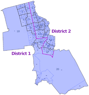
Pasay administrative boundaries. The complete boundaries of Pasay City's 2 districts, 20 zones, and 201 barangays are now in OpenStreetMap. This is the most boundaries included of any local government unit. | |
| Oct 6 | 
|
3D Mount Samat Shrine. The F4 Map has recently added SRTM elevation data to their 3-D map and Mount Samat Shrine now looks great standing on a mountain. | |
| Sep 15 | 
|
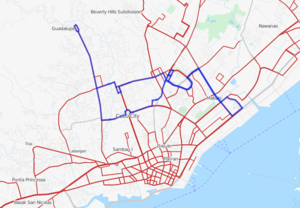
Cebu Jeepney Route 06H. User Karta has been adding a lot of jeepney route relations in Metro Cebu. This map shows the 06H jeepney route (in blue) overlaid on the Transport Map layer. |
