Pl:Tag:leisure=golf_course
Jump to navigation
Jump to search
| Opis |
|---|
| Miejsce lub obszar, na którym można grać w golfa. |
| Odwzorowanie w OSM Carto |
| Odwzorowanie w OSM Carto |

|
| Grupa: Wypoczynek |
| Używane na tych elementach |
| Implikuje |
| Przydatne kombinacje |
| Status: w rzeczywistości |
| Narzędzia |
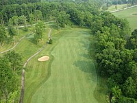
leisure=golf_course – stosowany do oznaczania miejsca lub obszaru na którym można grać w golfa.
Mapowanie
Rysujemy linię zamkniętą do utworzenia obszaru ![]() wokół obrysu pola golfowego, lub alternatywnie wystarczy umieścić węzeł
wokół obrysu pola golfowego, lub alternatywnie wystarczy umieścić węzeł ![]() centralnie w środku pola golfowego lub na szczególnej centralnej lokalizacji, np blisko wejścia lub klubu.
centralnie w środku pola golfowego lub na szczególnej centralnej lokalizacji, np blisko wejścia lub klubu.
Aby zobaczyć demo wideo patrz Mapowanie pola golfowego.
Podobne tagi
leisure=miniature_golf – minigolf.
Szczegóły w obrębie pola golfowego
Dla ścieżek dla wózków golfowych, zobacz Talk:Key:access#Golf_cart.
| Data | Klucz | Wartość | Opis |
|---|---|---|---|
| golf | tee | Area where play begins on a golf hole. Be aware there may be up to 4 tee boxes on a given hole, often with significant displacement from each other, and sometimes approaching the green from different directions. These are usually denoted by colours (most commonly blue, white and red, but may also be green, yellow, black) and names (Championship, Members, Womens). | |
| golf | hole | For the way to the hole. | |
| golf | hole | For the entire part of the golf course which is in play for the hole. Usually this will encompass, the tee boxes, fairways, bunkers and the green. This is to be preferred to use of the way as it is a genuine mappable feature and is far more relevant to all classes of golfer than a single line showing the notional direct line to the green. NOTE: See questions at Talk:Tag:leisure=golf_course#Hole_as_way_or_area.3F. | |
| golf | pin | For the location of the hole. Since this does change over time (as often as daily) to keep wear on the green even, it is not recommended to map it. Use golf=green and map the area. | |
| golf | green | The area of short grass on smooth ground surrounding a hole, short for the 'putting green'. | |
| golf | bunker | A type of hazard, also known as a sand trap, which is a depression in the ground filled with sand. Recommended to also tag with surface=sand or natural=sand. Do not use natural=beach--it's not a beach! (Tagging for the renderer) | |
| golf | fairway | The area between the tee and green where the grass is cut even and short. Do not use the tag landuse=grass is to make the rendering more appealing. Use surface=grass | |
| golf | rough | Areas within bounds which have longer length of grass. | |
| golf | water_hazard | Usually defined by yellow stakes or lines (Rule 26) - Always tag natural=water for the parts of the hazard that are filled with water. | |
| golf | lateral_water_hazard | Usually defined by red stakes or lines (Rule 26) - Always tag natural=water for the water areas if they exist. | |
| golf | driving_range | A driving range is an area where golfers can practice their golf swing. | |
| golf | out_of_bounds | Usually defined by white stakes or lines. | |
| golf | ground_under_repair | Ground under repair (GUR) is any part of the course so marked by order of the Committee or so declared by its authorised representative. | |
| golf | clubhouse | The building dedicated as a clubhouse. Always tag building=yes for the building itself. |
Narzędzia
- OSM-FR rendering, example: http://tile.openstreetmap.fr/?zoom=16&lat=48.72648&lon=2.60806
Zobacz też
- Proposed features/Golf course do dyskusji na temat dodatkowych obiektów, takich jak otwory i inne detale.
- sport=golf
- amenity=toilets
