Project of the week/2010/Apr 11
< Project of the week | 2010
Jump to navigation
Jump to search
"Get Wired!"
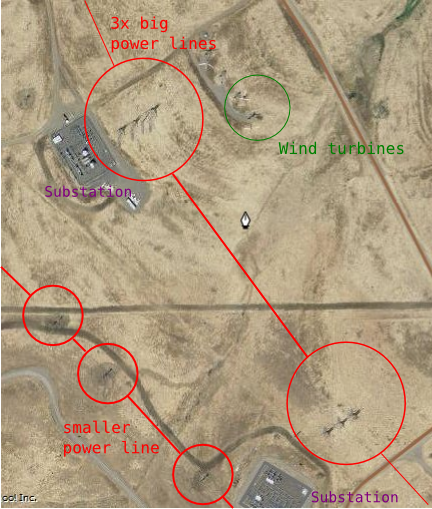
We can take for granted the infrastructure that runs our computers. the infrastructure that allows us to map, to listen to amplified music, to refrigerate food. This week we take a look at the power lines that distribute electricity. Map the high tension lines and supporting towers as available from aerial imagery.
Getting started
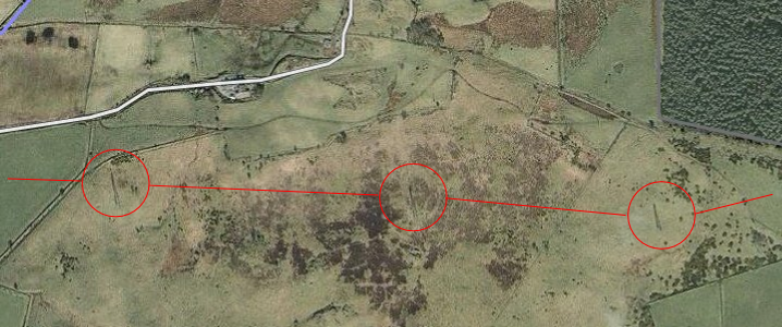
- Pick a random town with Yahoo! aerial imagery available, and look at the fields surrounding the town. Browse around a bit and look for the distinctive shadows of power-lines crossing a field. It helps if you can find somewhere sunny when the images were taken.
- or: start with an untouched TIGER power line and look at it on aerial imagery. You might see that it's actually several power lines on the ground that can be improved. Follow it along its length and you might discover unmapped power lines leading off from it.
- or: pick a random power station or hydroelectric dam and look for wires leading away from that. (e.g. by going to the wikipedia article on a power station and following the coordinates link)
Sample data from from near the Altamont Pass Wind Farm area here - even this area isn't completely mapped yet!
Following and mapping the line
- Create a way for the power line, placing a node everywhere you see the shadow of a tower
- If there are several lines running in parallel, consider mapping them separately. They will probably split-off from the other lines at some point, giving you something new to map.
Examples
See the great samples here [1]
A high tension pylon node
power=tower
The power line way between towers
power=line
Smaller distribution poles
power=pole
Lines between smaller distribution poles
power=minor_line


