Project of the week/2010/May 09
"So Far away From Me"
Sometimes mapping is a matter of pride. We map our hometown because we want to share our pride in our home. We want to help our neighbors with the best map possible.
Sometimes mapping is a matter of history. We map the places we lived, or went to school, because mapping those places makes them real.
Sometimes mapping is a matter of courtesy. We map the nice local restaurant or family business because they deserve to be on the map and people running small businesses don't always have time for mapping.
This Project of the Week is about mapping as adventure. We're going to learn about, and map, Karachi, Pakistan.
Karachi, Pakistan
Project of the Week, 09 May 2010
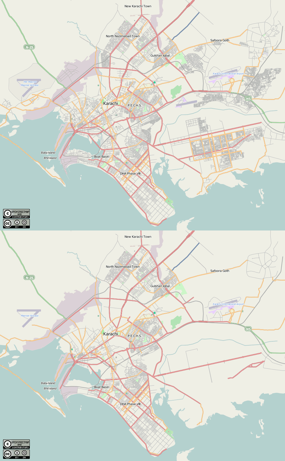
Mapping Karachi seems like an adventure to those who live so far away. The aerial imagery from Yahoo! is good, and the existing map of Karachi has some empty spots. So it is possible to make great improvements even when what we can map from the air is limited.
Before and after
This simple animation shows Karachi before the Project of the Week of 2010May10 and after. It looks as though the mapped area of Karachi has approximately doubled in size.
Mapping new places
There are some things to remember when mapping a place that you haven't visited. These are particularly important when a place is far away and the local conditions and context could be very different from your experience.
Some things that often can be interpreted from aerial images include:
- major roads highway=secondary
- sport fields leisure=pitch
- large buildings building=yes
- large parks leisure=park
Some things that are tougher to distinguish from the air:
- names of streets, buildings, anything. We don't copy information from copyright sources so just leave them for a local mapper.
- distinguish residential roads from unclassified, tertiary or other minor roads. highway=road
- detailed land use
Incremental improvement
If you are uncertain about adding or editing a feature, leave it alone. Better to leave it for another mapper with more experience, or for a local mapper with more information.
Save early and often
When mapping collaboratively it is advantageous to save early and often. Other mappers may be trying to add and edit the same items at the same that you are. So small changesets and frequent saves are the order of the day.
Divide and conquer
Divide the imposing, large, unmapped area into smaller manageable areas. Then map a small area in as much detail as the imagery allows.
http://www.openstreetmap.org/edit?lat=24.87372&lon=67.00054&zoom=16
http://wiki.openstreetmap.org/wiki/Karachi
Place names
Is there consensus to have default place names (e.g. name=) be in Urdu? or Romanised (Latin characters)? --filbertkm (talk) 01:11, 16 May 2010 (UTC)
