Proposal:Tag:landform=esker
| Esker | |
|---|---|
| Proposal status: | Abandoned (inactive) |
| Proposed by: | Acrosscanadatrails |
| Tagging: | landform=esker |
| Applies to: | way |
| Definition: | A narrow, sinuous, steep-sided ridge composed of sand or gravel deposited by a glacial stream. |
| Statistics: |
|
| Rendered as: | To Be Determined. |
| Draft started: | |
| Proposed on: | 2009-03-10 |
| RFC start: | 2009-03-10 |
| Vote end: | 2009-03-31 |
Summary
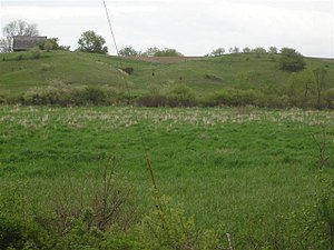
A Esker is a long, winding ridge of stratified sand and gravel, examples of which occur in glaciated and formerly glaciated regions of Europe and North America. Eskers are frequently several miles in length and, because of their peculiar uniform shape, somewhat resemble railroad embankments.
Reasoning
An esker is an interesting map feature and should be appropriately tagged.
Appearance
Perhaps looking like a double natural=cliff? To be determined.
Alternate tagging
Use proposed tag natural=landform; landform=esker
The tag natural=ridge is widely used for all kinds of ridges, including some eskers.
natural=esker has also been used.
Discussion
In Norway many such eskers (NO:morene) are very wide, and not so clearly visible in the terrain. They can often been observed as a hill stretching from one side of the valley and ending at the river path. Some times only on one side of the river, other with the river passing in some form of ravine in the middle. - I feel that a natural=landform with a list of landform:type=* or maybe just landform=* can do for many such formations. Even lone dominant hills can be tagged this way. Possible landform values: esker, hill, plateau. --Skippern 13:23, 11 March 2010 (UTC)
