Proposal:Terrain accident
Jump to navigation
Jump to search
| Terrain accident | |
|---|---|
| Proposal status: | Abandoned (inactive) |
| Proposed by: | * |
| Tagging: | accident=* |
| Applies to: | way |
| Definition: | General of linear (narrow) accidents of the terrain |
| Statistics: |
|
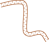
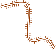
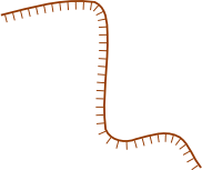
| Rendered as: | Brown line with perpendicular bars towards where the terrain goes down (left side of line when declaring direction) |
| Draft started: | |
| Proposed on: | 2009-02-20 |
If you have suggestions you can help either directly or in the discussion page.
Rationale
There is currently no unified way to tag trenches or ditches, levees (dikes, embankments, floodbanks, stopbanks or causeways), or sudden elevation changes due to landslides, or steep rocks. The steepness of the feature should usually be over 100%.
Origins of the issue :
- Hollow ways Proposed_features/hollow_way are ancient paths sunken in the ground due to human passage.
- In some regions small ditches can be found along roads and between fields to help permanent or rainwater evacuation.
- Causeways Proposed_features/Causeway.
Tagging
| key | values | meaning | rendering | |
|---|---|---|---|---|
| accident | trench, gully, ditch | Represents a type of linear excavation or depression in the ground. | 
| |
| accident | levee | Represents a natural or artificial slope or thick wall. | 
| |
| accident | terrace | Line along where terrain elevation goes up or down a few meters (Hikers should usually be able to climb down, even if significantly slowed down. Higher is usually a cliff natural=cliff) | The perpendicular dashes are oriented towards the lower ground 
| |
| accident | hole | A single hole a few meters wide | brown cross | |
| accident | rock,rocks | A heap of rocks or a large, single rock | brown dots | |
| height | * | The depth or height (in meters) of the feature | ||
| steepness | * | Steepness in degrees | ||
| width | * | Width in meters | ||
| material | ground, sand, concrete, rocks, wood |
Rendering
Rendering these features as proposed may not be technically possible with osmarender. To mark the declination, proper line direction should be used. In case of terrace, right side of line goes uphill.