Proposal:Roof position
(Redirected from Proposed features/Roof position)
Jump to navigation
Jump to search
| Roof position | |
|---|---|
| Proposal status: | Draft (under way) |
| Proposed by: | Marek_kleciak |
| Tagging: | bottom:shape=* |
| Applies to: | |
| Definition: | Notation of roof bottom shapes |
| Statistics: |
|
| Draft started: | 2016-05-30 |
This proposal describes tagging of elements with bottom:shape=*, bottom:height=*, min_heght=* tags for 3D modeling similar to Simple 3D Building Specification.
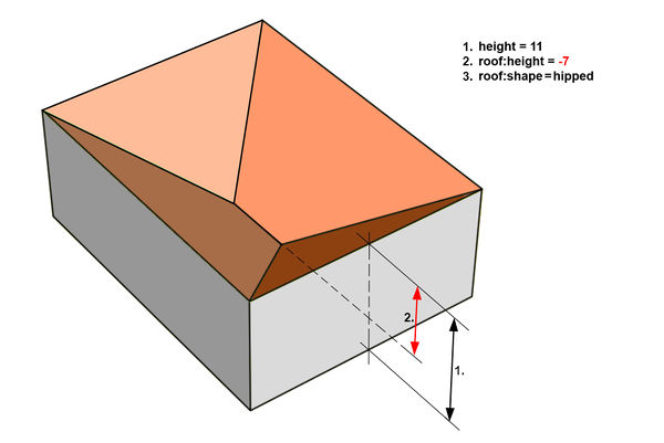
Some roofs have negative value of the roof:height=* tag. This should be used for 3D modeling:
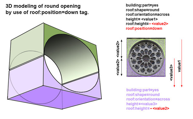
Some complex openings may be described as a sum of two or more building:part elements with bottom=* elements.
Following example - round opening in the wall is modeled with 2 elements:
Use of bottom:shape=* and bottom:height=* tags for building:part=* elements with bottom surfaces.


