Pyroute
- About
- a routing software
- Reason for being historic
- unmaintained and not ported to Python 3
- Captured time
- 2010
| Pyroute | |
|---|---|
| Author: | Ojw |
| License: | GNU General Public License |
| Platforms: | Windows, Linux, and Openmoko Linux |
| Status: | Broken |
| Language: | English |
| Website: | https://svn.openstreetmap.org/applications/routing/pyroute/ |
| Source code: | https://svn.openstreetmap.org/applications/routing/pyroute/ |
| Programming language: | Python 2.x |
|
Routing tool, predecessor of rana | |
This page is about the graphical version of pyroute for mobile phones. For the command-line interface, see PyrouteLib
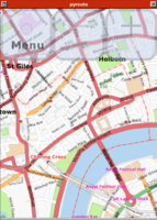
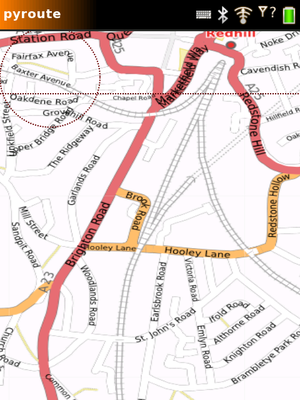
pyroute is a routing program written in Python by Ojw, and a mobile phone GUI for maps, GPS, and routing.
It is currently being replaced by rana, which does the same thing but with more loosely-coupled modules
Videos
The best introduction is probably with screenshot videos
- First draft, with a fixed route
- Routing to lots of places
- Continuously routing from a moving start position
- Menu for the GUI
- Routing to destinations from geoRSS or Geonames
- The zoom function (drag left/right at top of screen) and click menu (to route, set position, etc)
- sketching on the map - you could sketch a route and send it to someone or upload it to your blog. Right now, you can only save it as GPX (and load it in JOSM)
As seen on OpenGeoData!
Download and installing
Source code: https://svn.openstreetmap.org/applications/routing/pyroute/
GUI requires pycairo. Everything else just requires python
svn co https://svn.openstreetmap.org/applications/routing/pyroute/
cd pyroute/
python gui.py
For Windows XP (as of January 2008)
It is known to work using the following steps:
1) Download and install python (version 2.5 is known to work), available from here.
2) Create a folder and download pyroute into it (see instruction above), e.g. c:\data\pyroute. Revision 6290 is known to work.
3) Download and install pycairo, available from here
It is known to work with the Glade/GTK+ for Windows Toolkit binary version 2.10.7-1, with pycairo bundled, available from here
4) Download and install pygtk, available from here
Look for "Latest news" section for "PyGTK all-in-one installer for win32 Tuesday 13 February 2007" and download the executable file (not sure what is the exact version) from here
5) Open the Windows shell
6) Change directory to the pyroute folder, e.g. cd c:\data\pyroute
7) Key in: python gui.py
Enjoy!
Running the program
Run gui.py
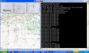
After it downloads some map images, it will either detect GPSD, use a pair lat,lon from a file pos.txt, or start with a map of Reigate.
- Drag the main map window to pan the map. Use +,- icons to zoom
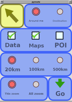
- Click on the top-left corner of the screen to get the menu.
- Click on the map to set your position there (if no GPSD is detected), or to create a route.
Before routing, you need to download some OSM data for the area. In the menu, go to "Download > DownloadRoute" to fetch the area around your current position from OSM ( note that this is not around the centre of the map view!). Download may take a while, depending on how dense the OSM data is.
If you forget to download the OSM data, routing will just be a straight line.
Features
| Data source | Displayed as | |
|---|---|---|
| Position | Connects to GPSD on default port | Red dot |
| Waypoints | Load from GPX. Auto-saves to same file. Add new ones via menu | Name in green text. Can view full list in menu |
| Tracklogs | Load/save (GPX) Record from GPS | Yellow lines |
| Sketches | Load/save (GPX) Sketch on map | Yellow lines |
| Map images | Download on demand from Osmarender, Mapnik, OpenAerialMap (with caching) | Background image (scaled) |
| Routes | Can't load or save. Can create, if OSM data is available | Thick red line |
| OSM vector data | Can't load or save. Can download for a small area around current position | Not displayed |
| GeoRSS | Can download at startup (hardcoded URLs, no caching) | Same as waypoints |
| Geonames (wikipedia) | Can download at startup (hardcoded URLs, no caching) | Same as waypoints |
| OSM points of interest | Not available | Not displayed |
Routing
- A*
- Loads OSM files with SAX
- Can load a city in "not unreasonably slow" time
- Probably not scalable much beyond city-size routing
- But doesn't require a database server to be available!
- Theoretically it can cache the routing tables once parsed, but this doesn't seem to be much quicker than loading the OSM file again
- Should be able to handle most of the transport types on Routing profiles
- Is currently optimised for cyclists (since I am one) pedestrians, and regular* cars
* a 'regular' car is one with no width, no height, and no weight, hence can drive down any road. You may have met this car in the GCSE 'applied mathmatics' course ;)
Limitations
- Doesn't store routing data when you exit and restart the program
- Cached map images never deleted
- Doesn't store your position on the map when you exit and restart
- GeoRSS disabled by default (because it doesn't cache the downloads yet)
Ideas
See Pyroute share server for some social and collaborative ideas that pyroute could implement relatively easily (dependent on network availability of course)
Download corresponding images from Open Aerial Map or from the NASA Blue Marble image set and overlay OSM data on top.


