Resilience Mappers
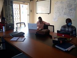
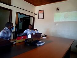
Resilience Mappers is mapping community in Uganda formed in March 2020. It was formed with an aim of responding to and providing geoinformation in areas where the government and Aid agencies have intervention programs in Uganda. Resilience Mappers is located at Millennium Estates, ZZana off Entebbe Road.
Resilience Mappers is in the process of becoming a Non-Governmental Organization with the same aforementioned cause.
Our Core Objectives
- To provide Spatial data and solutions that are most needed by government and aid agencies in intervention programs in Uganda for sustainable Development. .
- To provide training to government agencies, NGOs, Education Sectors and the Business fraternity on open data collection and management, Geographic Information System (GIS) and Remote Sensing and the other disciplines of Geo-Information.
- To build a resilient network of mappers that can respond to and manage the humanitarian, environmental, social and economic needs of our communities at local, national, regional and global scale.
- Liaise with the private sector, civil society, and government in implementing national development plans.
- Take part and facilitate mapping initiatives within Uganda, East African Community and Africa at large.
- To raise awareness and promote an active dialogue among the communities on the SDGs with a view to create a better world for the underprivileged groups of people.
Members
We are former members of YouthMappers and we have been contributing to OpenStreetMap since 2017 as freshmen and women at Makerere University
Projects
| Past Project | Description | |
| 1 | Mapping Informal Settlements of Kawempe Division | Following COVID-19 relief food program by the government of Uganda in April 2020, Resilience Mappers with a support from Humanitarian OpenStreetMap (HOT) Facebook Community Impact Micro-grant program collected geospatial data on the status of services in the informal settlements of Kampala, Uganda as a rapid response to the COVID-19 pandemic.
|
| Current Project | Description | |
| 1 | Mapping of Health Facilities, Waste Dumping Sites, and Education facilities in the Informal Settlements of Kawempe Division
|
Following the previous project, the data users identified a need to map and update data on service points specifically health facilities, education facilities and solid waste dumping points (both legal and illegal) in the informal settlements of Kampala. Resilience Mappers is currently collecting data on this service points under The Summit 2020 Microgrant program supported by ESRI.
|
Events
| Events | Description | Vedio Links | |
|---|---|---|---|
| 1 | QGIS boot camp online | In line with our vision to contribute to SDG 11 of urban communities through mapping, Resilience Mappers organised a 5 days QGIS boot camp online for beginner spatial data enthusiasts. The bootcamp involved training members in introduction to Geographical Information Systems, including spatial data types, formats for storing the spatial data, coordinate and projection system applied in GIS as well as making beautiful maps as a way of presenting the data to the users. We had sessions of beginning to end problem solving where we applied various tools in the QGIS platform to derive solutions for the challenges we had to solve. The learners were engaged in interactive sessions where they were able to appreciate the use of the Geographical Information System in problem solving and informed decision making processes. | QGIS Training BootCamp Day 1 Introduction to GIS and QGIS
|
Gallery
Partnerships
- MapUganda
- ActTogether
- GeoYouthMappers
- Somero
Contacts
- Twitter: https://twitter.com/RMappers
- Facebook: https://www.facebook.com/RMappers
- Email: resilience.mappers@gmail.com

