Richmond Hill
Jump to navigation
Jump to search
| V・T・E |
| latitude: 43.8828, longitude: -79.4403 |
| Browse map of Richmond Hill 43°52′58.08″ N, 79°26′25.08″ W |
| Edit map |

|
|
External links:
|
| Use this template for your locality |
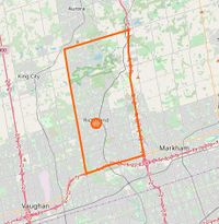
Richmond Hill is a city in Ontario, Canada at latitude 43°52′58.08″ North, longitude 79°26′25.08″ West.
Major Changes
- VivaNext (Yonge) - finished, awaiting updated satellite
- Highway 404 widening - under construction
- Leslie Street Widening
Minor Changes
- New cycle path on Leslie St from Major Mackenzie Dr to 16th Avenue. Awaiting satellite images.
Other changes required
- A few YRT routes that use any portion of Yonge Street north of 407 need to be updated to PTv2 after VIVA Rapidways have been added
- Need to complete mapping of buildings, which are completely lacking in many areas
- Need to complete mapping of sidewalks. Some areas are done.
- Very minor details (such as streetlights, signs, etc.) are extremely lacking compared to neighbouring Toronto.
- Local businesses need to be added. Many areas are lacking.
Finished
New sidewalk on Major Mackenzie Dr from Leslie to Via Renzo. Awaiting satellite images.