SPOT JOSM Get Started
Jump to navigation
Jump to search
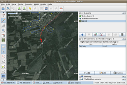
The following are set of steps which will get you up and running with Pakistan SPOT imagery using the WMSPlugin within JOSM.
Steps
- Download JOSM
- Start JOSM
- Open Preferences
- Configure Available Plugins
- Download List
- Select wmsplugin
- Click OK
- Restart JOSM
- Open Preferences
- Select WMS Plugin
- Click Add
- Enter For Name: SPOT
- Enter Below WMS URL:
http://www.geodatawork.net/__streaminguid.e30dcaa3-5929-4902-9834-12e6f51e1e7b/wms.ashx?request=GetMap&format=jpeg&layers=1896281c-d4a4-4de7-955c-47044ae2d272&
- Download relation of imagery coverage
- File -> Download Object
- Select "relation" for Object type
- Enter Object ID 1136222
- Click Download Object
- Zoom to Somewhere in the Downloaded Polygon
- Download Data for Editing
- File -> Download From OSM
- Press Download
- WMS -> SPOT
- Your Imagery Should Download for the Area
- Enjoy Editing
Further resources
- tutorial video explaining set-up (not following exactly the same steps)
- JOSM/Guide - For beginners using the JOSM editor
- 2010 07 Pakistan Floods - Pages about the flood mapping
